Name/Title
Oversize aerial photograph of west BroomfieldEntry/Object ID
2020.9.2Description
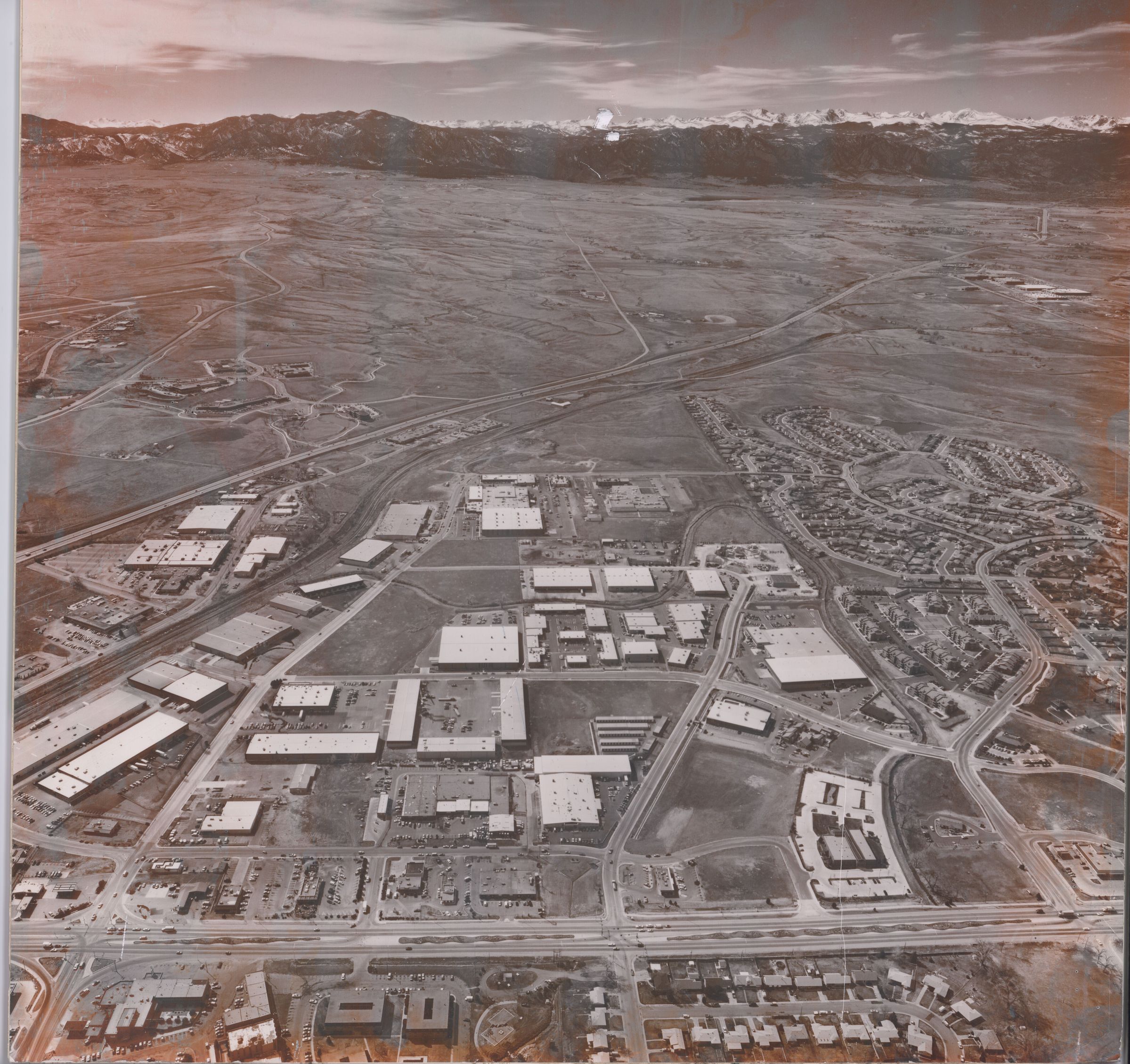
Oversize aerial photo mounted on foamcore. Shows west Broomfield looking west, Route 287 is in foreground. Exact date is unknown, but the Depot appears in its present location next to Zang Spur Park (the Depot was moved in 1976). Also the the neighboorhood around Lac Amora Park looks complete (built around 1980). Many of the buildings seen W. Midway and Industrial Lane are still standing in 2020.
Also visible is the Denver-Boulder Turnpike (Route 36), for which not much has been built onit's southern side yet at the time of this picture, with Interlocken visible but much smaller than what it is in 2020. At the bottom left corner might appear the Broomfield Manor Hotel (now a Walgreens in 2020). Visible at the bottom of this picture are some of the Garden Center Apartments and some oof the houses at Quartz Way and W. 6th Avenue.Collection
Permanent CollectionMade/Created
Date made
1980 - 1990Notes
Date: c. 1985Lexicon
Nomenclature 4.0
Nomenclature Primary Object Term
PhotographNomenclature Sub-Class
Graphic DocumentsNomenclature Class
Documentary ObjectsNomenclature Category
Category 08: Communication Objects