1984 Map of Broomfield
Name/Title
1984 Map of BroomfieldEntry/Object ID
2022.0.168Scope and Content
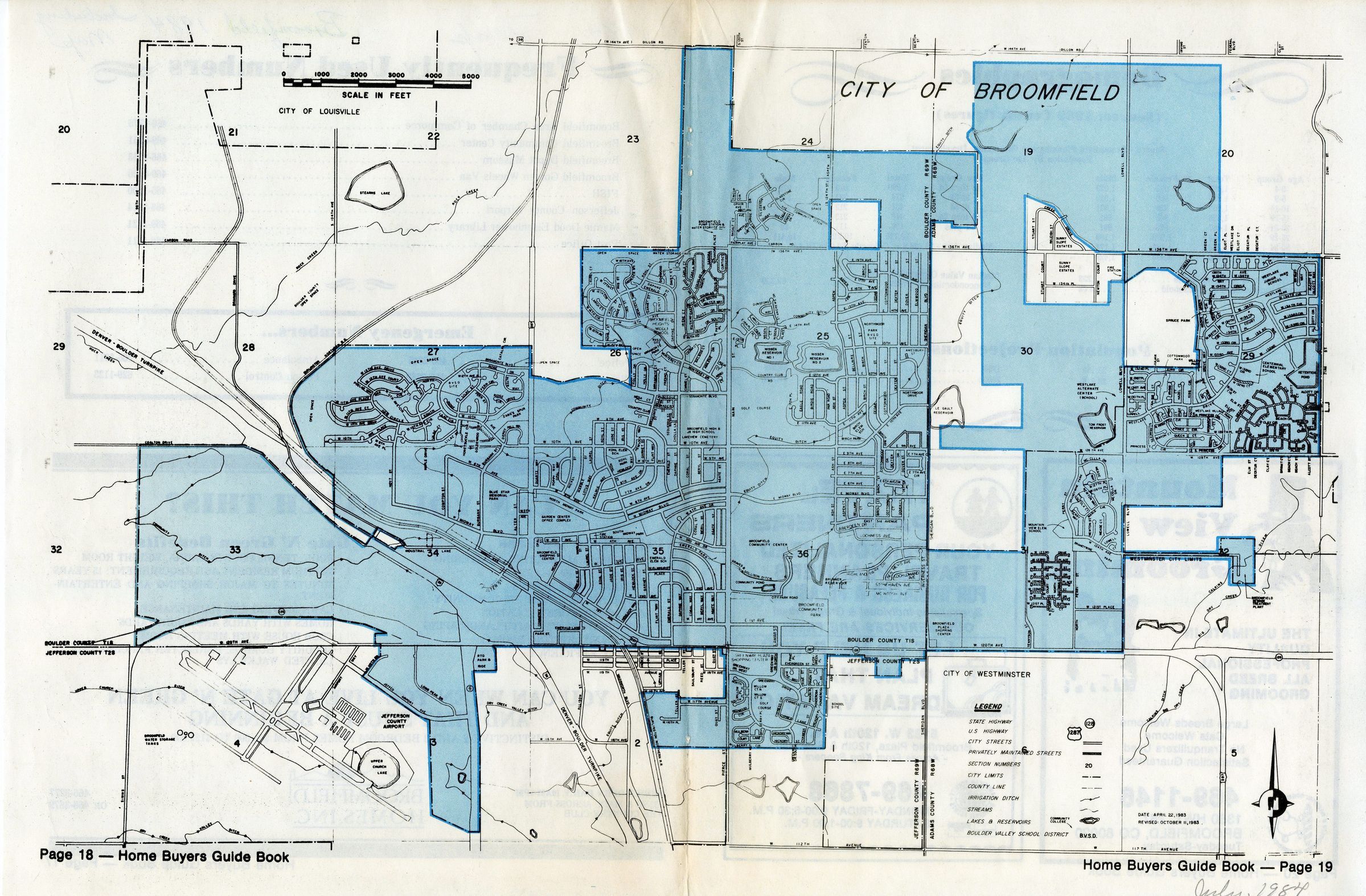
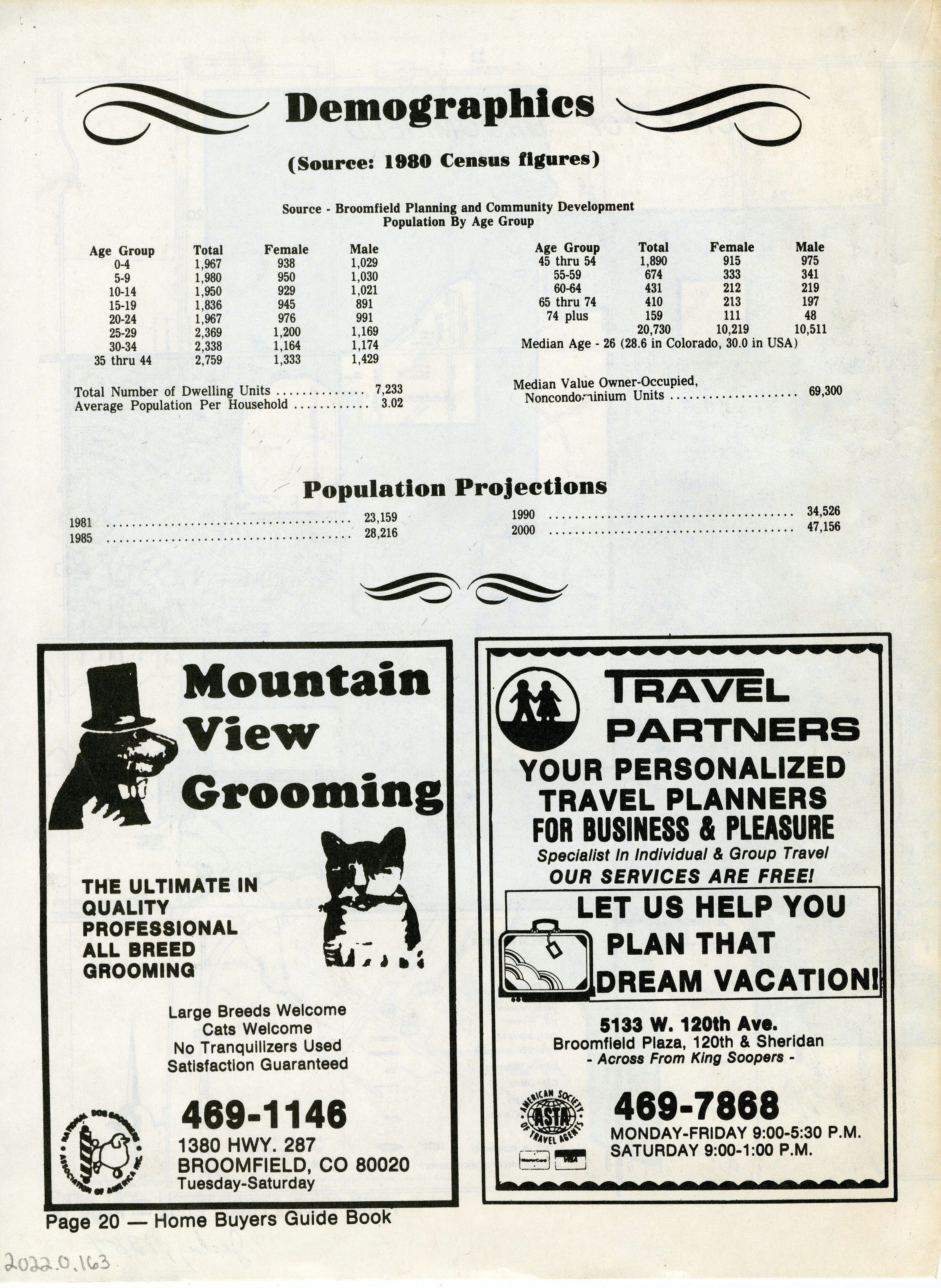
Excerpt from Home Buyers Guide Book (pages 17-20) containing a 1984 map of Broomfield. From Simms Street in the west, to Zuni Street in the east, to 144th in the north, to 112th in the south. Many areas west of Sheridan haven't been incorporated yet. Is an 11x17 piece of newsprint paper folder in half. The front includes a list of emergency and frequently used phone numbers and an advertisement for Broomfield Homes, Inc (Gate N' Green). The back cover lists the demographics (age, sex, number of dwelling units, and value of single-family homes) of the city as of the 1980 census, as well as population projections through the year 2000. Back side also has two ads; one for Mountain View Grooming and the other for Travel Partners.Collection
Permanent CollectionCategory
Maps