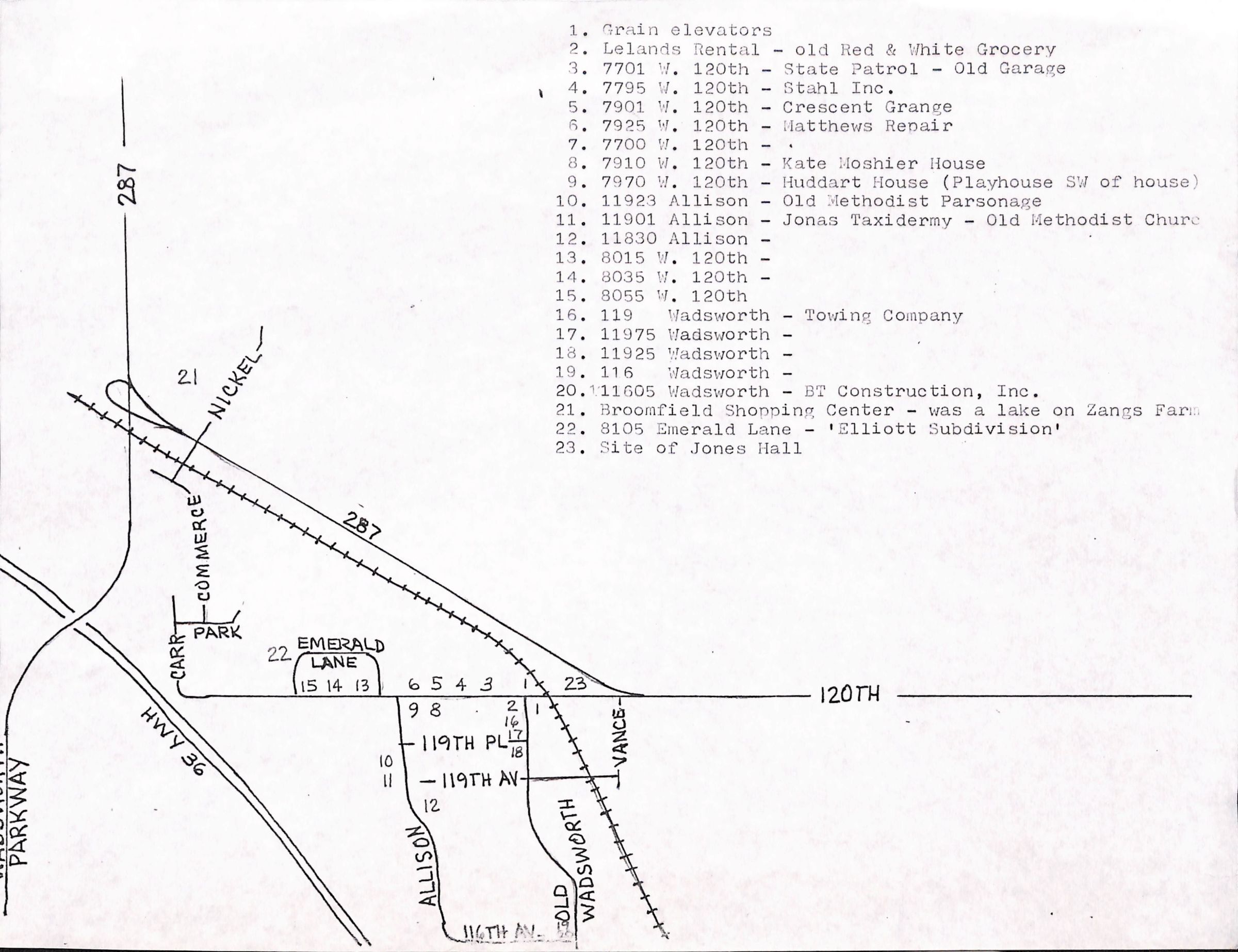
This is a map of the Southwest corner of Broomfield between 287, Highway 36 and 120th. This map shows varies locations (most likely historic) of Broomfield. The locations are numbered with corresponding numbers to the key.
The Locations are:
1. Grain Elevators
2. Lelands Rental - Old Red & White Grocery
3. 7701 W. 120th - State Patrol - Old Garage
4. 7795 W. 120th - Stahl Inc.
5. 7901 W. 120th - Crescent Grange
6. 7925 W. 120th - Matthews Repair
7. 7700 W. 120th -
8. 7910 W. 120th - Kate Moshier House
9. 7970 W. 120th - Huddart House (Playhouse SW of house)
10. 11923 Allison - Old Methodist Parsonage
11. 11901 Allison - Jonas Taxidermy - Old Methodist Church
12. 11830 Allison -
13. 8015 W. 120th -
14. 8035 W. 120th -
15. 8055 W. 120th -
16. 119 Wadsworth - Towing Company
17. 11975 Wadsworth -
18. 11925 Wadsworth -
19. 116 Wadsworth -
20. 11605 Wadsworth - BT Construction, Inc.
21. Broomfield Shopping Center - was a lake on Zang Farm
22. 8105 Emerald Lane - 'Elliot Subdivision'
23. Site of Jones Hall
Lexicon
Nomenclature 4.0
Nomenclature Secondary Object Term
Map
Nomenclature Primary Object Term
Cartograph
Nomenclature Sub-Class
Graphic Documents
Nomenclature Class
Documentary Objects
Nomenclature Category
Category 08: Communication Objects
Relationships
Related Places
Place
* Untyped Place
Joe Jonas Jr. Taxidermy, Broomfield Retail Center / Shopping Center, Methodist Church, Huddart House and Playhouse, Crescent Grange