Name/Title
Aerial Photo of Adams CountyEntry/Object ID
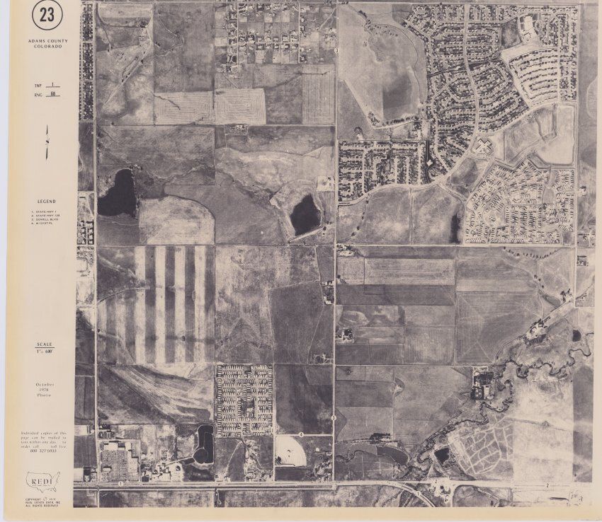
2019.6.2Scope and Content
A black and white aerial photo taken of Adams County. The scale is 1"600'. The photo was created in Octobeer 1978. It features several suburbs (Sunnyslope Estates and Continental Estates), properties still in development, fields full of crops, State Highway 1, State Highway 128, Dowell Blvd, and W 121st Pl. All estats mentioned still stand currently.
The legend reads:
1. STATE HWY 1
2. STATE HWY 128
3. DOWELL BLVD
4.W 121ST PLCollection
Permanent CollectionLexicon
Nomenclature 4.0
Nomenclature Secondary Object Term
MapNomenclature Primary Object Term
CartographNomenclature Sub-Class
Graphic DocumentsNomenclature Class
Documentary ObjectsNomenclature Category
Category 08: Communication ObjectsArchive Details
Creator
Real Estate Data IncorperatedDate(s) of Creation
1978