Name/Title
Geological Report / Hi-Way Mine / Ridgeview Heights / Broomfield, Colo.Entry/Object ID
2022.0.130Scope and Content
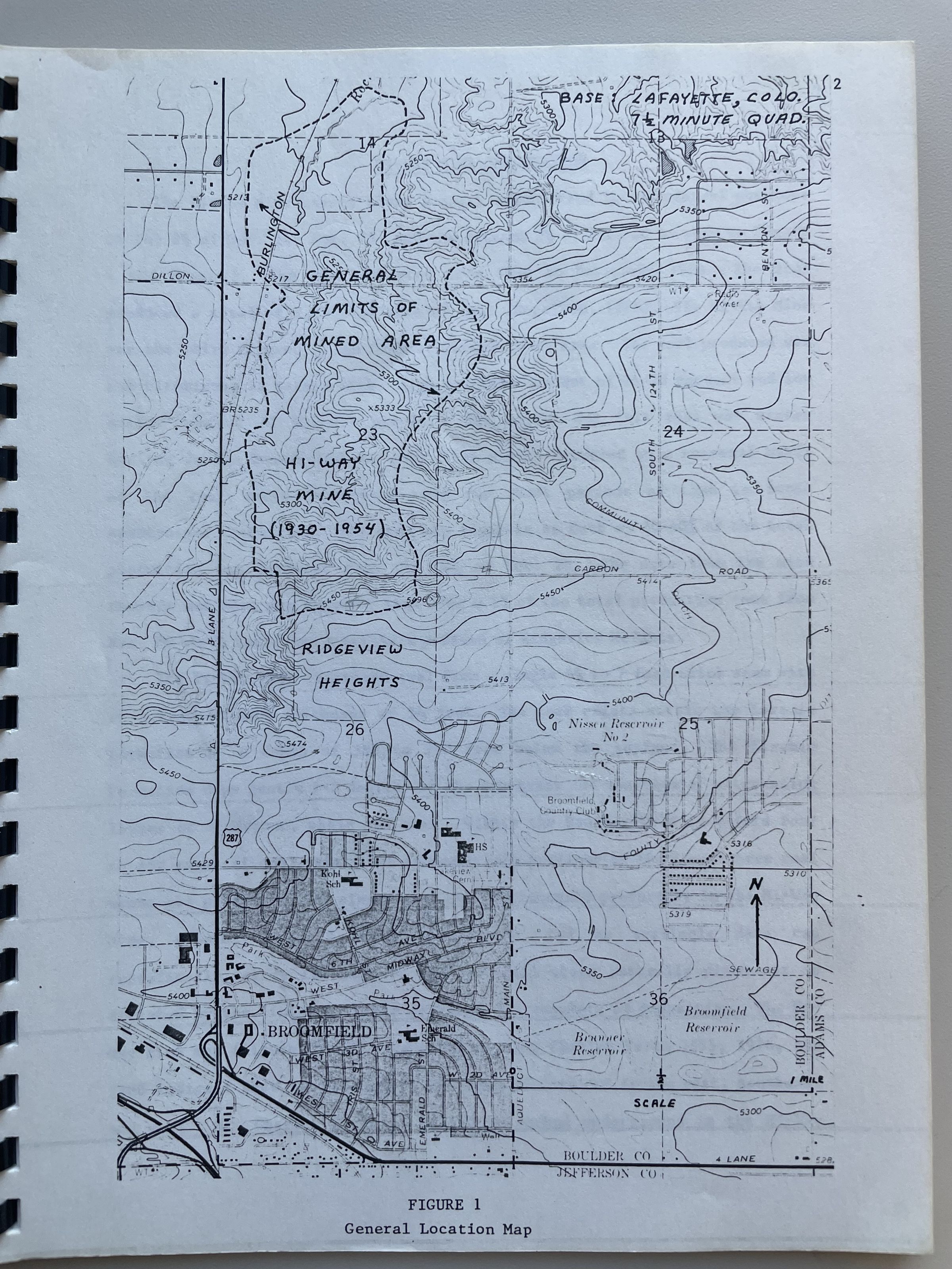
Geological report ("Subsistence Potential at Ridgeview Heights"on the potential for a housing development called "Ridgeview Heights" near the "Hi Way Mine" (the area that is now Ruth Roberts Park in northeast Broomfield/southeast Lafayette). This housing development looks to be today's neighborhood around Ridgeview Circle near Kohl Street and the water tanks.
"Geological Report on Subsistence Potental at Ridgeview Heights, Broomfield Colorado for Harold D. Meyers Weatherfield Homes Denver, Colorado by Wm. S. Calkin, D.Sc. Consulting Geologist Golden, Colorado January 18, 1980."
Includes map of area. Includes history of the Hi-Way Mine and detailed account on how the mine operated, as described by former miner Charles Porta. Mining stopped in 1954 after a fire destroyed the main shaft. Says that Mr. E.K. Pierce of Broomfield farmed the property continuously from 1958 to 1978.
Cover letter written by William S. Calkin, Consulting Geologist from Golden. Second letter written by Lynn A. Brown, Engineering Geologist
Document talks about possible mine collapses and recommends a 100ft set-back.Collection
Permanent CollectionLexicon
Nomenclature 4.0
Nomenclature Primary Object Term
ReportNomenclature Sub-Class
Administrative RecordsNomenclature Class
Documentary ObjectsNomenclature Category
Category 08: Communication ObjectsArchive Details
Date(s) of Creation
Feb 25, 1980