Name/Title
Tracing of Colorado and Southern Railway Map for BroomfieldEntry/Object ID
1975.7.4Scope and Content
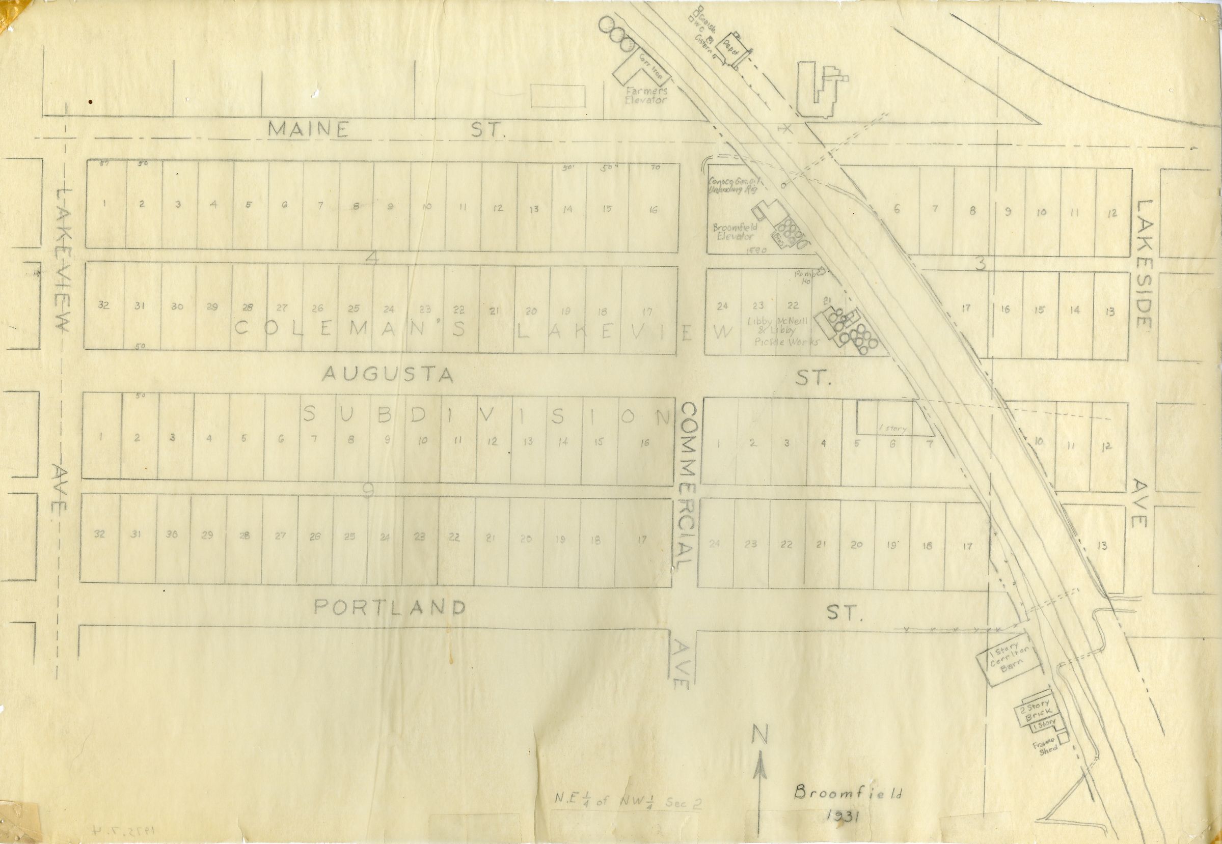
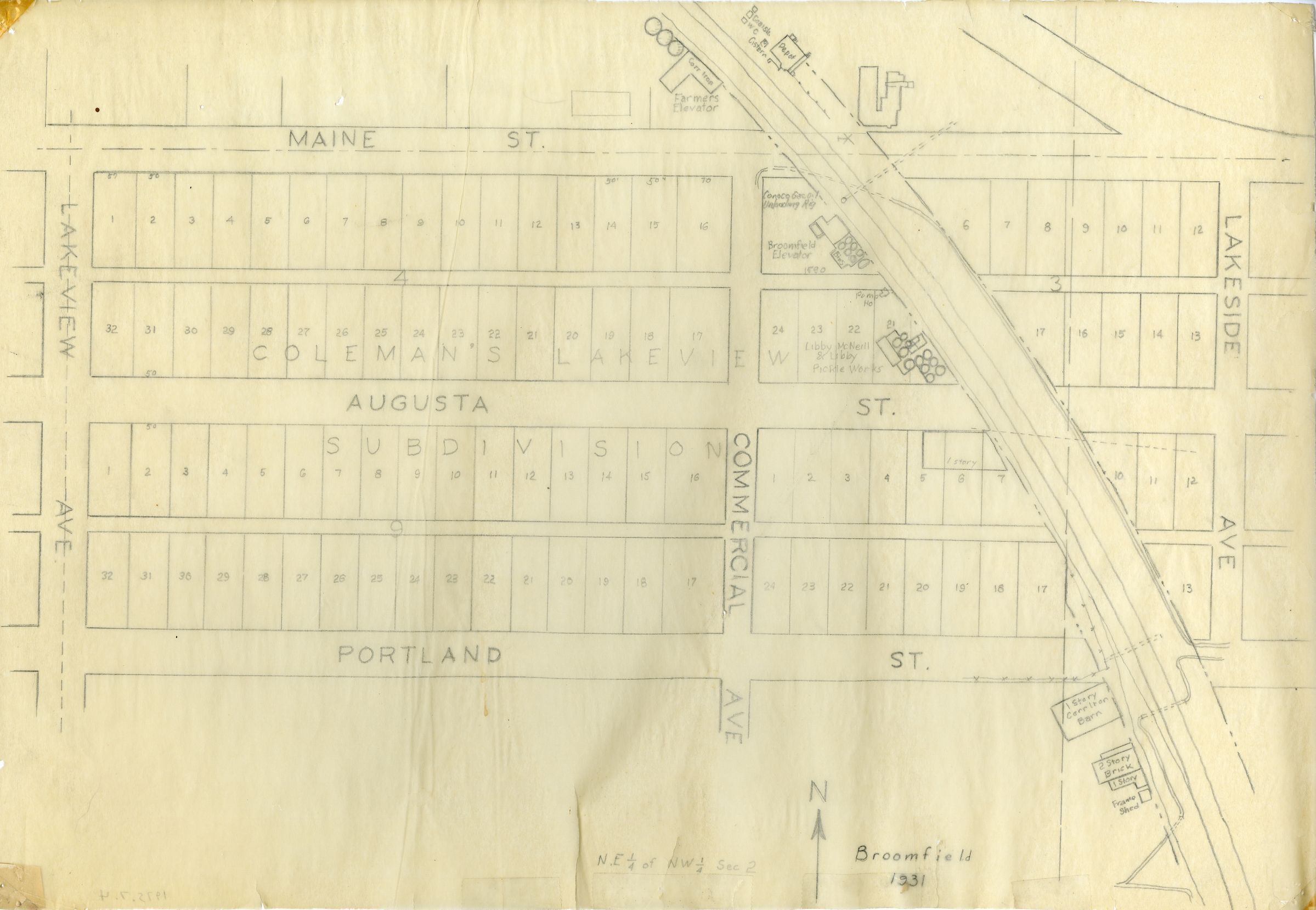
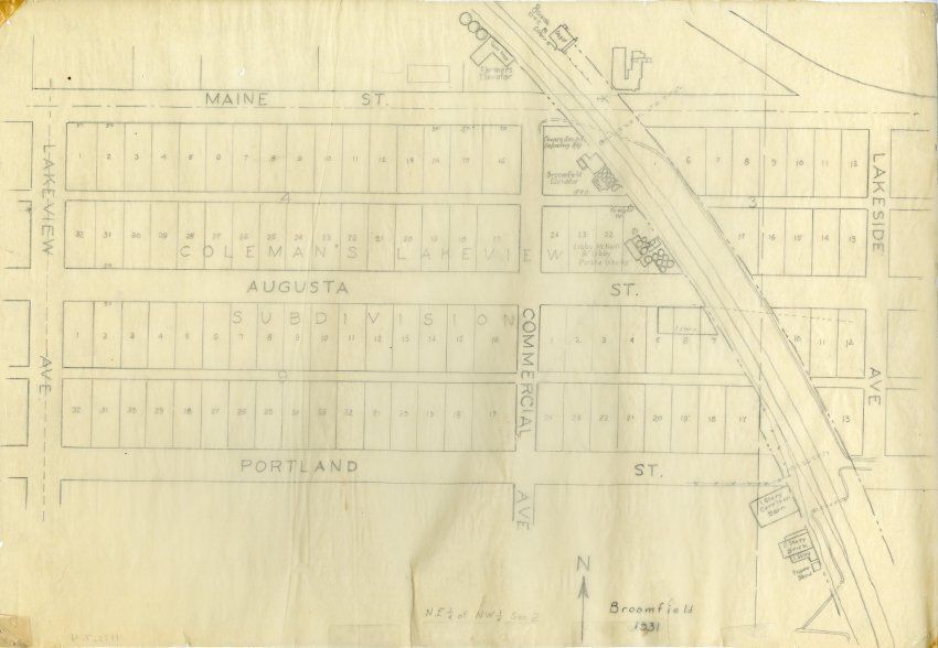
Station map, Broomfield, Jefferson & Boulder Counties.
Colorado & Southern Office of Chief Engineer - Denver, Colorado
Copy of Broomfield map (1975.2.1, 1980.6.1-2), 1931, labeled with pencil on thin tracing paper. It is smaller than the original, 12" x 17". The exact date the map was traced is unknown. This map shows not only the location of the Broomfield depot, but Burns Junction, businesses in old Broomfield, and residential plots. Streets shown are Maine Street, Augusta, and Portland heading East and West, and Lakeview Avenue and Lakeside Avenue going North and South. The Broomfield Railroad Depot, adjacent granary, and railroad tracks are also shown on the map. The map location is printed on the map as "NE 1/4 of NW 1/4 Sec. 2."Collection
Permanent CollectionLexicon
Nomenclature 4.0
Nomenclature Secondary Object Term
MapNomenclature Primary Object Term
CartographNomenclature Sub-Class
Graphic DocumentsNomenclature Class
Documentary ObjectsNomenclature Category
Category 08: Communication ObjectsLOC Thesaurus for Graphic Materials
Maps, Railroad depots, Railroad tracks, Streets, TracingsSearch Terms
Broomfield Depot, Colorado and Southern Railway, Boulder County, Jefferson CountyArchive Details
Date(s) of Creation
1931 - 1931Archive Size/Extent
In flat storage, approximately 16" x 21" archival board container.Archive Notes
Date(s) Created: Circa 1931
Date(s): 1931 circa
Medium: Paper
Scale: 1:1200
Copy/Orig/Other: Reproduction