Name/Title
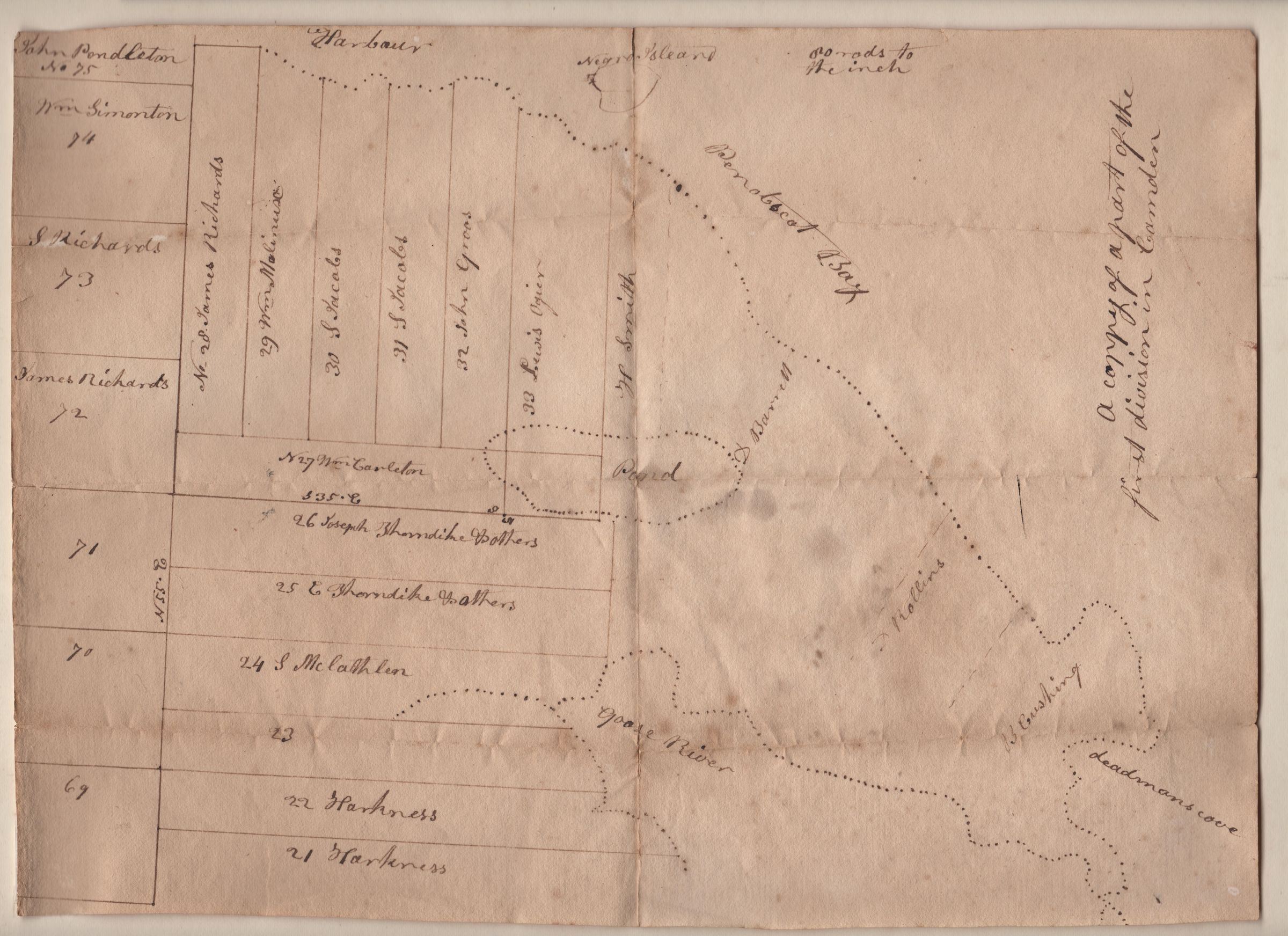
Map of the first division of Camden circa 1780Entry/Object ID
1970.718.2Description
Survey of the first division of Camden. Includes lots belonging to first settlers William Simonton, John Pendleton, James Richards, William Carleton, Joseph Thorndike, William Molyneaux (Molinaux), S. Jacobs, Lewis Ogier, John Groos [Gross?], H. Smith, Daniel Barrett, D. Rollins, Benjamin Cushing, and William McGlathry. Includes Negro Island (now Curtis Island in Camden), Goose River Harbor (now Rockport), Lily Pond, and Deadman's Cove.Collection
Map CollectionAcquisition
Accession
1970.718Source or Donor
UnknownMap Details
Maker or Creator
Harkness, JohnDate Published
1780 - 1785