HUB
Collections
Classifications
About
App
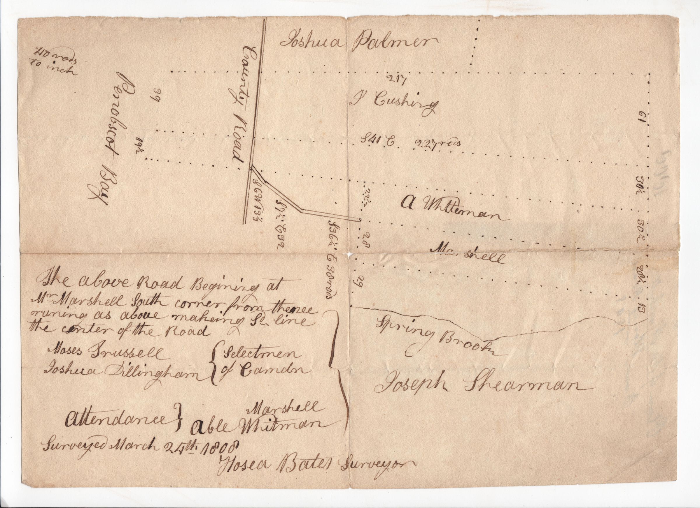
Plan of roads near Spring Brook in Camden, May 1808
Map
-
Camden-Rockport Historical Society
Name/Title
Plan of roads near Spring Brook in Camden, May 1808
Entry/Object ID
1970.718.3
Description
Survey of a road near Spring Brook and land belonging to Joseph Sherman in Camden. Scale of 40 rods to an inch.
Collection
Map Collection
Acquisition
Accession
1970.718
Source or Donor
Unknown
Map Details
Maker or Creator
Bates, Hosea
Scale
40 rods = 1 inch
Area or Region
Location
Maine/ Knox County/ Camden
Date Published
May 1808