A map of the farm of Seth Marvin Jun'r
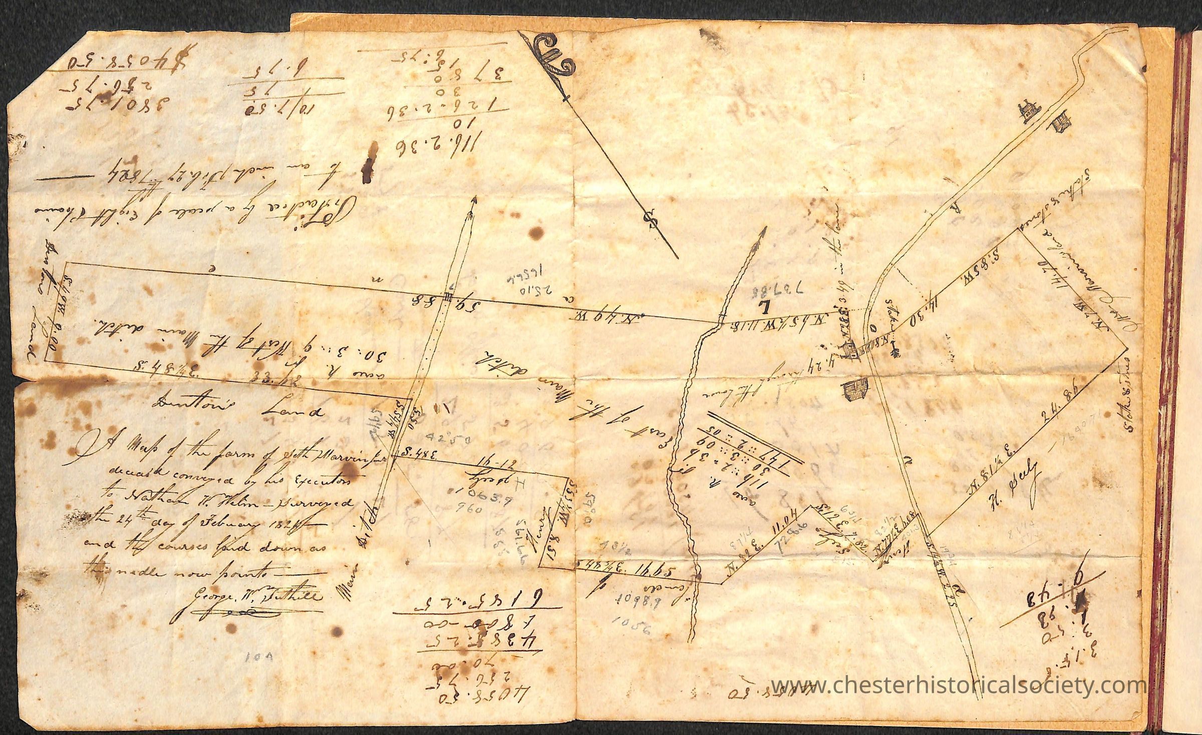
An 1824 map of the farm of Seth Marvin Jun'r
The image depicts an old, detailed hand-drawn map on aged paper, featuring various lines and annotations, likely representing land boundaries and measurements, with some areas marked with numbers and words in cursive writing, alongside a few ink blots and folds visible on the surface.
Name/Title
A map of the farm of Seth Marvin Jun'rEntry/Object ID
chs-019560Description
The old, detailed hand-drawn map on aged paper, of 1824 "A map of the farm of Seth Marvin Jun'r," features various lines and annotations, likely representing land boundaries and measurements, with some areas marked with numbers and words in cursive writing, alongside a few ink blots and folds visible on the surfaceContext
Is site later became a Women's prison and later Camp LaGuardia.Category
Marvin & Helm Farm, Marvin Farm, Camp LaGuardia
Farms