Transcription
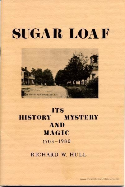
Sugar Loaf Its History Mystery And Magic 1703-1980
Richard W. Hull
ACKNOWLEDGEMENTS
I wrote this essay out of a firm belief that every citizen has a responsibility to know something about the community in which one lives. By knowing the past, we may understand the present, and plan wisely for the future. I also believe that the backbone of America is its grass-roots communities, both rural and urban. Therein lies the seeds and genius of our democracy. If we lose our sense of 'community' we will risk losing our basic freedoms. In the search for what 'America is all about', historians too often examine the big picture, our state and national institutions. Yet America really sprang from its small hamlets and drew its vitality from them. Today, these small communities are being swallowed up by our mass culture. Consolidations of our rail, postal, telephone and other services are obliterating our sense of community. Until now, Sugar Loaf has survived. . . and even thrived. This booklet explains why.
This cannot be considered a definitive work. Much more must be done. Nevertheless, what little I have written here could not have been accomplished without the assistance of such citizens as: Leonard Baird, Avril Baird, Mary Cameron, Ezra Decker, Donald Barrell, Donald Clark, Jim Conklin, Myrtle Edwards, Billie and Mark Laroe, 'Bus' Laroe, Henry Pomares, Walter Kannon, Irmgard Kurtz, Don Oppman, Grace Roosa, Alice Talmadge, Wilfred Raynor, Mrs. Seely Ward, and many others. The Information is also the product of a decade of sifting through local newspapers and history books, personal diaries and manuscripts, surveyor's notebooks, census records, old telephone and railroad directories, old maps, and post office records.
RICHARD W. HULL, PHD.
July, 1980
Sugar Loaf, New York
THE INDIAN ERA
Consider this book a walking guide through more than 277 fascinating years of Sugar Loaf history. Our first stroll begins in 1703. We pass clusters of wigwams and an occasional longhouse, or linear structure with attached segments to accomodate an expanding family. A little stream, a headwater of the Otterkill, meanders under canopies of towering Red, White, and Black Oak, White Ash, and stands of Elm, Chestnut, and Birch. Rarely broken is the primal silence of this sylvan wilderness.
The local Indians may have been Minsis, or Minisinks, a branch of the Leni Lenapes who were associated with the great Algonquin nation. Their totem was the wolf, an animal in abundance. Rambout was the chief in this locality and his people's deceased were placed on the eastern slope of Sugar Loaf mountain, to be gathered by the heavenly spirits.
The early white trappers, hunters, and settlers left no diaries concerning the people they encountered. After the Indians departed, or died, everyone seems to have developed a case of collective amnesia, perhaps out of guilt and from an obsession with the struggle for frontier survival in an uncertain present. Reference to Indians is made only by Charles Clinton, who in his Marble Book mentions spending a few nights in November, 1746, in wigwams while surveying the Sugar Loaf area for the Cheesekook patentees.
The mystery deepened in 1979 when John Bradner, searching for Celtic evidence, discovered a strange cluster of fifty or so cairns, or rock piles, near Sugar Loaf mountain's northern ascent. Each cairn rests on a slab of massive bedrock and they are tightly clustered in an area less than two acres. Clearly, they are neither property markers or fence supports. Are they of Indian provenance, or evidence of early Celtic influence? We may never find an answer; but we do know that the early white settlers regarded Sugar Loaf mountain as an important beacon for travelers. East Ridge Road, which follows an old Indian trail, lines up almost exactly with the site.
Many Indians passed through the Sugar Loaf valley, ambling along the Wawayanda path, today known as Kings Highway or County Route # 13. The path connected two major ceremonial centers, near present-day New Windsor and Philadelphia. Indian travelers may have enjoyed the many fine peach and apple trees flourishing in the area.
A PERFIDIOUS PARTITION
The year is 1703, Rambout and twelve other local chiefs have just affixed their marks to the Wawayanda Patent. Unwittingly, they have signed away nearly 194,000 acres of their ancestral lands to twelve white speculators, who had no intention of settling on the lands but who knew full well the Patent's implications for the future of Indian civilization. How could the Indians have known that whites in great number would eventually physically occupy their lands. For nearly a century, the white man's presence had been fleeting, and restricted to the banks of the lower Hudson River valley.
The Patent was of dubious legality from the start. No survey accompanied it; and a New York City physician of Dutch ancestry, Samuel G. Staats, claimed he had taken title three years earlier. In 1700 he had hastily constructed a stone house on a nearby ridge and chiseled his initials and date “SGS 1700" on a stone in the wall next to the front door. The house is today the residence of David Hull of Applewood Orchards. Lands east of Sugar Loaf mountain fell into the smaller Cheesekook (Cheesecock) Patent, signed in 1702 though also vaguely defined. 'Cheesekook' was an Indian word meaning 'up-land' and referred to the highlands west of the Hudson River.
By 1705, the patentees were feverishly subdividing. Adrian Hoagland and Anthony Rutgers acquired a large tract on the west side of the Wawayanda path. In time, more pieces, usually about a hundred acres each, were carved out of the two vast patents. Still, no whites exploited or settled the virgin lands, leading the Indians to believe that such real estate transactions would never disrupt their tranquil and self-sufficient lives. It can be compared to the situation today, where outside speculators have been quietly buying Orange County farms and leasing them back to local agriculturists. Visually, little has changed as a result and no one raises a cry of alarm. Eventually, we may wake up to discover that much of what we believe to be ours is actually being developed by absentee landowners.
THE COLONIAL ERA
A new, and for Indians a tragic, era opened in about 1738 when Hugh Dobbin; a barrel-chested northern Irishman of Scottish ancestry and his wife, Elizabeth, purchased land and settled on the southeastern slope of Sugar Loaf mountain. The Dobbins were probably the first permanent white settlers in the locality. Months later, Charles Seely bought and occupied property on the ridge northwest of Sugar Loaf, presently the Richard Banker farm.
It is still not certain how Sugar Loaf acquired its name. The most plausible tale is that Elizabeth Dobbin, during her first winter here, gazed up at that huge bald uplifted fault block, shrouded in heavy morning mist, so frosty at the summit yet so greenish-brown at the base, and was reminded of the hard loaves of sugar she and all colonial housewives made in their smokey kitchens. Rising majestically 1,226 feet above sea level, the mountain carried the name Sugar Loaf and with it the fertile lands stretching from the Wolfgang Kurtz and Burnett Bliven farms in the south, to the Fred and Kate Whaley farm in the north, and over to the Black Meadow Club entrances in the west.
Orange County was formed in 1683, after the Province of New York was divided into counties. Ours was named in honor of William, Prince of Orange. Nevertheless, local colonial government did not extend to the area until 1714 with the establishment of Goshen Precinct. White population growth in the southern part of the county was almost imperceptible until after 1735 when the British decided to widen the old Wawayanda Path into a Kings Highway. With the prospect of improved transportation, land in this area became more desirable. Families streamed in, trekking mainly from western Connecticut, Long Island, and Bergen County, New Jersey. Between 1731 and 1746, the county's non-Indian population grew from 1,969 to 3,268, much of that growth occuring in the southern half. Nearly 10% of that number consisted of blacks. The economic fortunes and misfortunes of Orange County have always been determined by the adequacy of transportation.
The road through here was completed in 1739. In anticipation, two more land speculators, Samuel and Mary Clowes of Jamaica, Queens, bought property on both sides of the road on a high knoll, bounded on the east and west by two streams. By then, the Clowes's had become major landowners in Orange County. Since 1705 they had been buying up parcels from the original patentees. In 1714, they laid out the town of Goshen. In our locality, they purchased lands from Staats, Rutgers, Hoagland, Denne, and Merritt. Between 1745 and 1748 they subdivided their Sugar Loaf holdings, intending to establish one of the county's first tract housing developments. Mary conceived of the development as a craft and provisioning center for surrounding farmers and she decided to call it Sugar Loaf hamlet. Surprisingly, women played an important role in real estate transactions and inheritance questions in the pre-revolutionary period. Only after the Revolution would women lose a large measure of their legal standing vis-a-vis men.
Outside the hamlet, many of the original Cheesekook and Wawayanda patentees still held extensive lands, namely Derrick Vandenburgh, John Merritt, Christopher Denne, Peter Mathews, and Daniel Honan. But they continuously sold off portions to newcomers who wished to clear the land and cultivate.
By 1760, the Indian population was practically nil. Most had fallen victim to the white man's smallpox, measles, or common cold. For the survivors, the tranquility of Sugar Loaf had been broken constantly by the hunters' gunshots; and wildlife haunts were uprooted by the settlers' plows and axes. Fields were cleared of stones and stones were piled to form walls for excluding strangers. Indian self-sufficiency and self-esteem collapsed. Alcoholic beverages, especially rum, became a major item of barter and alcoholism eroded the fragile fabric of indigenous civilization. From puberty, Indian men became cheap day laborers on settler farms, clearing the woodlands on which their independent livelihood depended. Surprisingly, no records exist of physical resistance to this alien onslaught. These people had never known warfare; and fighting was not a part of their ethical or social system. Nor was the concept of private and exclusive ownership of property.
Kings Highway, and the constant subdivision and settlement of their ancestral lands, drove the Indians westward, toward the Delaware. In about 1750, Hugh Dobbin bought two additional parcels, or 83 acres, from Clowes and built a new house. This is today on the estate owned by Walter and Marion Kannon; and it may have been the hamlet's first permanent residential structure.
When Indians attacked the western region of Orange County in 1755-57, Dobbin, who ran a thriving horse business, pastured 115 horses for John Wisner, an officer in this so-called French and Indian War. Sugar Loaf residents participated in the War in the name of their colonial overlords, the English monarchy. Caleb Knapp fought the French at famed Fort Louisbourg in Canada. Nathaniel Knapp, junior and senior, also went to war.
The settler population of the Sugar Loaf area grew rapidly after the French and Indian War and the establishment of security on the frontiers of the North American colonies. Most new arrivals were families of English, Scottish, Irish, and French ancestry: among them the Demarests, Conklins, Knapps, Seelys, Howells, Stevens, Vances, Wells, Hallocks, Woods, and Raynors. Their descendants still reside in the vicinity.
The two great characters of those days were Nathaniel Knapp and Hugh Dobbin. Knapp, who died in 1812 at 86, was buried at a site on a hill behind Leonard Baird's present house, where he had single-handedly struggled with an enormous male bear and managed to kill him with a small knife. Old Nathaniel died while his son was fighting pirates off the North African coast of Tripoli.
The more worldly Hugh Dobbin was envied, respected, and, by a few, disliked. He was a shrewd horse trader, came from money in Northern Ireland, but later lost his estate while living in distant Sugar Loaf. He was extremely bright, mild-mannered, but exceedingly confident to the point of appearing arrogant. He was an eternal optimist, and rather prescient, about the future prospects of Sugar Loaf as a craft community and as a center for horse breeding and trading. According to the 1775 assessment roll, Dobbin and a newcomer, Barnabus Horton, were among the area's largest contributors to the property tax.
REVOLUTION AND REACTION
The American Revolution found Sugar Loaf residents bitterly divided, even within families. Violence was condoned and some people used this as an opportunity to settle old scores. In 1776, one resident shot and almost killed his neighbor, whom he accused of Loyalist sympathies. In fact, the two families had been feuding for years. Jacobus Demarest, along with many others, joined the regiment of Warwick's Colonel Hathorn. The Demarests, of French Huguenot origin, left Oradell, New Jersey in about 1752 and established a farm on the ridge above Sugar Loaf, today owned by Isadore Demarest. Demarest's son, Gilyam, followed the Loyalists and eventually fled to Prince Edward Island in Canada. The youthful William and Samuel Raynor were also Loyalists. Samuel smuggled food and supplies to his brothers on Long Island who sold them to British troops. After the Revolution, the Raynors managed to retain their lands but it was generations before they were fully accepted back into the community.
Other families were less fortunate. The local 'Committee of Safety' identified 'traitors' and forced more than thirty families in the Warwick-Sugar Loaf area to emigrate to such distant places as Prince Edward Island, Nova Scotia, the West Indies, and Great Britain. Anyone refusing to sign the Revolutionary Pledge in July, 1775, was suspected of Loyalist sympathies. Those expelled found their properties confiscated by the Commissioners of Conspiracies. One Sugar Loaf widow, who resided in the present Richard Manley house, was dispossessed, along with her four children. Nathaniel Knapp, fresh home from fighting in the Dutchess County regiment, bought the property from a land Commission.
One either had to be for or against the Revolution. Before 1775, very few people expressed grievances against the local government. In fact, some Revolutionary war heroes were formerly tax assessors, large landowners, surveyors, physicians and attorneys, all of whom fared quite well under the colonial system. Government was certainly as close, if not closer, to the people than it is today; and relatively speaking taxes were not nearly as burdensome. In this locality, most people were quite content with the status quo. Perhaps others believed that their full economic and political potential would never be reached until total independence had been achieved. If newspaper commentaries are considered, there seemed to be a lot less grumbling about taxes and responsible government at that time than today. Why did hitherto rather conservative small farmers suddenly become revolutionaries? Much more research at the grass roots level needs to be done on this tantalizing question. From political and economic viewpoints, very little fundamental reform resulted directly from the revolution in this locality. Property taxes were not reduced, nor was the method of taxation radically altered. Many of the tax collectors and other local government officials remained in office after the Revolution.
During the Revolution, fence-sitters, equivocators, neutralists, and pacifists were not tolerated. The famous French-born agronomist, St. John de Crevecoeur, who lived up the road in Greycourt, was driven away. His only crime was a desire to remain apolitical and to pursue his agricultural experimentation, which benefited local farmers,
By 1777, the Goshen jail was full of suspected Loyalists, or Tories. Eventually, most people in the Sugar Loaf area supported the Revolution and participated in it: John Holbert, Cato Dean, John Sutton, Sam Vance, Benjamin Jennings, George Howell and David Howell Jr., John Howell, Henry Dobbin, Jacobus Bertholf, Hugh McWhorter, William Helm, Nathaniel Knapp (junior and senior), Timothy Clark, Jacobus LaRue, and young Hendrik and Crynis LeRoux. Some of their descendants live here today.
So do a few of the descendants who remained loyal to Great Britain. One prominent county resident, Claudius Smith, raided farms in Blooming Grove, Cornwall, and Monroe and sold horses to the British at Stony Point and Fort Lee. Old-timers claimed that Sugar Loaf mountain was one of his hideouts. The Commissioners eventually captured him and before a crowd of nearly 500, he and a few other Loyalists were hung on a chilly morning in January, 1779 near today's Goshen Presbyterian Church. Hugh Dobbin, by contrast, sold horses to the Continental army.
In some ways, Sugar Loaf profited from the war. King's Highway served as a vital thoroughfare from New England and New York to New Jersey and Pennsylvania. When New York City was occupied by the British, Kings Highway became well-traveled by couriers en route to Washington's headquarters in Newburgh.
After the war, life continued pretty much as before. Rum remained the preferred alcoholic beverage; though some farmers sold wheat, rye, barley, buckwheat and English oats to local brewers for making malt and beer. Most men and a few women chewed or smoked tobacco. Money was in short supply and many business transactions were barter arrangements. Pounds and shillings remained units of currency for a long time and the former colonists retained the antiquated English system of weights and measures, in preference to the metric system. In 1798 it was hardly noticed that Sugar Loaf was administratively placed under Warwick. Goshen, and all other Precincts were dismantled by 1801 and large localities such as Warwick became towns.
In one sense, the colonial era was not laid to rest until 1785 with the settlement of a long-standing legal battle over the delimitation of the original land patents. Aaron Burr and Alexander Hamilton served as attorneys for the patentees, in a case heard in the Yelverton barn in Chester.
Sugar Loaf may have experienced a flurry of mining activity at the turn of the century. In 1795 an offer was made by Daniel Honan and Mr. Vandenburgh to sell rights to the 'Sugar Loaf mines' for the then considerable sum of $2,500. Many of the early land speculators considered the area rich in exploitable minerals and saw the county more for its mining than agricultural potential.
The Revolutionary War stimulated a popular desire for literacy. In 1791, a school opened on the corner of Hen Street (now Well Sweep lane) and Kings Highway. Literacy spread; and in 1797 a library was incorporated in nearby Chester village. Inexplicably, it was short-lived.
THE EARLY SOCIAL AND ECONOMIC FABRIC
Our second stroll through Sugar Loaf begins in 1803, just a century after the Wawayanda Patent. The extent of change is phenomenal. A civilization and its entire population has vanished, virgin timberlands have all but disappeared, fields have replaced forests, and Indian foot paths are now rutted wagon roads.
It's a cold January afternoon, Mrs. Jesse Wood has picked, spun, carded, woven, and was now dyeing wool sheared from the many local Merino sheep. She may also have visited the hamlet's small carpet factory that day. Mrs. Jacobus Demarest on the ridge is knitting long gray woolen and linen socks. Sugar Loaf women favored the colors blue indigo, ocre, and pokeberry red. Mrs. Howell, in the heart of the hamlet, is completing a pair of mittens. The Hallocks on the east side of Kings Highway are dipping candles for their neighbors, the Helmses and the LaRues, who live down the street at the south end. Old Nathaniel Knapp at the north end is adding a second story to his home, today owned by Richard and Joann Manley. Architecturally, Sugar Loaf's two-room log cabins were being transformed into two-story clapboards with brick fireplaces and front porches. The present homes of Arthur Ahr, the furniture maker; and Joseph Green, are among the few remaining structures of that type.
Everyone wore heavy, rough woolen clothing almost year round. Men's slacks were made of woven leather and in winter their shirts were linsey-woolsey, a fabric combining the durability of linen with the warmth of wool. Cotton calico was difficult to obtain and expensive before about 1830.
Sugar Loaf was a moderately prosperous reasonably well educated region, boasting of eight one-room schools, and a hamlet with a wagonmaker, cabinetmaker, a carpet factory, a cheese factory, a tannery, two cooperages, a blacksmith shop, and Gershom Wells' general store. Wells had just bought the business from Jesse Wood. On cold snowy days, the women congregated around his fireplace and conversed, much to Wells's delight. On clear, warmer days, usually Wednesdays, they were down at the stream behind what is today the home of Arthur and Maxine Ahr, washing clothes with soap made in a little shop from ashes taken out of local hearths. Southeast of the hamlet, Ira Bull operated a gristmill and sawmill. Both were flourishing enterprises.
Sugar Loaf residents were industrious and self-sufficient. In winter they made good use of locally-grown rye, corn, and wheat for bread and porridge. Some of the finest wheat in early America came from Orange County farms and was in great demand in the best New York bakeries and pastry shops.
The blue flowers of the flax, for linen-making, grew in the shadow of Sugar Loaf mountain behind what is today Sym's jewelry shop in Scott's Meadow. Bark for the tanning of leather was obtained from tall trees growing on Brimstone and Mine hills, located, respectively, on the south and north ends of Sugar Loaf mountain, and on Pine Hill on the hamlet's west flank. Some of the richest milk for butter, cream, and cheese came from the Raynor farm. The butter was placed in wooden tubs, called firkins, and sent to New York City via Hudson River sloops. Fresh milk, so perishable, could not reach the distant city before spoiling.
In those days, New York City was more distant in traveling time by sloop or wagon than Tokyo is today by air freight. Yet our farmers were undaunted and took every opportunity to meet the challenge. It took courage, for New York was a forbidding place to many. Some elderly residents had never visited the City and nearly everyone looked upon it as an evil place of crime, prostitution, and debauchery. Sugar Loaf residents spent much of their precious leisure time fishing for hass and pickerel in Thompson's Pond, now Glenmere Lake.
Most Sugar Loaf families were large; and inter-marriage with second or third cousins was not unusual. The Stevens families were prolific and numerically dominated the southern end of the valley. They kept fine sheep for wool and mutton. Most infants in Sugar Loaf died before the age of five. If they reached thirteen and survived such killers as diptheria, pneumonia, or smallpox, their chances were quite good of living well into their seventies.
Not all residents were white. Blacks with names of Obi (Nigerian origin), and Quash, Quam, and Coffee (Ghanaian and Gambian) were not uncommon. Some families living in the southern end of the valley were of mixed Indian, African, and European, mainly Dutch, ancestry. These were the McGinnesses, Petersons, Catos, and Hicks. On Sugar Loaf mountain we might have encountered 'Old Tune' Tunison, who caught rattlesnakes and skunks, extracted their oil, and sold it to people as a cure for arthritis. There was also 'Old Claus', an Afro-Indian who lived for a while in the rock overhang on the mountain's western face.
Slavery was not an important institution in the Sugar Loaf area. Very few people owned slaves and those who did, held only one or two. Pawning was more common and persisted well into the 20th century. Under the system, poor debtor families would 'farm out' a child or two for varying lengths of time. They received food, clothing, and shelter in return for their labor. It was a benign form of servitude. Moreover, a suprisingly large number of families, from early times, squatted on lands, lived in shacks, and toiled as tenant farmers. That situation did not disappear until after the Second World War, with the mechanization of local agriculture, new economic opportunities elsewhere for semi-skilled industrial labor, and, most important, the growth of free public education. Local people can still remember when only middle class families could afford the tuition charges for an education beyond the seventh grade of the Sugar Loaf schools. A high school education was a privilege not a right.
Our walk continues. We need some refreshment so let's take a run over to Laroe's Tavern, up the hill where Ridge road meets Kings Highway. Sugar Loaf has always been famous for its taverns, going back to the French and Indian War when Edgar Litchult opened our first, across from the present Methodist Church in what is today the Trevor Sprake house.
LaRoe's tavern, run by Sara Raynor LaRoe, was the most popular of the three in our locality. However, stiff competition came from Bill Seely's tavern, the former Litchult establishment. The LaRoes were already old-timers by 1803. Jacobus LeRoux had moved his family from Saddle River, New Jersey, to this area in 1753. One of his sons, Crynis, married Sara Raynor.
Now that we're in the tavern, let's order St. Croix West Indian rum, just brought up the Hudson to New Windsor on the sloop called 'Susanna'. Or should we ask for the popular red or Malaga wine, cognac, gin, or local peach brandy? If you desire something cheap and strong, there is always apple jack, made in one of Sugar Loaf's three distilleries, the largest owned by Patrick Flynn.
Around the bar, people are talking about Lea Demarest's expedition in 1787 to Nootka sound on the wild Pacific coast. He had returned as a local teacher but now prepared to leave for Robert Owen's utopian community in New Harmony.
Many rough and ready teamsters frequented Sugar Loaf's taverns, for in those days Kings Highway was a major regional artery, especially for mule-drawn wagons, of up to six mules in harness, carrying coal from the fields of eastern Pennsylvania to New England.
BOTTLES, BIBLES, AND MURDER
Sugar Loaf was acquiring a bad reputation for brawls and bawdy life. This led some residents, under John Conklin's inspiration, to form a Methodist congregation in 1804. The Wheadons, Wells's, Wisners, Stevens, and Bertholfs were among the founding families. They may have chosen Methodism because of its rigid strictures against the consumption of alcoholic beverages.
The congregation grew rapidly and in 1810 the first church building was erected, directly across from the most notorious tavern in town, Seely's old Sugar Loaf Hotel. But Sugar Loaf's reputation could not be rebuilt overnight. In February 1818, the first murder-for-hire in New York State occurred here, in a field off Pine Hill road.
Richard Jennings, an unpopular local figure, was shot by a black ex-sailor, Jack Hodges, hired by three local men. Jennings' nephew was William Henry Seward, a Florida resident and later Secretary of State under Abraham Lincoln. After a long trial in Goshen, two of the three conspirators were hung. Hodges was given 20 years at hard labor. Later, he became deeply religious, was pardoned, and became a famous evangelist in upstate New York.
Spiritually, demographically, and economically, the little hamlet grew steadily. B. R. Conklin opened a feed and coal business in 1808, at a time when the Sugar Loaf area boasted of eight one-room schools. In 1829, a post office was established in Conklin's store, not far from Augustus Ackley's tailor shop. In 1980, Postmaster Don Oppmann marked 151 years of continuous postal service. No other institutions have been more enduring and more responsible for maintaining Sugar Loaf's identity than the post office and the Methodist Church. They remain the two most important forums for community dialogue and interaction.
Sugar Loaf was still torn between the commercial and spiritual ethics. In 1835, the first Methodist parsonage was opened, in what is today Jean Isner's Gift Shop. Four years later a new brick school was built, our present firehouse. By then, Sugar Loaf had three large distilleries and boasted of more than 140 inhabitants residing in at least 25 dwellings. A dance hall was opened over the livery on the north end of the Sugar Loaf Hotel. The soap factory had expanded into a community cooperative. Nearby labored a cooper, who made and repaired cider, vinegar, and whiskey barrels.
In 1845, the Town of Chester was created, forming an amalgam of pieces of surrounding towns. With the completion of the Erie railroad, old Chester village, which for decades served as a major freight forwarding center, was destined to become an important rail transportation interchange for local farmers. The village's commercial center moved northward and clustered around the new railroad station, next to the famed Howland House Hotel. Most of the Sugar Loaf area was detached from the Town of Warwick and became part of Chester. The hamlet has remained under Chester Town. It never became incorporated as a village or developed its own governmental institutions. The villages of Chester and Warwick grew rapidly between 1850 and 1875 and Sugar Loaf became ... [truncated due to length]