Name/Title
Erie Main Line Track Map CollectionEntry/Object ID
chs-000128Description
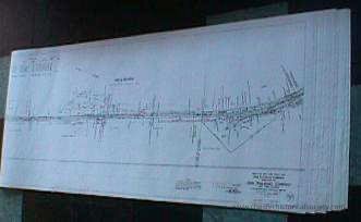
57 x 25” Paper reproductions of the thirty original linen 1918 Right of Way and Track Maps from Suffern to Goshen. List owners of acquired properties and some adjacent businesses.Category
Erie, Erie-Lackawana, Conrail
Acquisition
Notes
8/17/2000 Gift from Douglas BarberioMap Details
Maker or Creator
Charles H MoonArea or Region
* Untyped Area or Region
Rockland & Orange CountiesPublisher
Erie RailRoad CompanyDate Published
Jun 30, 1918Transcription
Map V.2.NY #19 1636+38.2 to 1690+60 Hillburn
Map V.2.NY #20 1690+60 to 1742+40 Ramapo
Map V.2.NY #21 1742+40 to 1796+20 Sterlington
Map V.2.NY #22 1796+20 to 1849+00 Sloatsburg
Map V.2.NY #23 1849+00 to 1901
Map V.2.NY #24 1901+80 to 1954+60
Map V.2.NY #25 1954+60 to 2007+40 Tuxedo
Map V.2.NY #26 2007+40 to 2060+20
Map V.2.NY #27 2060+20 to 2113+00
Map V.2.NY #28 2113+00 to 2165+80 Southfields
Map V.2.NY #29 2165+80 to 2218+60
Map V.2.NY #30 2218+60 to 2271+40
Map V.2.NY #31 2271+40 to 2324+20 Arden
Map V.2.NY #32 2324+20 to 2377+00
Map V.2.NY #33 2377+00 to 2429+80 Newburgh
Map V.2.NY #34 2429+80 to 2482+60 Harriman
Map V.2.NY #35 2482+60 to 2535+41
Map V.2.NY #36 2535+40 to 250
Map V.2.NY #36 2535+40 to 2588+20 Monroe
Map V.2.NY #37 2588+20 to 2641+00
Map V.2.NY #38 2641+00 to 2693+80
Map V.2.NY #39 2693+80 to 2746+60
Map V.2.NY #40 2746+60 to 2799+40 Newburgh Cut
Map V.2.NY #41 2799+40 to 2852+20 Greycourt
Map V.2.NY #42 2582+20 to 2905+00 Chester
Map V.2.NY #43 2905+00 to 2957+80
Map V.2.NY #44 2957+80 to 3010+60
Map V.2.NY #45 3010+60 to 3063+40
Map V.2.NY #45A 3040+00 to 3086+33
Map V.2.NY #46 3063+40 to 3116+20 Goshen
Map V.2.NY #47 3116+20 to 3169+00 GoshenDimensions
Height
63.5 cmWidth
144.8 cmCreate Date
October 22, 2024Update Date
November 23, 2024