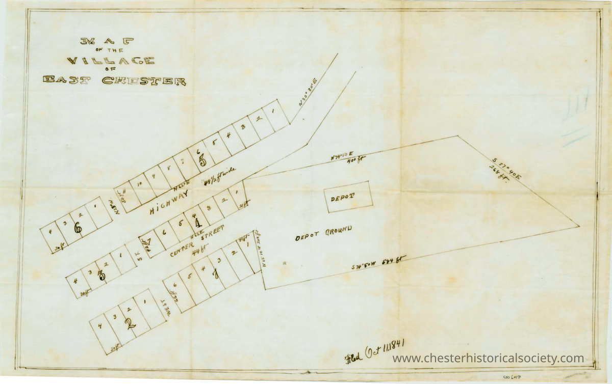
Name/Title
Map of the Village of East ChesterEntry/Object ID
chs-006017Secondary Title
1841 Map of the Village of East Chester.Description
18 by 11 1/2 inches on linenAcquisition
Notes
2/20/2004 Gift from Lorraine HomMap Details
Area or Region
* Untyped Area or Region
Chester (Village) - Orange County - New YorkTranscription
Map of the Village of East Chester
Filed Oct 11, 1841
--------------
Now known as Downtown Chester. Depot grounds became mostly G.M. Roe Lumber & Coal yard which was leased from the Erie. Parcels for downtown became different dimensions. Center Street survives, Highway became Main Street, turning into Railroad Ave. as it turns up the hill.Dimensions
Height
29.2 cmWidth
45.7 cmCreate Date
October 22, 2024Update Date
November 22, 2024