Name/Title
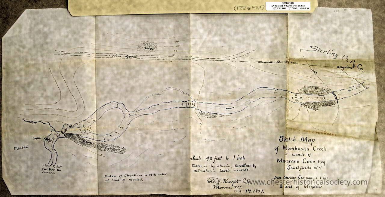
Sketch Map of Mombasha CreekEntry/Object ID
chs-011117Secondary Title
1901 Sketch Map of Mombasha CreekDescription
Courtesy of the New York State Library, Manuscripts and Special Collections.Collection
New York State Library, Manuscripts and Special Collections.Acquisition
Accession
New York State Library, Manuscripts and Special Collections.Notes
1/30/2008 Reproduced from New York State Library, Manuscripts and Special Collections.Map Details
Maker or Creator
Knight, Fred J.Area or Region
* Untyped Area or Region
Tuxedo (Town) - Orange County - New YorkDate Published
Oct 17, 1901Transcription
Sketch Map
of Mombasha Creek
on the lands of
Macgrane Coxe, Esq.
Southfields, N.Y.
from Sterling Company’s Line
to Head of Meadow
Scale 40 feet to 1 inch
Distances by Stadia, Directions by estimastion - Level accurate.
Fred. J. Knight C.E.
Monroe, NY
Oct 14, 1901.
Datum of Elevation is still water at head of Meadow.
- - -
New York State Library Manuscripts and Special Collections:
Sterling Iron And Railway Company
Records,
1740-1918,
SC14069,
Box 2, Folder 5, Item 221.
- - - -Dimensions
Height
17.8 cmWidth
56.2 cmCreate Date
October 22, 2024Update Date
November 22, 2024