Orange & Ulster Counties Map

Orange & Ulster Counties Map
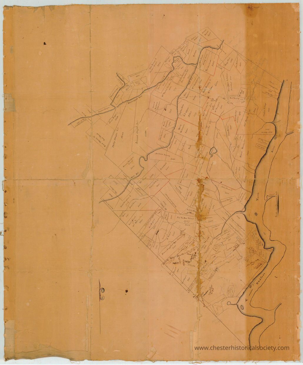
A circa 1740 hand-drawn Orange & Ulster Counties Map with a brownish paper tone, showing various outlined land parcels and sections, each labeled with text, possibly indicating ownership or usage. The map features a prominent meandering river running vertically on the right side, with smaller tributaries branching out into the sections. Lines divide the parcels, and there is evidence of aging, such as creases and discoloration along the edges.
Name/Title
Orange & Ulster Counties MapEntry/Object ID
chs-011126Description
A circa 1740 hand-drawn Orange & Ulster Counties Map with a brownish paper tone, showing various outlined land parcels and sections, each labeled with text, possibly indicating ownership or usage. The map features a prominent meandering river running vertically on the right side, with smaller tributaries branching out into the sections. Lines divide the parcels, and there is evidence of aging, such as creases and discoloration along the edges. This map of Orange & Ulster Counties includes what is now Rockland County. Names shown include several original Wawayanda Patentees. The original is held by the NYS Library, call number: MSC XX19862.Collection
New York State ArchivesCategory
Orange County
Other Locales
