Portion of Map of Orange County, N.Y.
Portion of Map of Orange County, N.Y.
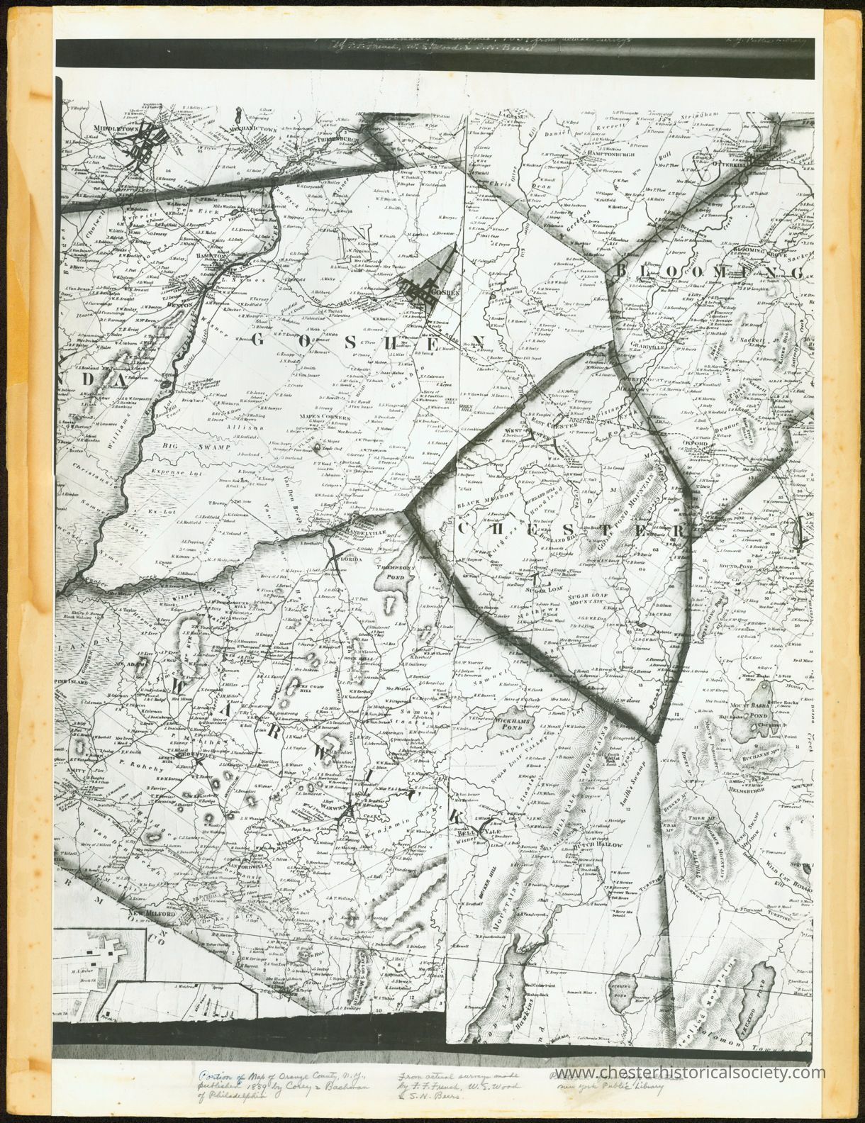
The image is a detailed black-and-white photostat historical map mounted on heavy cardstock from Map Collection New York Public Library of several regions, including Goshen, Chester, Blooming Grove, an Warwick.
Name/Title
Portion of Map of Orange County, N.Y.Entry/Object ID
chs-011339Description
Orange and Rockland Counties from Actual Surveys (Philadelphia: Corey & Bachman, 1859) -- Portion of Map of Orange County, N.Y., published 1859 by Corey & Bachman of Philadelphia From actual surveys made by F.F. French, W.E. Wood & S.N. Beers. Photostat mounted on heavy cardstock from Map Collection New York Public Library.Collection
The New York Public Library CollectionCategory
Orange County
Other Locales