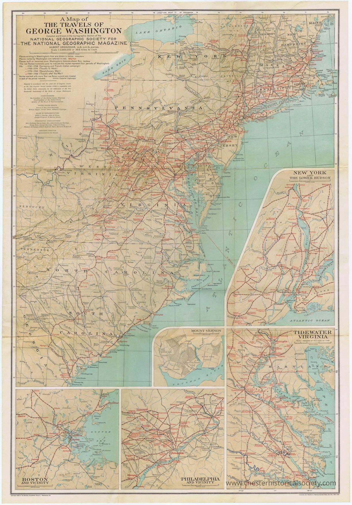
Transcription
A Map Of The Travels Of George Washington
Compiled and Drawn in the Cartographic Section of the National Geographic Society For The National Geographic Magazine
Gilbert Grosvenor, LL.D., LItt.D., Editor
Scale 1:2,500;000 or 39.5 miles to 1 inch
Places existing in Washington's time are shown in italics: WilkesBarre
Places visited by Washington are lettered in red: Valley Forge
Places built or renamed since Washington's time are shown thus: Fall River
The red, Roman numerals used to indicate the routes represent four periods of Washington's life:
I 1732 - 1758 (Surveying and French-Indian camnaign)
II 1759 - 1774 (Travels to West)
III 1775 - 1783 (Revolutionary War)
IV 1784 - 1799 (Travels after the War)
Routes marked with more than one Roman numeral were traveled in each of the periods indicated. = Colonial highways
----–
Prepared in accordance with the Joint Act of Congress known as the 71st Congress, Second Session, S3398, in cooperation with the United States Commission for the Celebration of the Two Hundredth Anniversary of the Birth of George Washington.
-<>-
Commissioners
The President of the United States
Chairman Vice President of the United States
Speaker of the House of Representatives
United States Senate
Simeon D. Fess, Vice Chairman
Arthur Capper, Carter Glass, Millard E. Tydings
House of Representatives
Willis C. Hawley, John Q. Tilson, Joseph W. Byrns, R. Walton Moore
Presidential Commissioners
Mrs. Anthony Wayne Cook. Mrs. John Dickinson Sherman, Henry Ford, George Eastman, C. Bascom Slemp, Wallace McCamant,Albert Bushnell Hart, Bernard M. Baruch
Associate Director
Representative Sol Bloom
Copyright 1931 By The National Geographic Society, Washington, D.C.
Engraved And Printed By Redfield-downey-odell Co. Inc., New York