Map of the Counties of Orange and Rockland
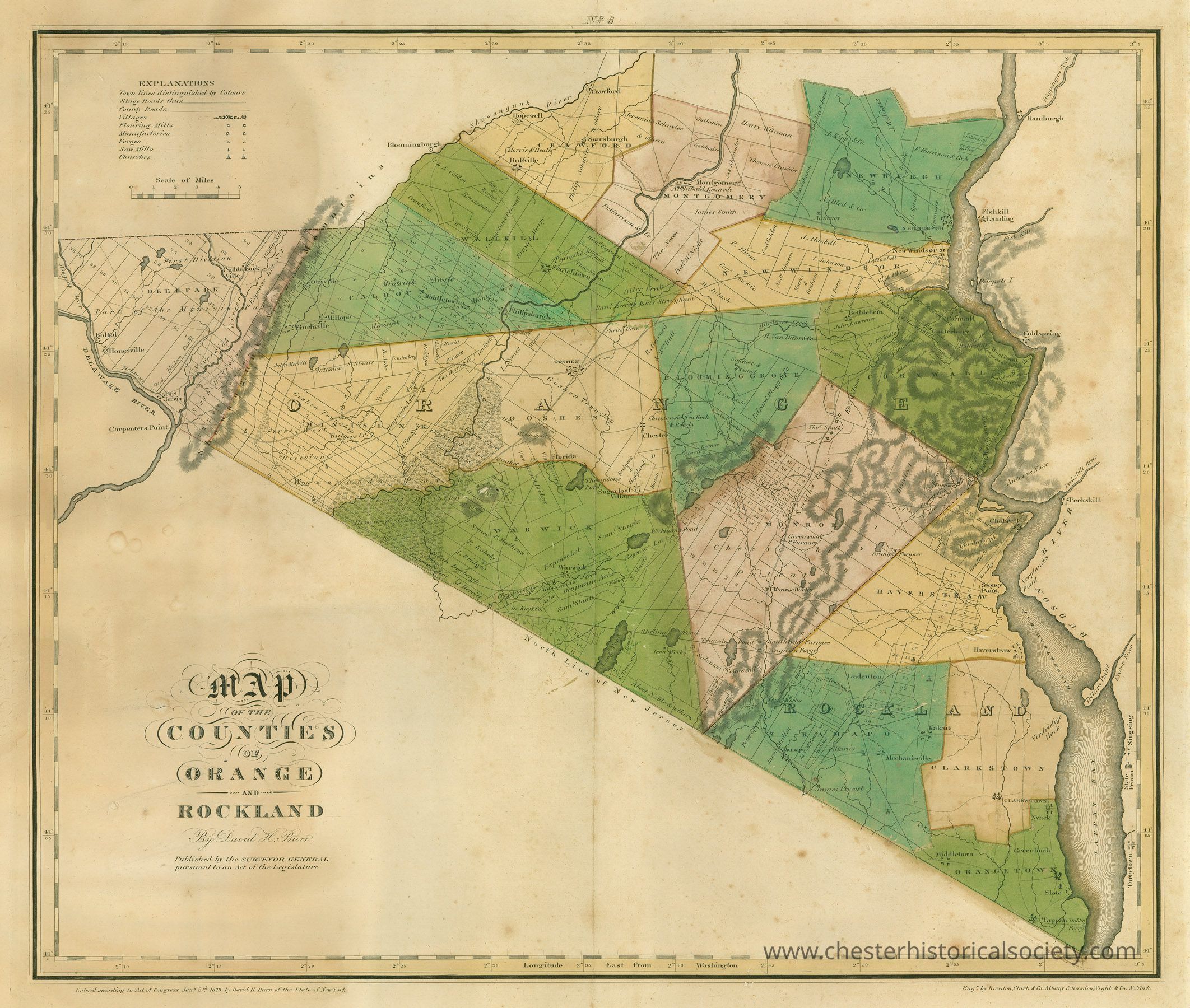
1829 Map of the Counties of Orange and Rockland
The image shows an old map of Orange and Rockland counties, featuring labeled areas, rivers, mountains and town boundaries.
Name/Title
Map of the Counties of Orange and RocklandEntry/Object ID
chs-012370Description
Map of the Counties of Orange and Rockland By David H. Burr Published by the Surveyor General pursuant to an Act of the Legislature Entered according to Act of Congress Jan. 5th, 1829 by David H. Burr of the State of New York The original is held by Orange County, 255 Main Street, Goshen, New York 10924.Category
Maps