Bridgman's new rail road & township map of New York from the latest official & other authentic sources adapted for use in institutions of learning, business offices & libraries.
Bridgman's new rail road & township map of New York - 1896.
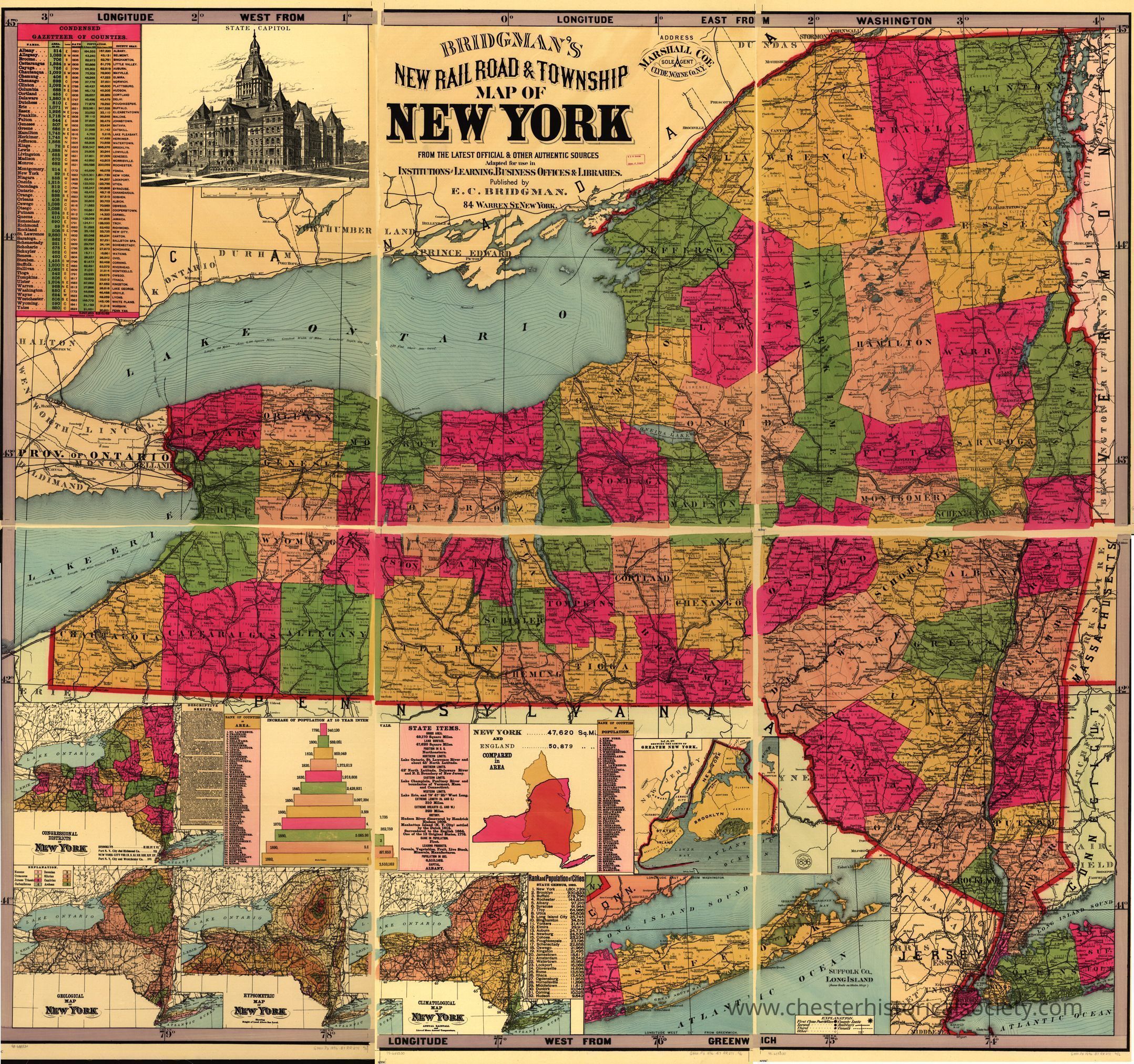
The image is an 1896 map titled "Bridgman's New Railroad & Township Map of New York," intricately displaying the state's counties in various colors, bordered by adjacent states and large bodies of water like Lake Ontario. In the top left corner, an illustration of a prominent building is noted, surrounded by longitude and latitude calculations. Detailed inset maps show sections like New York City, Long Island, and neighboring regions with clear legend keys, diagrams of population data, and distances. This vibrant depiction highlights rail lines.
Name/Title
Bridgman's new rail road & township map of New York from the latest official & other authentic sources adapted for use in institutions of learning, business offices & libraries.Entry/Object ID
chs-015300Description
1896 map titled "Bridgman's New Railroad & Township Map of New York," intricately displaying the state's counties in various colors, bordered by adjacent states and large bodies of water like Lake Ontario. In the top left corner, an illustration of a prominent building is noted, surrounded by longitude and latitude calculations. Detailed inset maps show sections like New York City, Long Island, and neighboring regions with clear legend keys, diagrams of population data, and distances. This vibrant depiction highlights rail lines. The original is held by the Library of Congress Geography and Map Division Washington, D.C. 20540-4650 USA dcu #98688530Category
Railroads