West Point And Vicinity Photomap Series V021S, Edition 4-AMS
West Point And Vicinity PhotomapSeries V021S, Edition 4-AMS recto
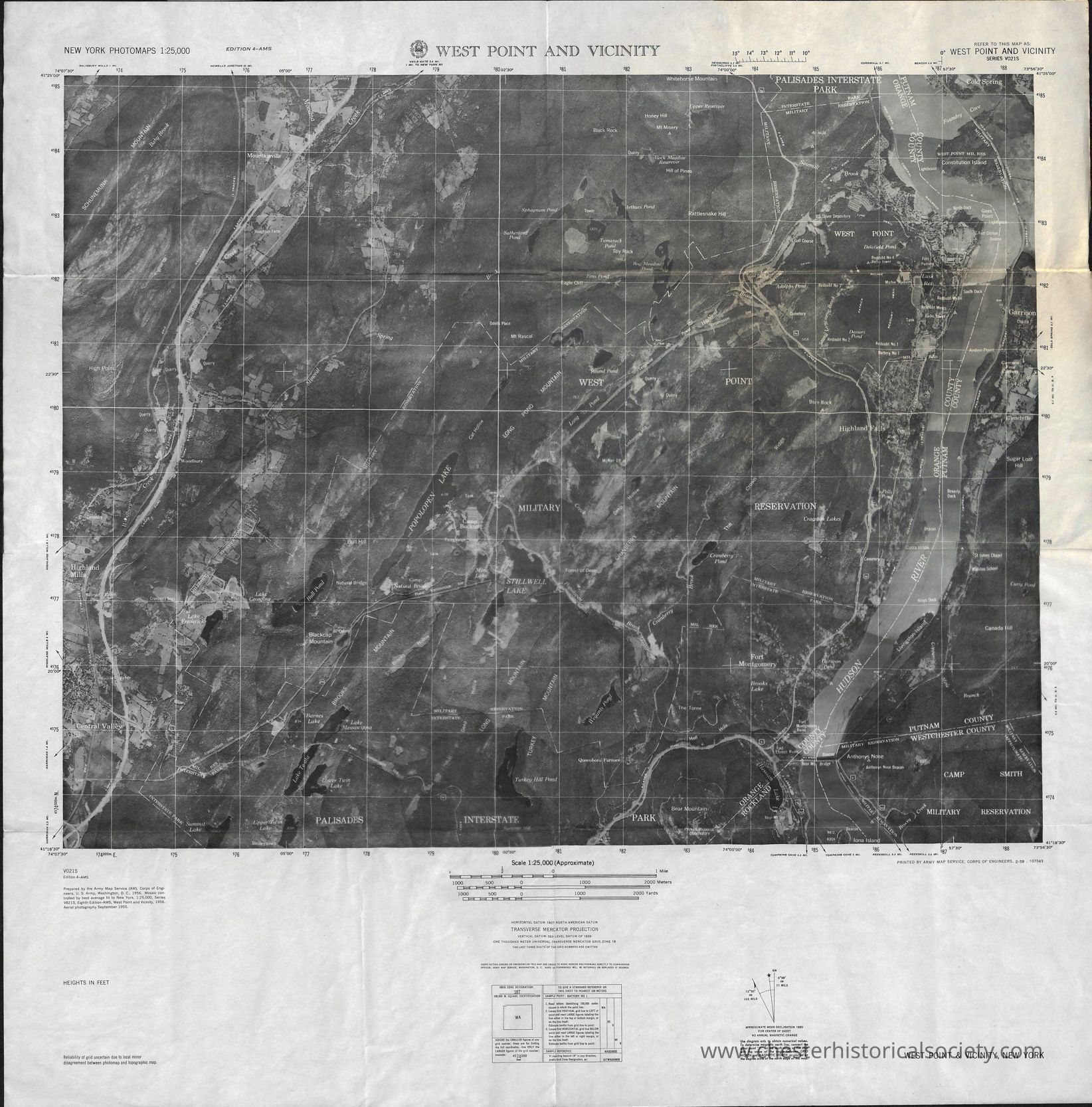
This image is a detailed photomap titled "West Point and Vicinity," showing a topographic representation of the area around West Point, New York, with markings for significant landmarks such as the U.S. Military Academy. The map includes various geographic details, such as rivers, roads, and wooded areas, outlined with a grid for reference. The scale is 1:25,000, providing precise distances and enabling accurate navigation through the region. Topographic features like elevation are noted.
Name/Title
West Point And Vicinity Photomap Series V021S, Edition 4-AMSEntry/Object ID
chs-015693Description
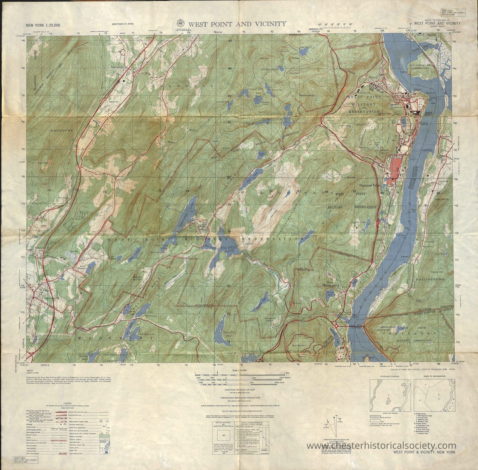
The front side is a detailed photomap titled "West Point and Vicinity," showing a topographic representation of the area around West Point, New York, with markings for significant landmarks such as the U.S. Military Academy. The map includes various geographic details, such as rivers, roads, and wooded areas, outlined with a grid for reference. The scale is 1:25,000, providing precise distances and enabling accurate navigation through the region. Topographic features like elevation are noted. The reverse is a detailed topographic map labeled "West Point and Vicinity," highlighting the terrain around West Point, New York. The map uses contour lines to represent elevation, with various natural features like rivers, forests, and water bodies marked in shades of green and blue. Roads and infrastructure are illustrated in red, indicating transportation routes. The Hudson River runs prominently along the right side, with the West Point Military Reservation clearly marked. In the legend, symbols explain different features such as roads, buildings, and other features.Category
Maps