Popolopen Lake Topographic Map
Popolopen Lake Topographic Map
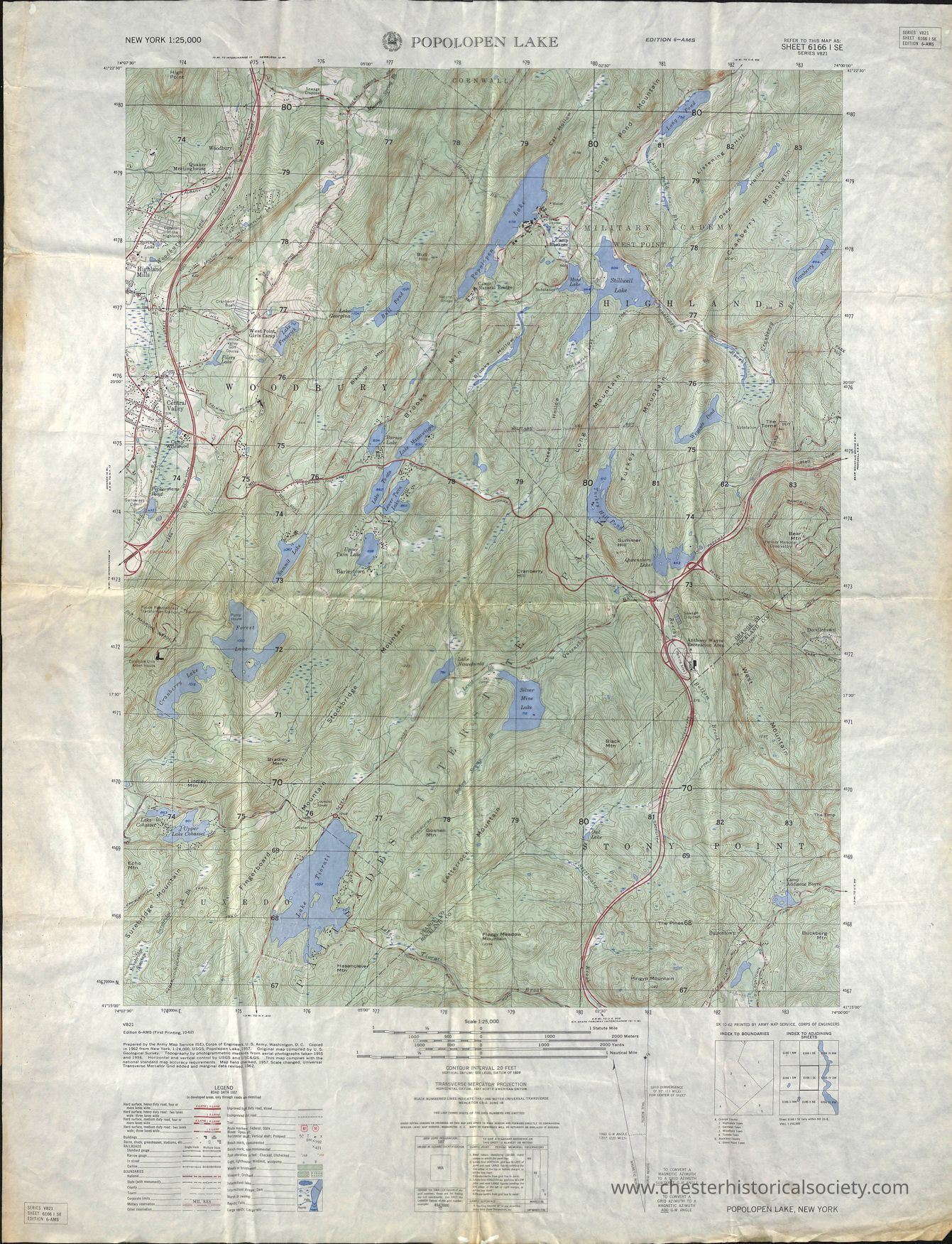
The image depicts a topographic map of the Popolopen Lake area in New York, highlighting detailed elevation contours, roads, bodies of water, and wooded areas. The map’s meticulous design features elevation indicated by contour lines, which demonstrate the varying heights of the terrain, while several roads meander throughout the landscape, accompanied by scattered blue lakes that contrast against the green and brown topographic lines. It's a highly detailed geographical representation intended for detailed navigation or exploration, providing insight into the natural and built environments.
Name/Title
Popolopen Lake Topographic MapEntry/Object ID
chs-015694Description
A topographic map of the Popolopen Lake area in New York, highlighting detailed elevation contours, roads, bodies of water, and wooded areas. The map’s meticulous design features elevation indicated by contour lines, which demonstrate the varying heights of the terrain, while several roads meander throughout the landscape, accompanied by scattered blue lakes that contrast against the green and brown topographic lines. It's a highly detailed geographical representation intended for detailed navigation or exploration, providing insight into the natural and built environments. Sx 10-62 Printed By Army Map Service, Corps Of Engineers Index To Boundaries A. Orange County 1. Highland Town 2. Cornwall Town 3. Woodbury Town 4 Tuxedo Town B. Rockland County 1. Stony Point TownCategory
Maps