West Point
West Point, New York 1:25,000 Map
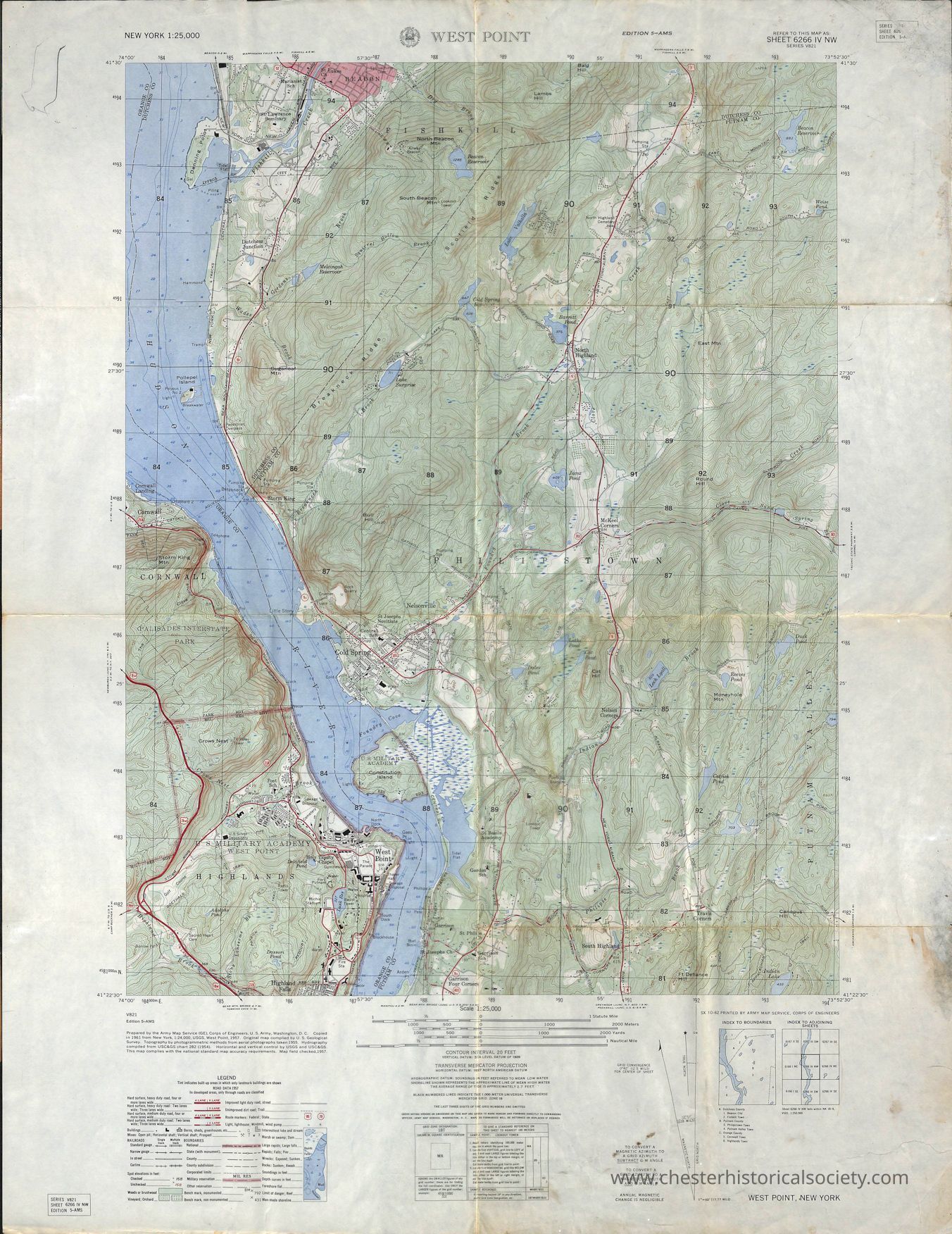
This image is a detailed topographic map of the West Point area in New York, displaying geographic features like elevation contours, water bodies such as the Hudson River, and terrain details with green indicating woodland areas; red and black lines indicate roads, while grids denote coordinates for navigation; urban areas, including the U.S. Military Academy at West Point, are represented in the southern portion, demonstrating clear demarcations of various physical and man-made infrastructures; labels and legends provide additional information on map scale, symbols, and etc.
Name/Title
West PointEntry/Object ID
chs-015695Description
A detailed topographic map of the West Point area in New York, displaying geographic features like elevation contours, water bodies such as the Hudson River, and terrain details with green indicating woodland areas; red and black lines indicate roads, while grids denote coordinates for navigation; urban areas, including the U.S. Military Academy at West Point, are represented in the southern portion, demonstrating clear demarcations of various physical and man-made infrastructures; labels and legends provide additional information on map scale, symbols, and etc. Index To Boundaries A. Dutchess County 1. Beacon City 2 Fishkill Town B. Putnam County 3. Philipstown Town 4. Putnam Valley Town C. Orange County 5. Cornwall Town 6. Highlands TownCategory
Maps