Map of the Counties of Orange and Rockland
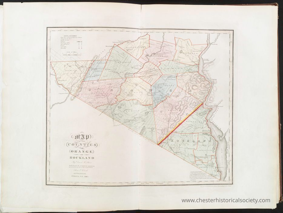
Map of the Counties of Orange and Rockland
The image displays a historical map of Orange and Rockland counties, featuring various geographical and administrative boundaries marked in distinct colors with labeled sections, roads, and natural features such as rivers. The map is detailed with annotations to indicate townships, and it includes a legend for reference. Published in 1829, the map is bordered by a decorative outline and shows a combination of hand-drawn and printed elements, reflecting cartographic techniques of the time.
Name/Title
Map of the Counties of Orange and RocklandEntry/Object ID
chs-015978Description
The image displays a historical map of Orange and Rockland counties, featuring various geographical and administrative boundaries marked in distinct colors with labeled sections, roads, and natural features such as rivers. The map is detailed with annotations to indicate townships, and it includes a legend for reference. This map is from an atlas published in 1841 although this map was originally published in 1829 is bordered by a decorative outline and shows a combination of hand-drawn and printed elements, reflecting cartographic techniques of the time. The original is held by the Lionel Pincus and Princess Firyal Map Division of The New York Public Library.Category
Orange County
Other Locales