Name/Title
Map of Part of Chester, N.Y.Entry/Object ID
chs-016881Description
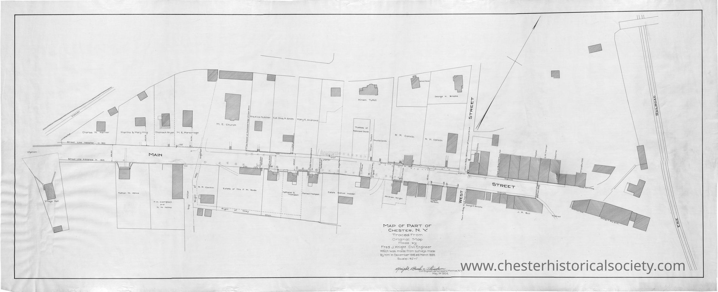
A scan of a 1924 map that depicts the downtown part of Chester, New York, showing streets, structures, and property labels. James Nelson, Town of Monroe Historian retains the original #819.Acquisition
Accession
James Nelson, Town of Monroe HistorianNotes
3/11/2019 Reproduced from James Nelson, Town of Monroe Historian.Map Details
Maker or Creator
Knight, Fred J.Scale
40' - 1"Area or Region
* Untyped Area or Region
Chester (Village) - Orange County - New YorkPublisher
Fred J. KnightDate Published
May 1, 1924Transcription
Transcription
Sidewalk
Hydrant
Village Hall
George H. Brooks
School House
Hiram Tuthill
Mrs. Alice Dutcher
Est. Chas. P. Smith
Mary E. Andrews
Trustees of Episcopal Church
M. E. Church
R. P. Conklin
R. P. Conklin
Mrs. Alice Conkin
Charles W. Kerner
Martha & Mary King
Thomas H. Bryan
Street Line Adopted in 1901
Street Line Adopted in 1901
Main Street
F. H. Campbell
M. W. Helme
Samuel Hadden
Abraham Wright
Estate of Mrs. F. M. Bodle
Charles A. Thompson
Right of Way
Right of Way
Ditch
Chester Nat. Bank
West Street
George H. Brooks
S. Wilkins
Masten
C. W. Kerner
Osborne
McGrath Hotel
J. P. Bull
American House
Geo. M. Roe & Co.
Erie Railroad
Map Of Part Of Chester, N. Y
Traced From Original Map Made by
Fred J. Knight Civil Engineer
Which was made from surveys made by him in December 1895 and March 1899.
Scale: 40'-1'
Knight, Bush & Thompson
Civil Engineers & Surveyors, Monroe, N.Y.
May 1 1924.Transcriber
Clifton PatrickCreate Date
October 22, 2024Update Date
December 18, 2024