2010 Census - Urban Cluster Reference Map: Chester, NY
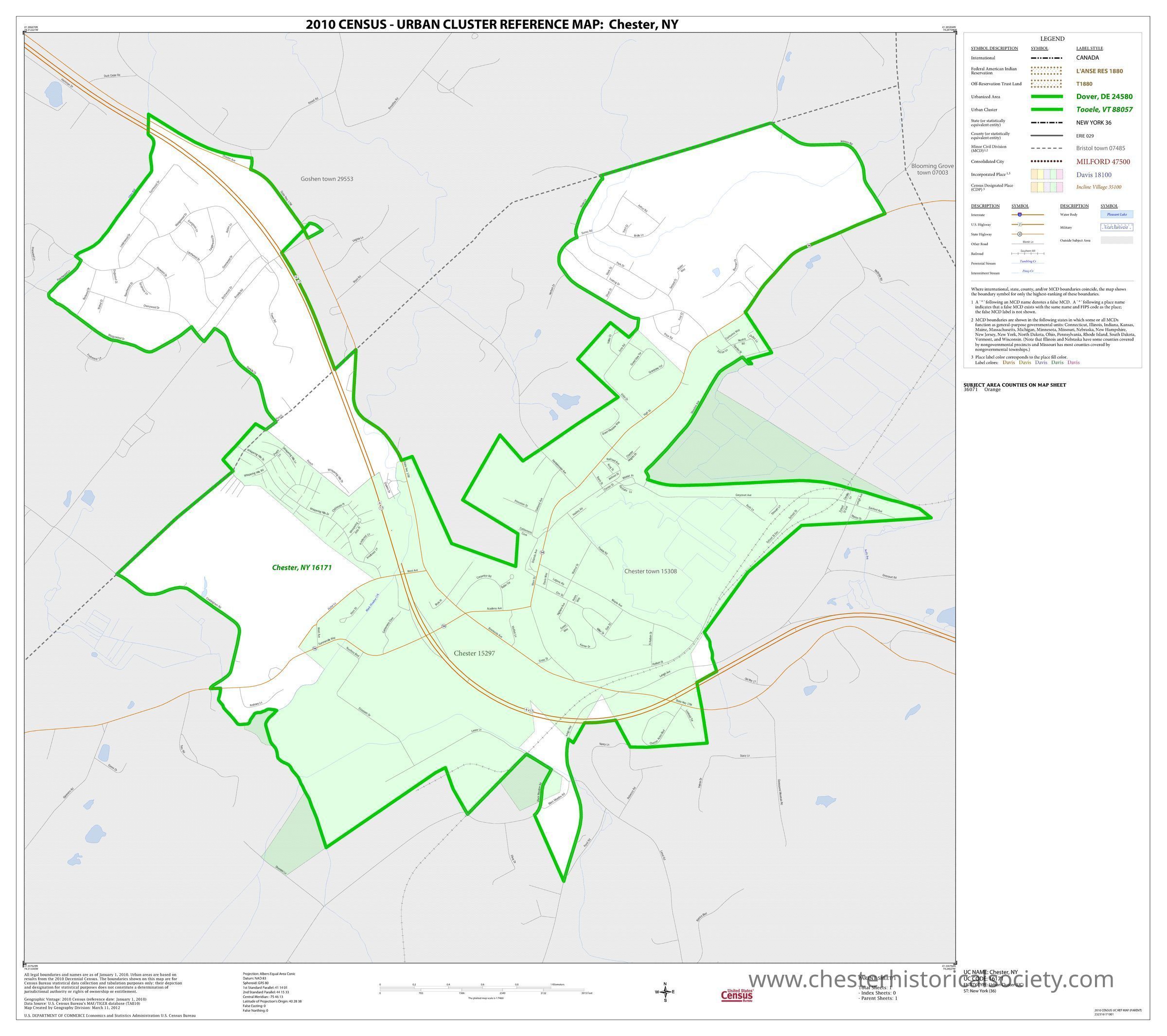
2010 Census - Urban Cluster Reference Map: Chester, NY
2010 Census - Urban Cluster Reference Map: Village of Chester, NY.
Name/Title
2010 Census - Urban Cluster Reference Map: Chester, NYEntry/Object ID
chs-019370Description
2010 Census - Urban Cluster Reference Map: Village of Chester, NY DC10UC16171.pdf Portable Document File (PDF), 170 KB Access: Unrestricted Use: Unrestricted Part of 3. This section contains 3 list items. Copy shareable link Record Group 29 Records of the Bureau of the Census 1790 – 2007 Series Urban Area Reference Maps from the 23rd Census of Population and Housing 2010 – 2010 File Unit [Decennial] Census of Population and Housing, 2010: Urban Cluster (UC) and Urban Area (UA) Reference Maps for New York Department of Commerce, Bureau of the Census, Office of the Associate Director for Decennial Census, Geography Division, January 1987–July 15, 2011, Archived Copy Attention: The following may not represent the current availability of these records. If you plan to access these records in person, please contact the following location prior to your visit to confirm current availability. Archived Copy Location: National Archives at College Park - Electronic Records, 8601 Adelphi Road, College Park, MD, 20740-6001 Phone Number: (301) 837-0470 Fax Number: (301) 837-3681 Email: cer@nara.govCategory
Census