Village of Chester Zoning Map, circa 2014
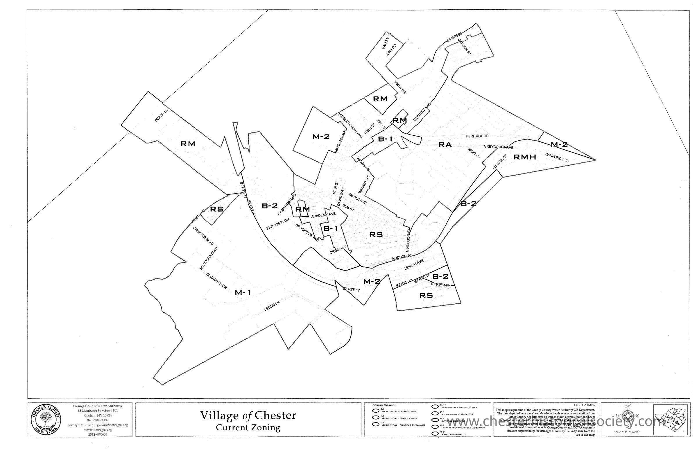
Village of Chester Zoning Map, circa 2014
The image shows an undated zoning map of the Village of Chester, highlighting different zones. Circa 2014.
Name/Title
Village of Chester Zoning Map, circa 2014Entry/Object ID
chs-019538Secondary Title
Undated Village of Chester Current Zoning Map, believed to be from about 2014.Category
Chester, Village of