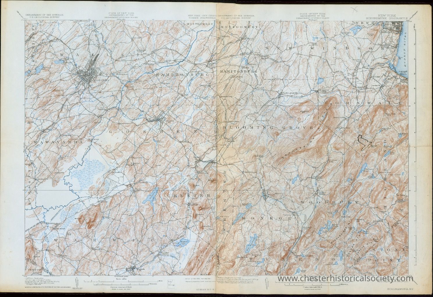
Combined Goshen-Schunemunk, NY 15' USGS topographic maps
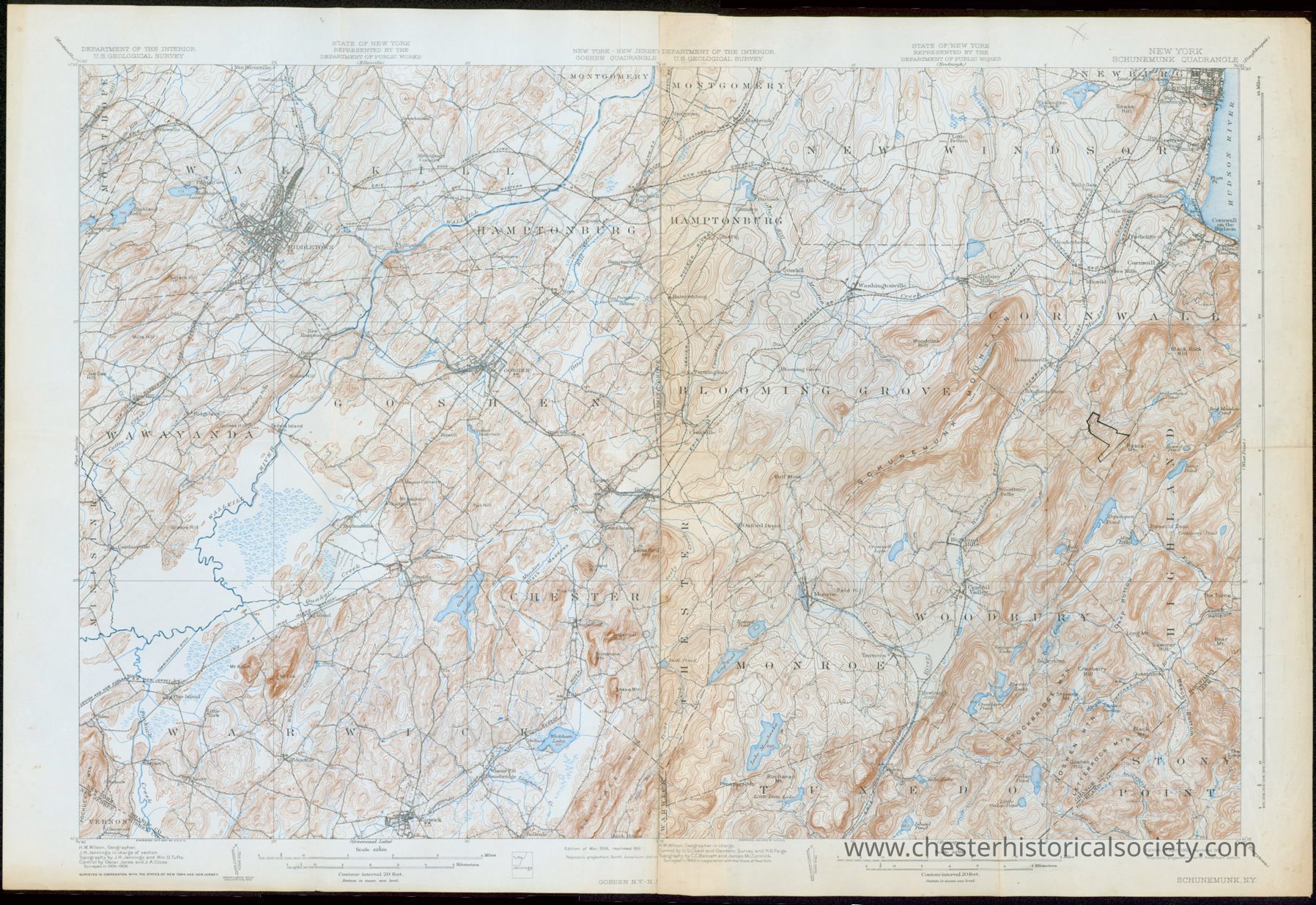
1931 Combined Goshen-Schunemunk, NY 15' USGS topographic map
The image shows a detailed 1931 topographical map of the New York, Goshen & Schunemunk Quadrangles depicting various geographical features.
Name/Title
Combined Goshen-Schunemunk, NY 15' USGS topographic mapsEntry/Object ID
chs-011868Description
Combined Goshen-Schunemunk, NY 15' USGS topographic map A topographic map of Goshen, Chester, Warwick, Wallkill, Hamptonburg, Blooming Grove, Wawayanda, and Monroe (1931), based on 1899 survey. Hand-drawn polygon near Rascal Mt. in the Town of Cornwall.Collection
W. S. DurlandCategory
Maps