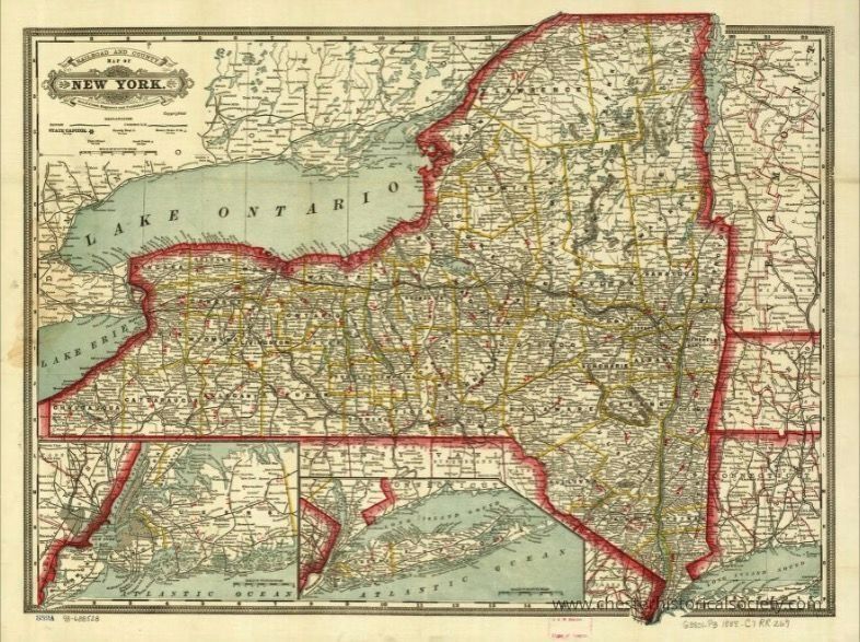
Cram's township and rail road map of New York.
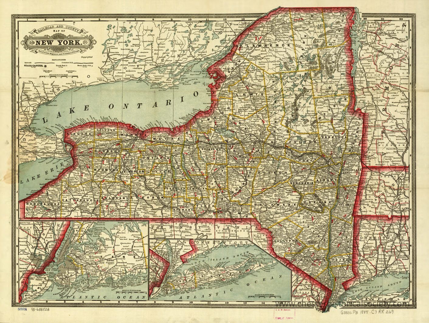
Cram's 1888 township and rail road map of New York.
This 1888e map of the state of New York, prominently displaying its borders with a red outline and detailing various counties within the state using yellow lines, accompanied by numerous cities and towns labeled in black text; significant geographical features include Lake Ontario and Lake Erie to the northwest, while an inset at the bottom highlights the southern portion of New York, including Long Island, with maritime boundaries extending into the Atlantic Ocean, making it a detailed representation of transportation routes and settlements as they were mapped.
Name/Title
Cram's township and rail road map of New York.Entry/Object ID
chs-015298Description
This 1888e map of the state of New York, prominently displaying its borders with a red outline and detailing various counties within the state using yellow lines, accompanied by numerous cities and towns labeled in black text; significant geographical features include Lake Ontario and Lake Erie to the northwest, while an inset at the bottom highlights the southern portion of New York, including Long Island, with maritime boundaries extending into the Atlantic Ocean, making it a detailed representation of transportation routes and settlements as they were mapped. The original is held by the Library of Congress Geography and Map Division Washington, D.C. 20540-4650 USA dcu #98688528Category
Railroads