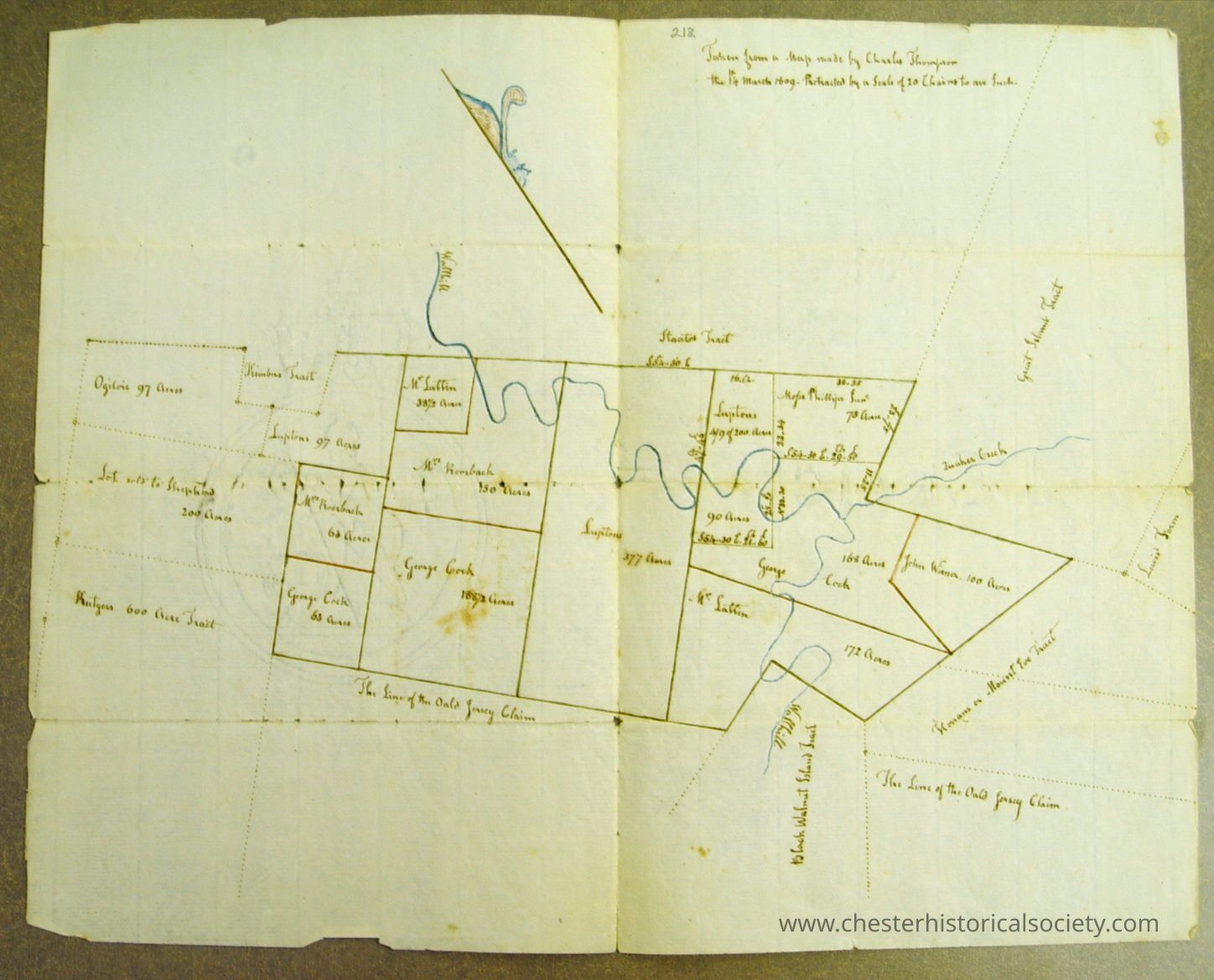
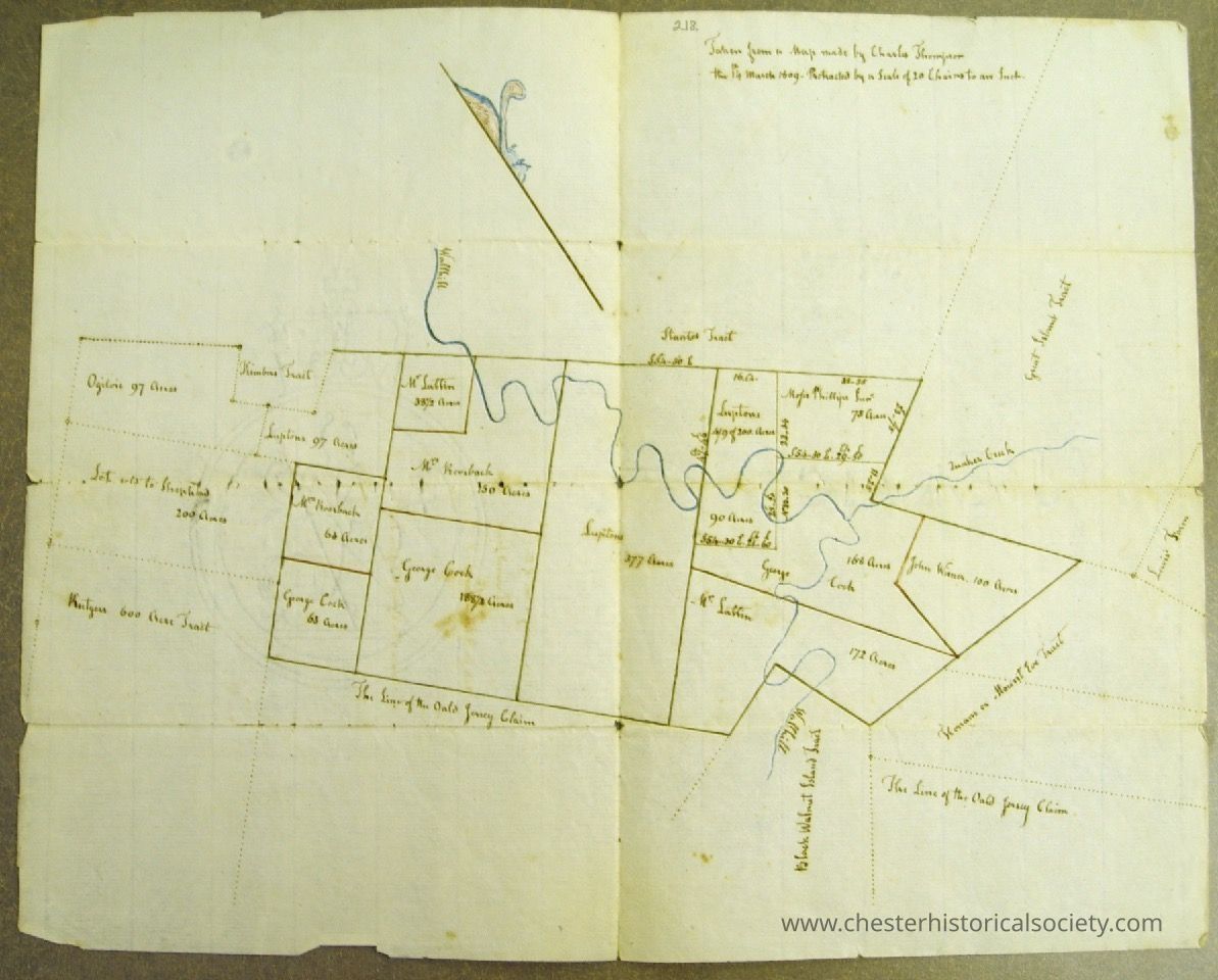
Drowned Lands Map, made for Wm. Townsend
Drowned Lands Map, made for Wm. Townsend
The image shows a hand-drawn historical land map with labeled plots, acreages, and a river.
Name/Title
Drowned Lands Map, made for Wm. TownsendEntry/Object ID
chs-011111Tags
MapsDescription
A March 14, 1809 hand-drawn historical land map by Charles Thompson with labeled plots, acreages, and a river. Original is held by the New York State Library, Manuscripts and Special Collections in the "Wallkill River, Black Walnut Channel, Wayawanda Channel & Quaker CreekBox," Sterling Iron And Railway Company Records, 1740-1918, SC14069, Box 2, Folder 2, Item 218. Map shows a part of the Drowned Lands, at the confluence of the Wallkill River and Quaker Creek made for Wm. Townsend from a survey made by Charles Thompson. William Townsend resided in Chester and was a son of Peter Townsend, 1738?-1783. He was also one of the proprietors of the Sterling Iron Works.Collection
New York State Library, Manuscripts and Special Collections.Category
Agriculture: Black Dirt, Drowned Lands