Name/Title
Erie Main Line Track Map CollectionEntry/Object ID
chs-000128Tags
MapsDescription
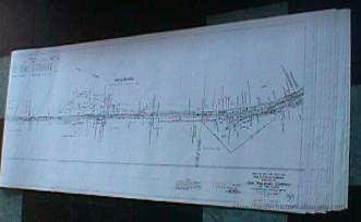
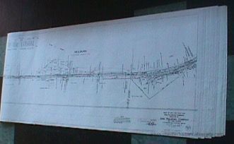
57 x 25” Paper reproductions of the thirty original linen 1918 Right of Way and Track Maps from Suffern to Goshen. List owners of acquired properties and some adjacent businesses.Category
Erie, Erie-Lackawana, Conrail
Acquisition
Notes
8/17/2000 Gift from Douglas BarberioMap Details
Maker or Creator
Charles H MoonArea or Region
* Untyped Area or Region
Rockland & Orange CountiesPublisher
Erie RailRoad CompanyDate Published
Jun 30, 1918Transcription
Map V.2.NY #19 1636+38.2 to 1690+60 Hillburn
Map V.2.NY #20 1690+60 to 1742+40 Ramapo
Map V.2.NY #21 1742+40 to 1796+20 Sterlington
Map V.2.NY #22 1796+20 to 1849+00 Sloatsburg
Map V.2.NY #23 1849+00 to 1901
Map V.2.NY #24 1901+80 to 1954+60
Map V.2.NY #25 1954+60 to 2007+40 Tuxedo
Map V.2.NY #26 2007+40 to 2060+20
Map V.2.NY #27 2060+20 to 2113+00
Map V.2.NY #28 2113+00 to 2165+80 Southfields
Map V.2.NY #29 2165+80 to 2218+60
Map V.2.NY #30 2218+60 to 2271+40
Map V.2.NY #31 2271+40 to 2324+20 Arden
Map V.2.NY #32 2324+20 to 2377+00
Map V.2.NY #33 2377+00 to 2429+80 Newburgh
Map V.2.NY #34 2429+80 to 2482+60 Harriman
Map V.2.NY #35 2482+60 to 2535+41
Map V.2.NY #36 2535+40 to 250
Map V.2.NY #36 2535+40 to 2588+20 Monroe
Map V.2.NY #37 2588+20 to 2641+00
Map V.2.NY #38 2641+00 to 2693+80
Map V.2.NY #39 2693+80 to 2746+60
Map V.2.NY #40 2746+60 to 2799+40 Newburgh Cut
Map V.2.NY #41 2799+40 to 2852+20 Greycourt
Map V.2.NY #42 2582+20 to 2905+00 Chester
Map V.2.NY #43 2905+00 to 2957+80
Map V.2.NY #44 2957+80 to 3010+60
Map V.2.NY #45 3010+60 to 3063+40
Map V.2.NY #45A 3040+00 to 3086+33
Map V.2.NY #46 3063+40 to 3116+20 Goshen
Map V.2.NY #47 3116+20 to 3169+00 GoshenDimensions
Height
63.5 cmWidth
144.8 cmGeneral Notes
Note
Map
Paper reproductions of the thirty original linen 1918 Right of Way and Track Maps from Suffern to Goshen. List owners of acquired properties and some adjacent businesses.
8/17/2000Create Date
October 22, 2024Update Date
February 16, 2026