Local Iron Furnaces and Mines Map
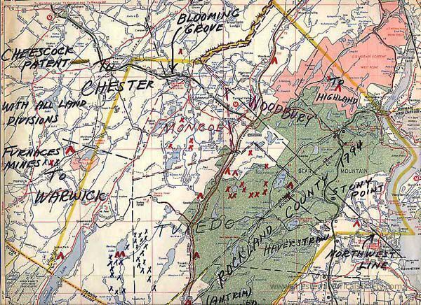
Local Iron Furnaces and Mines Map
The image depicts a section of a 1972 Rand McNally Road Map map with handwritten annotations showing locations of local iron furnaces, mines, towns, roads, and land divisions.
Name/Title
Local Iron Furnaces and Mines MapEntry/Object ID
chs-000171Tags
MapsDescription
12 by 11 inch section of a 1972 Rand McNally Road Map with local Iron Furnances and Mines PlottedCollection
Johnson Family CollectionCategory
Industry: Iron Mining & Related