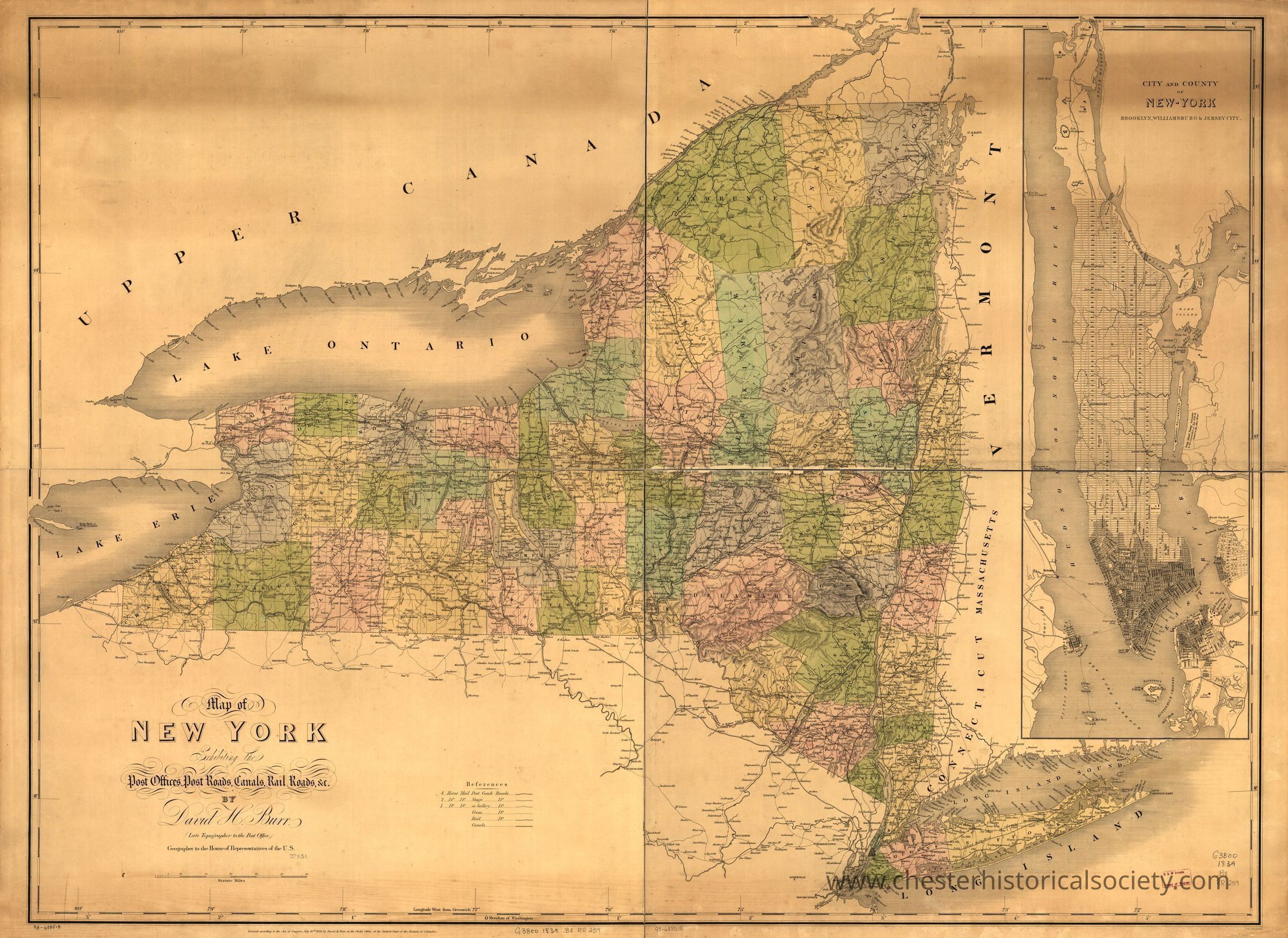
Map of New York exhibiting the post offices, post roads, canals, rail roads &c. By David H. Burr; (Late topographer to the Post Office.) Geographer to the House of Representatives of the U.S.
Map of New York exhibiting the post offices, post roads, canals, rail roads &c.
This vintage map of New York depicts detailed geographical features, including post offices, post roads, and canals, with an inset focusing on New York City and the surrounding areas, such as Brooklyn, Williamsburg, Jersey City, and Long Island. The map is intricately colored to distinguish counties and regional boundaries and showcases natural landmarks like Lake Erie and Lake Ontario. Important neighboring areas, like Upper Canada and New England states such as Vermont and Connecticut, are also marked. The map was published by David H. Burr.
Name/Title
Map of New York exhibiting the post offices, post roads, canals, rail roads &c. By David H. Burr; (Late topographer to the Post Office.) Geographer to the House of Representatives of the U.S.Entry/Object ID
chs-015297Description
This 1839 map of New York depicts detailed geographical features, including post offices, post roads, and canals, with an inset focusing on New York City and the surrounding areas, such as Brooklyn, Williamsburg, Jersey City, and Long Island. The map is intricately colored to distinguish counties and regional boundaries and showcases natural landmarks like Lake Erie and Lake Ontario. Important neighboring areas, like Upper Canada and New England states such as Vermont and Connecticut, are also marked. The map was published by David H. Burr. The original is held by the Library of Congress Geography and Map Division Washington, D.C. 20540-4650 USA dcu #98688518Category
Railroads