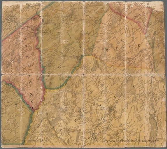
Name/Title
Map of part of Orange County, New YorkEntry/Object ID
chs-016482Tags
MapsDescription
Lionel Pincus and Princess Firyal Map Division
Shelf locator: Map Div. 16-6001Category
Orange County
Other Locales
Acquisition
Notes
6/1/2018 Download by Clifton PatrickTranscription
Downloaded from:
New York Public Library
NOTES
Content: Relief shown by hachures.
Content: Title devised by cataloger.
Funding: Mapping the Nation (NEH grant, 2015-2018)
PHYSICAL DESCRIPTION
Extent: 1 map : hand colored ; on sheet 52 x 47 cm
TYPE OF RESOURCE
Cartographic
IDENTIFIERS
RLIN/OCLC: 948297088
NYPL catalog ID (B-number): b20645828
Other local Identifier: US166.1.03
Universal Unique Identifier (UUID): 7b6d8530-1b8b-0134-fc4a-00505686a51cCreate Date
October 22, 2024Update Date
February 16, 2026