Note Type
Cataloging NoteNote
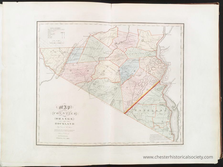
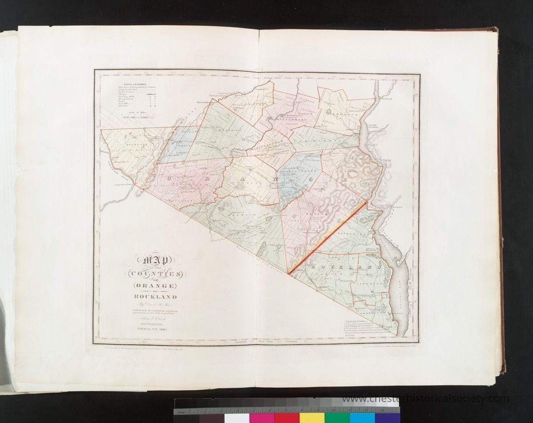
TITLE
Map of the counties of Orange and Rockland
NAMES
Stone & Clark Republishers (Publisher)
Burr, David H., 1803-1875 (Cartographer)
Rawdon, Clark & Co. (Engraver)
Rawdon, Wright & Co. (Engraver)
New York (State). Surveyor General (Associated name)
COLLECTION
Atlases of the United States
New York
An atlas of the state of New York : containing a map of the state and of the several counties
DATES / ORIGIN
Date Issued: 1841
Place: Ithaca, N.Y. :
Publisher: Stone and Clark,
LIBRARY LOCATIONS
Lionel Pincus and Princess Firyal Map Division
Shelf locator: Map Div. +++ 02-231[In slip case]
Shelf locator: Map Div. +++ 02-231 (No. 8)
TOPICS
New York (N.Y.)
Real property -- New York Metropolitan Area
Landowners -- New York (State) -- Orange County
Landowners -- New York (State) -- Rockland County
Orange County (N.Y.) -- Maps
Real property -- New York (State) -- Orange County
Real property -- New York (State) -- Rockland County
Rockland County (N.Y.) -- Maps
GENRES
Atlases
Maps
NOTES
Content: Colored vignette on t.p.
Content: Corr. and improved.
Content: Each map accompanied by a statistical table.
Content: National Endowment for the Humanities Grant for Access to Early Maps of the Middle Atlantic Seaboard.
Content: Originally published: New York : D.H. Burr, 1829.
Statement of responsibility: by David H. Burr.
Content: "Entered according to Act of Congress Jany 5th. 1829 by David H. Burr of the state of New York."
Content: "Published by the Surveyor General, pursuant to an Act of the Legislature. Stone & Clark, republishers, Ithaca, N.Y. 1840.
Content: Prime meridian: Washington, D.C.
Content: Relief shown by hachures.
Content: Shows flouring mills, factories, forges, saw mills, churches, and landowners.
Statement of responsibility: by David H. Burr ; engd. by Rawdon, Clark & Co., Albany, & Rawdon, Wright & Co., N. York.
PHYSICAL DESCRIPTION
Extent: 1 map : hand col. ; 41 x 50 cm.
TYPE OF RESOURCE
Cartographic
IDENTIFIERS
RLIN/OCLC: 27015629
NYPL catalog ID (B-number): b13994142
RLIN/OCLC: 48915107
NYPL catalog ID (B-number): b15334686
Universal Unique Identifier (UUID): 279aac70-c5f6-012f-7e4f-58d385a7bc34
RIGHTS STATEMENT
The New York Public Library believes that this item is in the public domain under the laws of the United States, but did not make a determination as to its copyright status under the copyright laws of other countries. This item may not be in the public domain under the laws of other countries. Though not required, if you want to credit us as the source, please use the following statement, "From The New York Public Library," and provide a link back to the item on our Digital Collections site. Doing so helps us track how our collection is used and helps justify freely releasing even more content in the future.