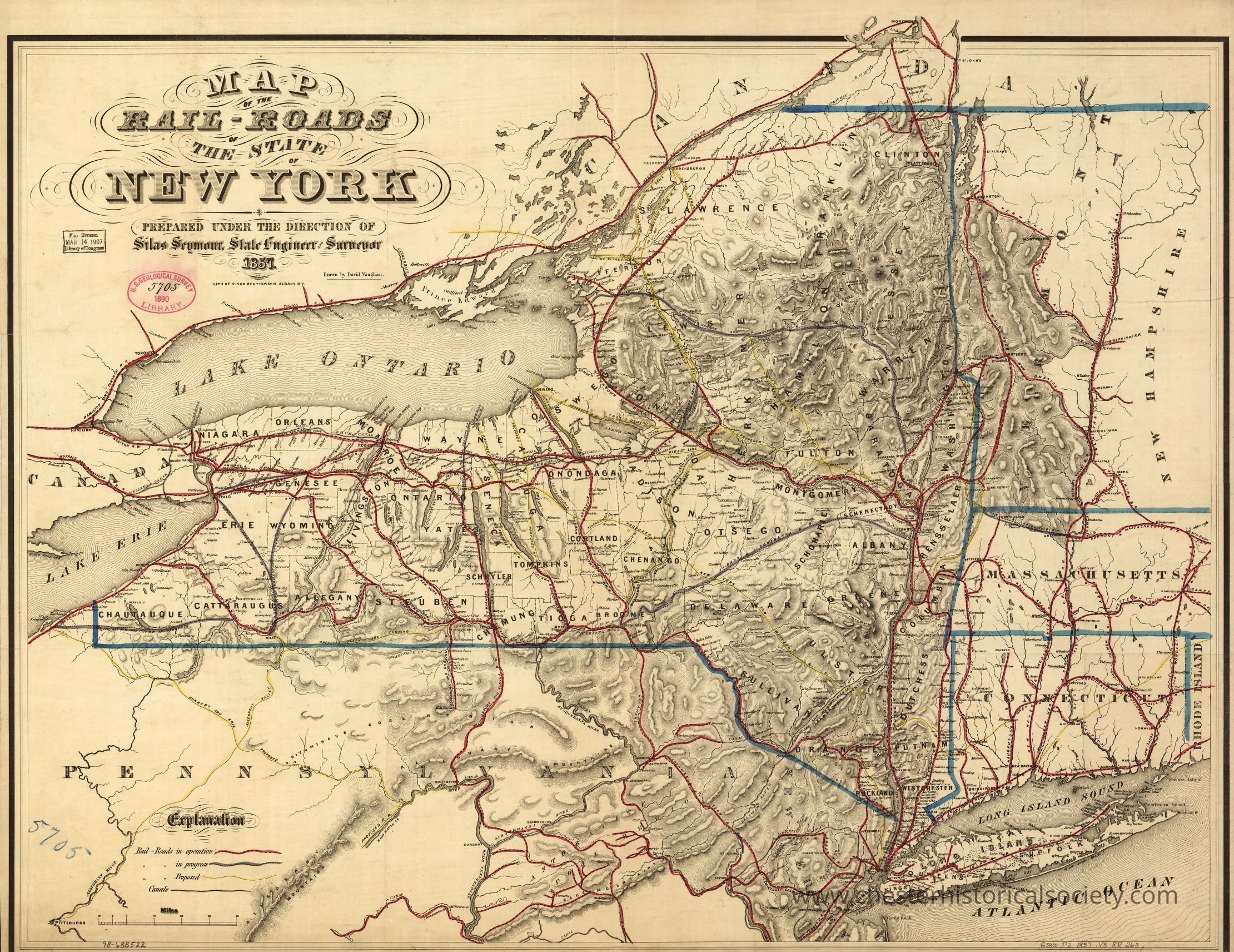
Map of the rail-roads of the state of New York prepared under the direction of Silas Seymour, state engineer surveyor.
Map of the rail-roads of the state of New York prepared under the direction of Silas Seymour, state engineer surveyor.
This historical map from 1857 intricately details the railroad network across the state of New York, highlighting major cities, towns, and geographical features such as Lake Ontario, Lake Erie, and the surrounding states, meticulously showcasing the connectivity and transportation routes of that era, with rail lines prominently marked in red, while boundaries and other geographic markers are outlined, providing a comprehensive understanding of early infrastructure development, with particular emphasis on New York's integration into the broader regional and national rail system.
Name/Title
Map of the rail-roads of the state of New York prepared under the direction of Silas Seymour, state engineer surveyor.Entry/Object ID
chs-015296Description
This historical map from 1857 intricately details the railroad network across the state of New York, highlighting major cities, towns, and geographical features such as Lake Ontario, Lake Erie, and the surrounding states, meticulously showcasing the connectivity and transportation routes of that era, with rail lines prominently marked in red, while boundaries and other geographic markers are outlined, providing a comprehensive understanding of early infrastructure development, with particular emphasis on New York's integration into the broader regional and national rail system. The original is held by the Library of Congress Geography and Map Division Washington, D.C. 20540-4650 USA dcu #98688522Category
Railroads