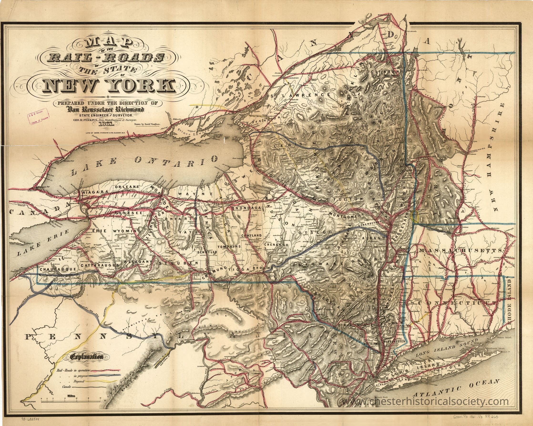
Map of the rail-roads of the state of New York prepared under the direction of Van Renssselaer Richmond, state engineer and surveyor; Geo R. Perkins, Dep State Engineer & Surveyor.
Map of the rail-roads of the state of New York prepared under the direction of Van Renssselaer Richmond, state engineer and surveyor; Geo R. Perkins, Dep State Engineer & Surveyor.
The image depicts a vintage map illustrating the railroads throughout the state of New York in 1861. It highlights major waterways such as Lake Ontario and Lake Erie, and marks significant cities along the routes, including Albany, Rochester, Buffalo, and Syracuse. Intricate details showcase the railroad lines crisscrossing the state, while the map's aged appearance suggests its historical significance. Boundaries with neighboring states like Pennsylvania and Massachusetts are visible, and geographical features such as mountains and rivers are artistically rendered.

Name/Title
Map of the rail-roads of the state of New York prepared under the direction of Van Renssselaer Richmond, state engineer and surveyor; Geo R. Perkins, Dep State Engineer & Surveyor.Entry/Object ID
chs-015295Description
A 1861 map illustrating the railroads throughout the state of New York. It highlights major waterways such as Lake Ontario and Lake Erie, and marks significant cities along the routes, including Albany, Rochester, Buffalo, and Syracuse. Intricate details showcase the railroad lines crisscrossing the state, while the map's aged appearance suggests its historical significance. Boundaries with neighboring states like Pennsylvania and Massachusetts are visible, and geographical features such as mountains and rivers are artistically rendered. The original is held by the Library of Congress Geography and Map Division Washington, D.C. 20540-4650 USA dcu #98688524Category
Railroads