Merrit's map by Richard Edsall Oct. 15, 1782
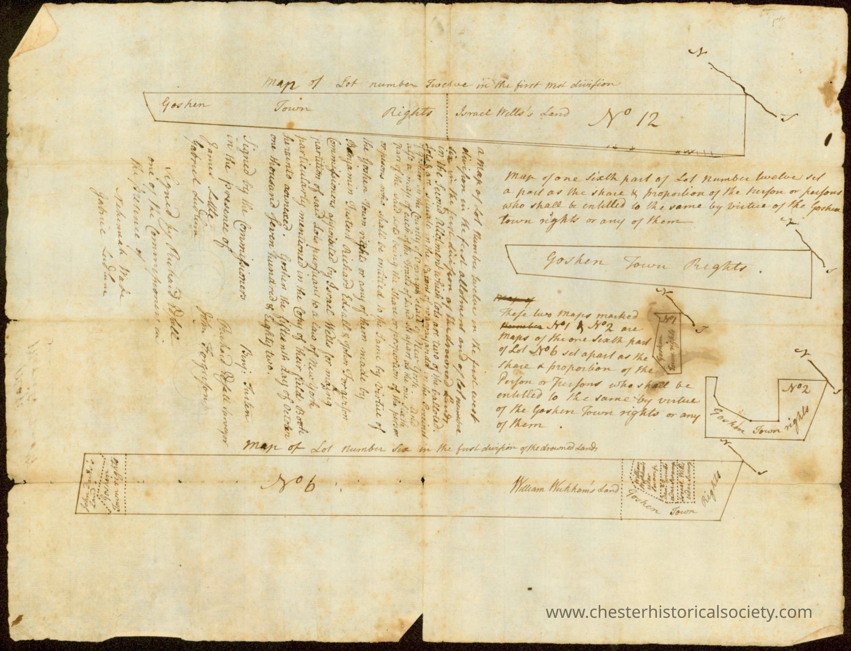
Merrit's map by Richard Edsall Oct. 15, 1782: The image depicts an old, sepia-toned document, from the 18th century, featuring handwritten text that includes map references, land descriptions, and property rights. On the paper, annotations and lines sketch out plots of land with labels such as "Goshen Town Rights" and "Samuel Wells's Land," suggesting it may be a legal or official document related to land distribution or ownership. Handwritten notes in cursive script spill over the page, detailing terms and agreements regarding land division, boundaries, or rights. Distinct lines and shapes within the document outline specific land segments labeled numerically and textually, indicating different areas or plots. The paper has visible creases and a slightly torn edge, emphasizing its age and historical significance. Signatures and titles appear at certain points, indicating agreements or official acknowledgments by involved parties, hinting that this document might have served as a legal record, possibly used in transactions or dealings related to real estate.
Merrit's map by Richard Edsall Oct. 15, 1782

The image depicts an old, sepia-toned document, from the 18th century, featuring handwritten text that includes map references, land descriptions, and property rights. On the paper, annotations and lines sketch out plots of land with labels such as "Goshen Town Rights" and "Samuel Wells's Land," suggesting it may be a legal or official document related to land distribution or ownership. Handwritten notes in cursive script spill over the page, detailing terms and agreements regarding land division, boundaries, or rights. Distinct lines and shapes within the document outline specific land segments labeled numerically and textually, indicating different areas or plots. The paper has visible creases and a slightly torn edge, emphasizing its age and historical significance. Signatures and titles appear at certain points, indicating agreements or official acknowledgments by involved parties, hinting that this document might have served as a legal record, possibly used in transactions or dealings related to real estate.

Name/Title

Merrit's map by Richard Edsall Oct. 15, 1782

Entry/Object ID

chs-011553

Description

Merrit's map by Richard Edsall This manuscript document is an official partition and allotment record concerning the Drowned Lands in Orange County, New York, dated October 15, 1782. Document Overview Title/Subject: A legal survey and allotment instrument detailing partitions of Lot Number Twelve and Lot Number Six in the first division of the Drowned Lands, associated with Goshen town rights and Israel Wells's land. Date: October 15, 1782, executed in the City of New York. Purpose: Officially records the division and proportional assignment of shares of land among claimants holding Goshen town rights, pursuant to a New York law enacted for making partitions of said land. Key Content & Layout Textual Body: The central legal text names the commissioners appointed by Israel Wells for the partition— Benj. Tusten, Richard Edsall, and John Ferguson—and outlines the specific shares allocated under the law. Signatures: Signed and attested by commissioners and witnesses, including Richard Edsall, John Ferguson, Benj. Tusten, and others, alongside surveyor notes by Charles Clinton. Associated Maps: The document incorporates multiple hand-drawn diagrams and plats labeled as maps of Lot No. 12, fractions thereof (marked No. 1 and No. 2), and Lot No. 6, referencing neighboring tracts such as William Wickham's land.

Collection

H. R. Decker Collection

Map Details

Date Published

Oct 15, 1782

Dimensions

Height

31.1 cm

Width

40.4 cm

Create Date

October 22, 2024

Update Date

September 6, 2026