Orange & Ulster Counties Map Replica
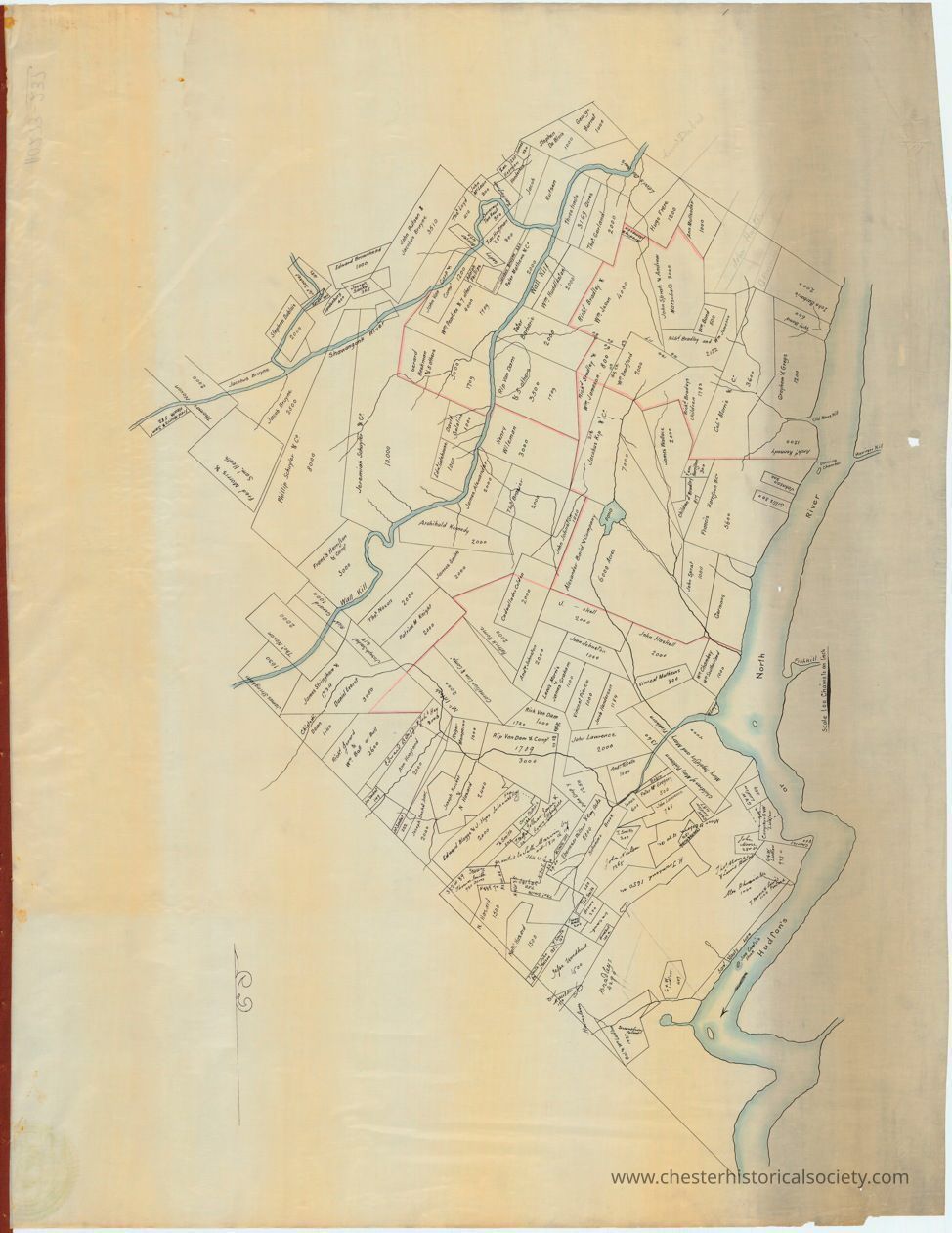
Orange & Ulster Counties Map Replica: An Orange & Ulster Counties Map Replica of the original, circa 1740, depicting a specific geographic area with a network of boundaries and labeled plots or properties. There are waterways, such as rivers or streams, that meander through the landscape. Some lines on the map are highlighted in red or black, which might indicate different types of borders or important routes. The text labeling various sections might include names or numbers relevant to the map's historical or geographical context. The map encompasses a layout demonstrating land distribution and topographical details.
Orange & Ulster Counties Map Replica

An Orange & Ulster Counties Map Replica of the original, circa 1740, depicting a specific geographic area with a network of boundaries and labeled plots or properties. There are waterways, such as rivers or streams, that meander through the landscape. Some lines on the map are highlighted in red or black, which might indicate different types of borders or important routes. The text labeling various sections might include names or numbers relevant to the map's historical or geographical context. The map encompasses a layout demonstrating land distribution and topographical details.

Name/Title

Orange & Ulster Counties Map Replica

Entry/Object ID

chs-011127

Description

A replica of a circa 1740 hand-drawn Orange & Ulster Counties Map with a brownish paper tone, showing various outlined land parcels and sections, each labeled with text, possibly indicating ownership or usage. The map features a prominent meandering river running vertically on the right side, with smaller tributaries branching out into the sections. Lines divide the parcels, and there is evidence of aging, such as creases and discoloration along the edges. This map of Orange & Ulster Counties includes what is now Rockland County. Names shown include several original Wawayanda Patentees. The original is held by the NYS Library, call number: MSC XX19862. Scanned by NYS Library.

Collection

New York State Archives Collection

Map Details

Area or Region

County

Orange (county) - New York

Dimensions

Height

80.1 cm

Width

61.8 cm

Create Date

October 22, 2024

Update Date

August 20, 2026