Province de New-York : en 4 feuilles
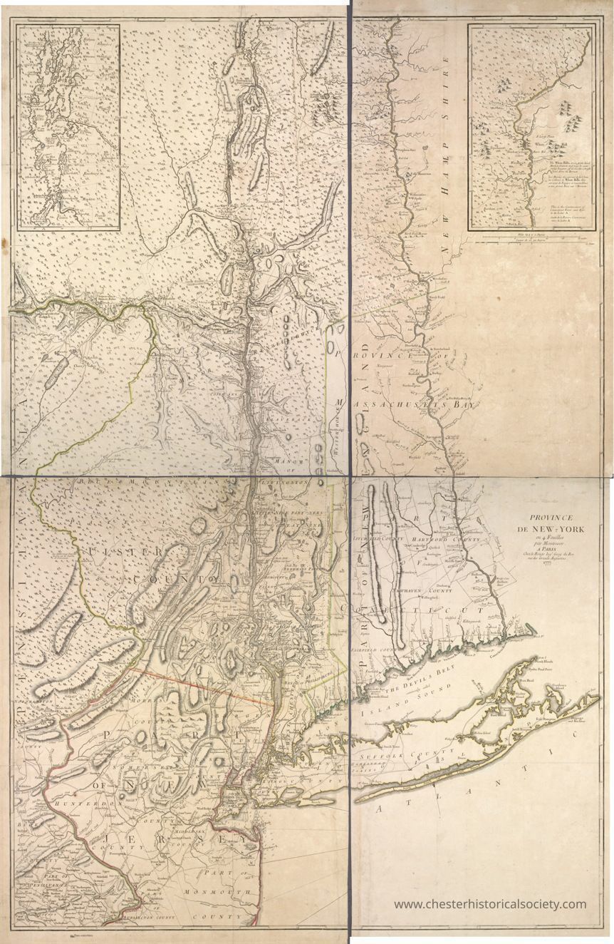
Province de New-York : en 4 feuilles
The image shows an intricately detailed vintage map of the Province of New York from the 18th century, highlighting geographical features, boundaries, and settlements of the time, with insets that provide additional detailed views of specific areas. The map includes various rivers, mountain ranges, and the Atlantic coastline, showcasing the historical cartographic representation used during that era. Names of counties and regions are inscribed in stylized fonts, and the map's artistry reflects the period's style.
Name/Title
Province de New-York : en 4 feuillesEntry/Object ID
chs-015979Description
The image shows an intricately detailed vintage map of the Province of New York from the 18th century, highlighting geographical features, boundaries, and settlements of the time, with insets that provide additional detailed views of specific areas. The map includes various rivers, mountain ranges, and the Atlantic coastline, showcasing the historical cartographic representation used during that era. Names of counties and regions are inscribed in stylized fonts, and the map's artistry reflects the period's style. The original is held by the Lionel Pincus and Princess Firyal Map Division, The New York Public Library.Category
Maps