Name/Title
Sidney Map of Orange County New York : from actual surveysEntry/Object ID
chs-018804Description
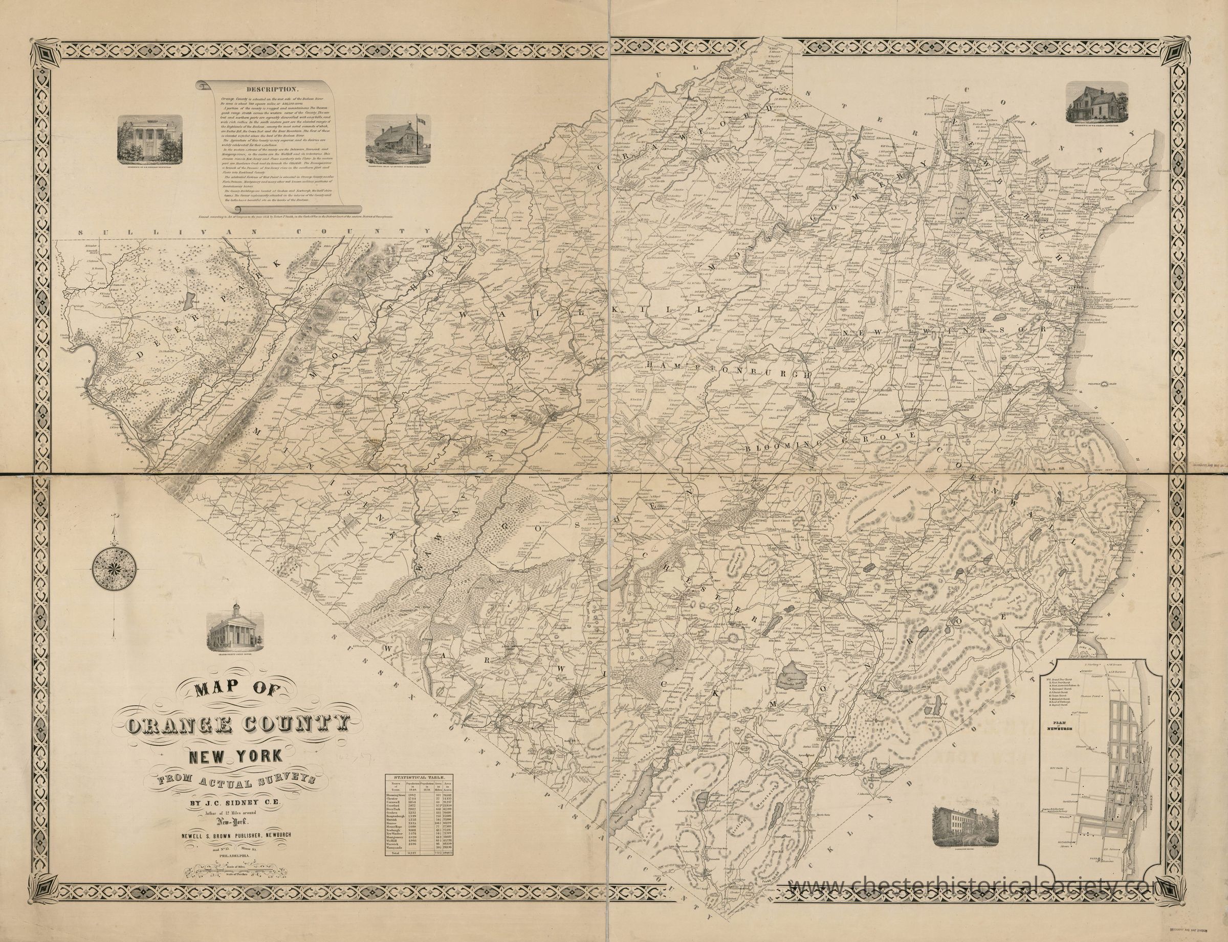
Map of Orange County New York : from actual surveys, dated 1851 by J.C. Sidney C.E., featuring detailed town names, and topographical elements.Acquisition
Notes
12/12/2021 Download by Clif Patrick, Town of Chester HistorianMap Details
Maker or Creator
Sidney, J. C. (James C.), cartographer.Publisher
Brown, Newel S.Date Published
1851Transcription
Title
Map of Orange County New York : from actual surveys
Contributor Names
Sidney, J. C. (James C.), cartographer.
Smith, Robert Pearsall, 1827-1898, contributor.
Brown, Newel S., publisher.
Created / Published
Philadelphia : Newell S. Brown, Publisher, 15 Minor St., 1851.
Subject Headings
- Landowners--New York (State)--Orange County--Maps
- Cities and towns--New York (State)--Orange County--Maps
- Orange County (N.Y.)--Maps
- United States--New York (State)--Orange County
Genre
MapsGeneral Notes
Note
Map
Sidney, J. C. , Cartographer, Robert Pearsall Smith, and Newel S Brown. Map of Orange County New York: from actual surveys. Philadelphia: Newell S. Brown, Publisher, 15 Minor St, 1851. Map. Retrieved from the Library of Congress, <www.loc.gov/item/2013593254/>.
12/12/2021Create Date
October 22, 2024Update Date
February 16, 2026