Sketch of Chester with historical labels
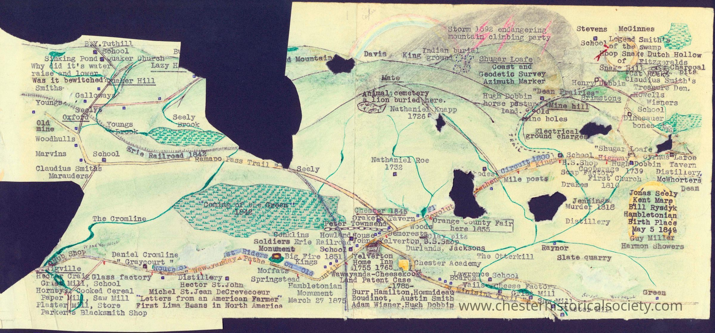
Donald M. Barrell's Sketch of Chester with historical labels: The image is a hand-drawn, vintage-style map by Donald M. Barrell featuring various intriguing labels and landmarks, such as "Old mine," "Quaker Church," "Claudius Smith's Marauders," and "Erie Railroad 1842," interspersed with rivers, roads, and named locations like "Oxford," "Seely Brook," and "Ramapo Pass Trail." It includes topographical features like hills and valleys, marked with scribbled annotations and symbols indicating points of interest or historical significance, etc.
Donald M. Barrell's Sketch of Chester with historical labels

The image is a hand-drawn, vintage-style map by Donald M. Barrell featuring various intriguing labels and landmarks, such as "Old mine," "Quaker Church," "Claudius Smith's Marauders," and "Erie Railroad 1842," interspersed with rivers, roads, and named locations like "Oxford," "Seely Brook," and "Ramapo Pass Trail." It includes topographical features like hills and valleys, marked with scribbled annotations and symbols indicating points of interest or historical significance, etc.

Name/Title

Sketch of Chester with historical labels

Entry/Object ID

chs-009634

Description

The image is a hand-drawn, vintage-style map by Donald M. Barrell featuring various intriguing labels and landmarks, such as "Old mine," "Quaker Church," "Claudius Smith's Marauders," and "Erie Railroad 1842," interspersed with rivers, roads, and named locations like "Oxford," "Seely Brook," and "Ramapo Pass Trail." It includes topographical features like hills and valleys, marked with scribbled annotations and symbols indicating points of interest or historical significance, etc.

Collection

Donald M. Barrell Collection

Map Details

Maker or Creator

Donald M. Barrell

Area or Region

Town

Chester (Town) - Orange County - New York

Dimensions

Height

18 cm

Width

40.7 cm

Create Date

October 22, 2024

Update Date

July 23, 2026