Woodhull parcel map
Woodhull parcel map
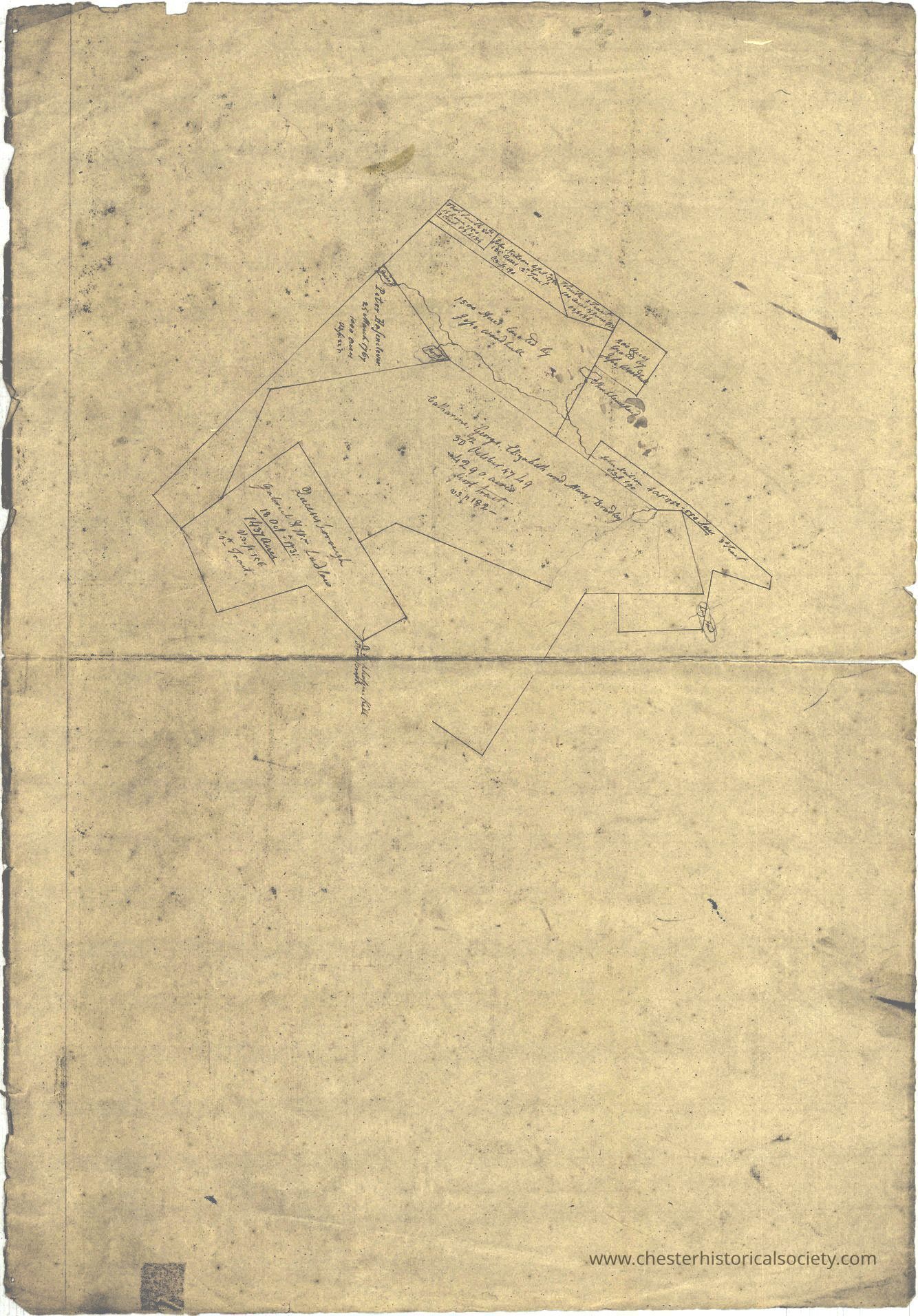
Circa 1770 map of Jessie Woodhull's parcel in Orange County.
Name/Title
Woodhull parcel mapEntry/Object ID
chs-011129Tags
MapsDescription
Circa 1770 map of Jessie Woodhull's parcel in Orange County. Persons listed: Bradley, Catherine Bradley, Elizabeth Bradley, George Bradley, Mary Hasenclever, Peter Ludlow, Gabreil Ludlow, Gabreil Ludlow, William Neilson, John Smith, Thomas Woodhull, Jesse Original map held by the NYS Archives. (Note: this access image has been graphically adjusted to make it more readable.)Collection
New York State ArchivesCategory
Orange County
Other Locales