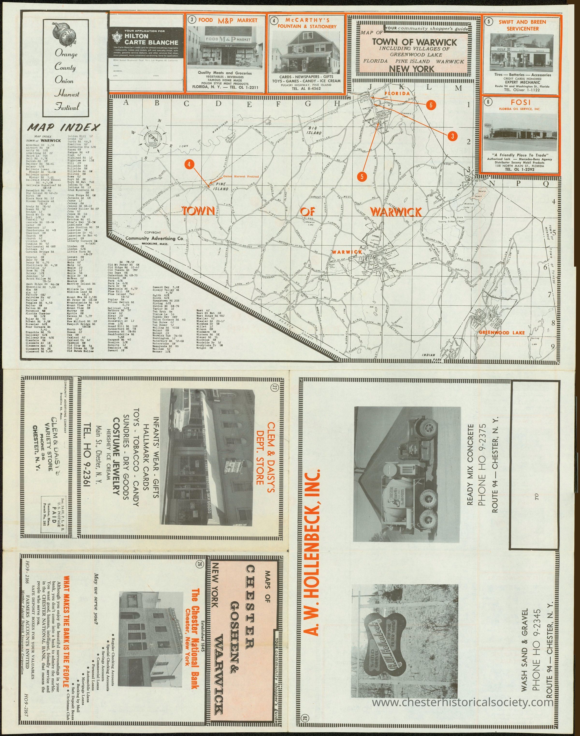
Your Community Shopper's Guide & Map of Towns of Goshen, Chester & Warwick
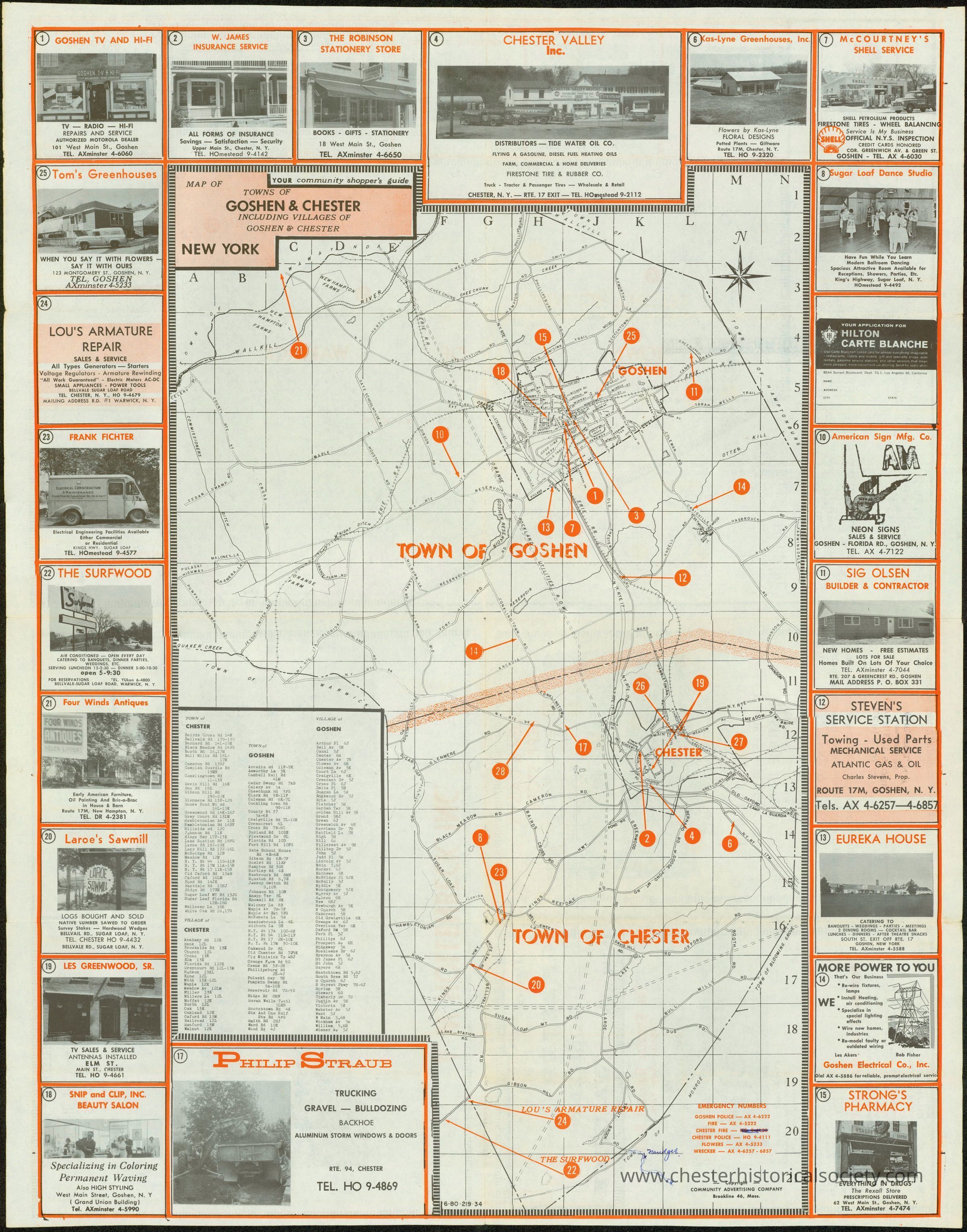
Your Community Shopper's Guide & Map of Towns of Goshen, Chester & Warwick obverse
This image is a 1950 - 1960 vintage map showing the towns of Goshen and Chester in New York, surrounded by advertisements for local businesses and images of prominent buildings. The map itself highlights main roads, transportation routes, and significant landmarks with numbered circles and corresponding key listings to provide an informative geographical snapshot. The surrounding advertisements include various services such as armature repair, trucking, greenhouses, and insurance providers, which depict the commercial landscape during the time of the map's creation. It also includes a road/street index.