Name/Title
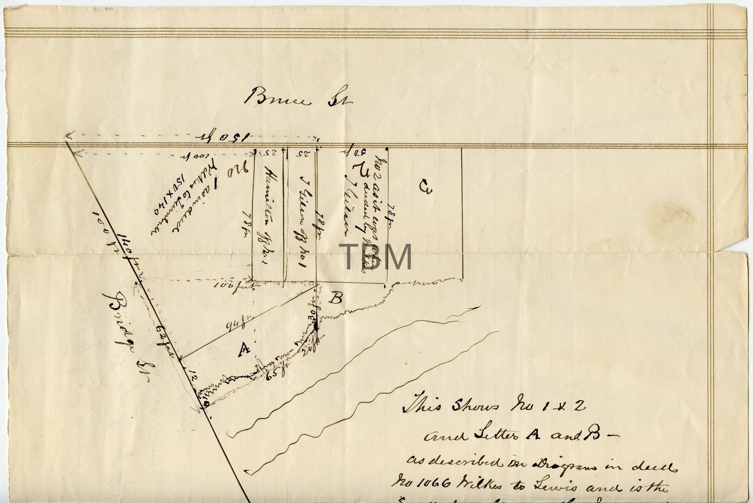
Map of Bruce St. and Bridge St., ThornburyEntry/Object ID
2008-042-813Description
A single-sheet hand-drawn map executed in black ink on pre-printed cream-colored ledger paper (featuring faded horizontal and vertical grid lines).
A hand-drawn cadastral (land survey) map illustrating early property lot divisions at the junction of Bruce Street and Bridge Street in Thornbury. The document features an extensive handwritten legal annotation tracing the chain of title and disputing a property boundary mistake involving a local riverbank. The document tracks a sequence of land transfers involving prominent local names (Wilkes, Lewis, Hunt, McMahon, Gibson, and W.N. Andrews).
One edge of the sheet is irregularly torn or ripped, indicating systematic extraction from a bound account book or ledger notebook.
The map features a hand-drawn sketch detailing the specific property lots positioned within the intersection of Bruce Street and Bridge Street. Faint dotted red lines are overlaid on the ink diagram to delineate a specific parcel of land contested or referenced in local property deeds.
The reverse side of the ledger sheet contains two distinct pencil and ink markings: A handwritten contextual note in ink reading: "Part of Mill reserve / North of bridge West of River / and SouthEast of Bruce / Thornbury" and a vertical column of raw numerical figures and calculations written in pencil, typical of ledger accounting notes.Dimensions
Height
26 cmWidth
25.7 cmDimension Notes
H: 26 cm x W: 25.7 cm