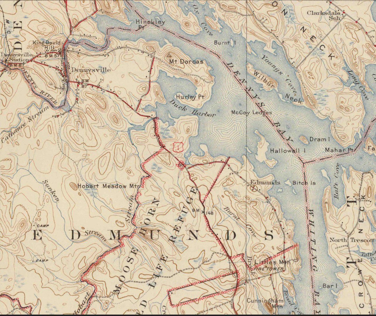
Dodge and Sunken Stream Roads in Edmunds, Maine
The Dodge and Sunken Stream Roads in Edmunds, Maine
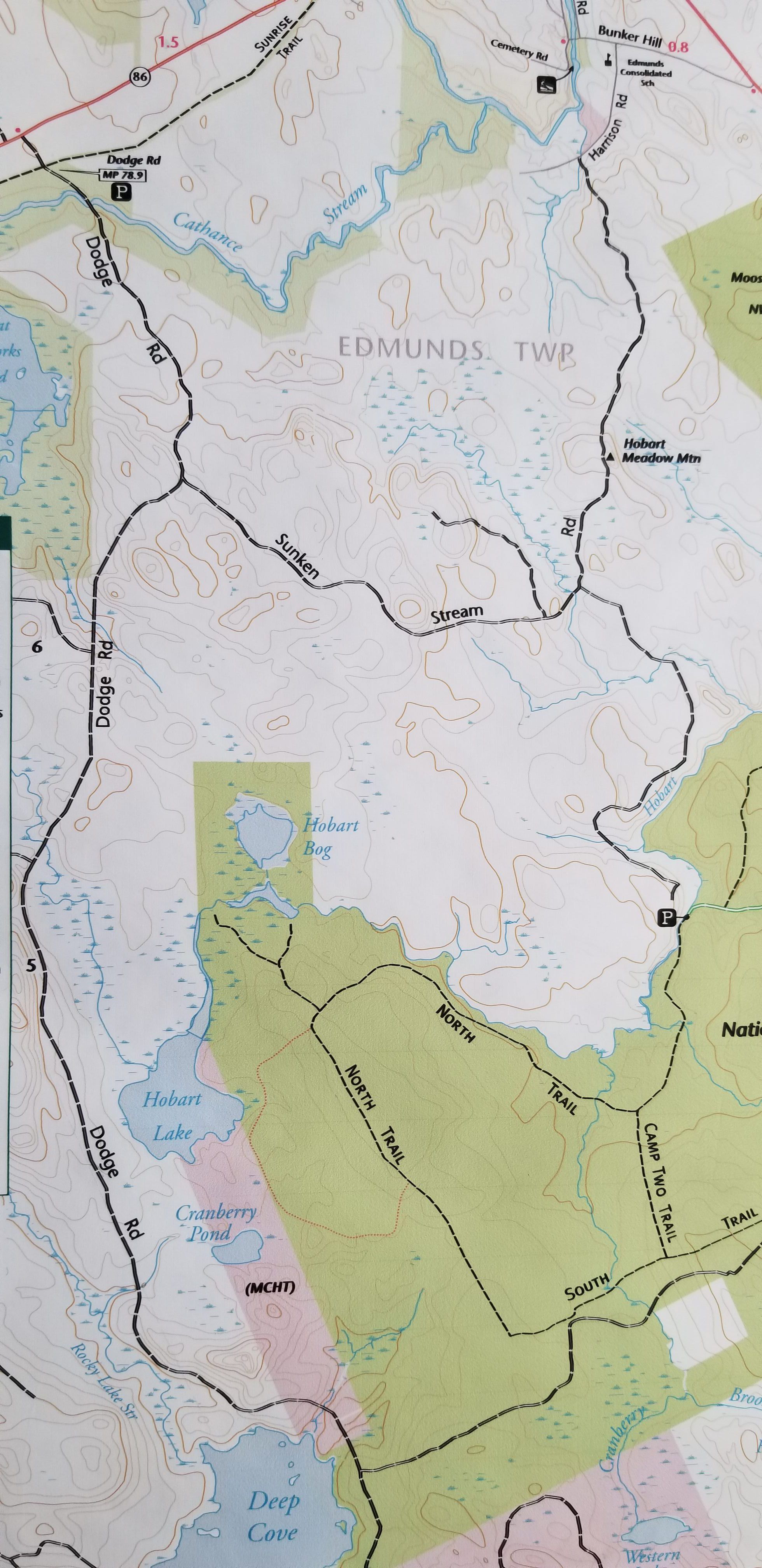
Detail of woods roads in Edmunds, Maine, on a trail map prepared for the Cobscook Shores Foundation in 2022, used with permission.
Detail of woods roads in Edmunds, Maine, on a trail map prepared for the Cobscook Shores Foundation in 2022, used with permission.