HUB
Collections
Classifications
About
App
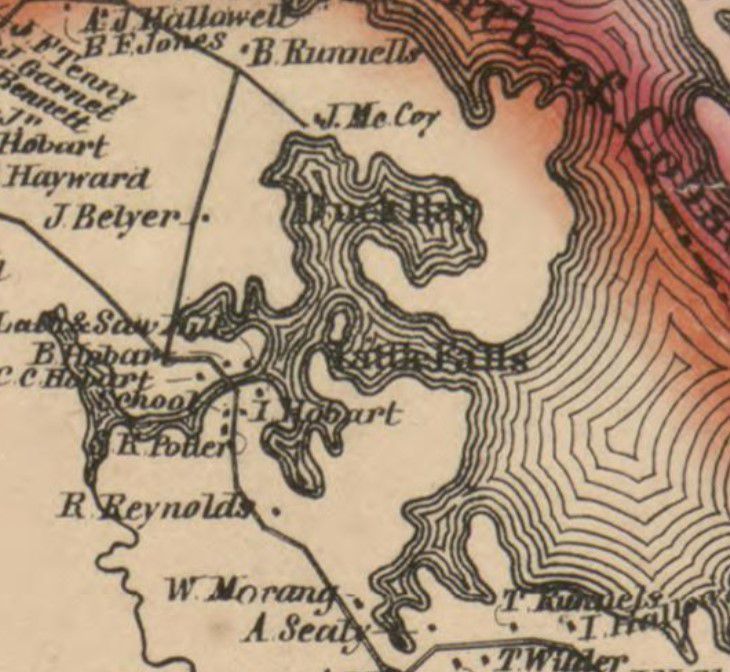
Map of Little Falls, Edmunds, Maine 1861
Map
-
Dennys River Historical Society
Map of Little Falls, Edmunds, Maine in 1861
Details of the Topographical map of Washington County, Maine, 1861
Name/Title
Map of Little Falls, Edmunds, Maine 1861
Description
Detail of the map of the residents and shoreline around Little Falls in Edmunds, Maine, in 1861.
Collection
Photos for Map