Name/Title
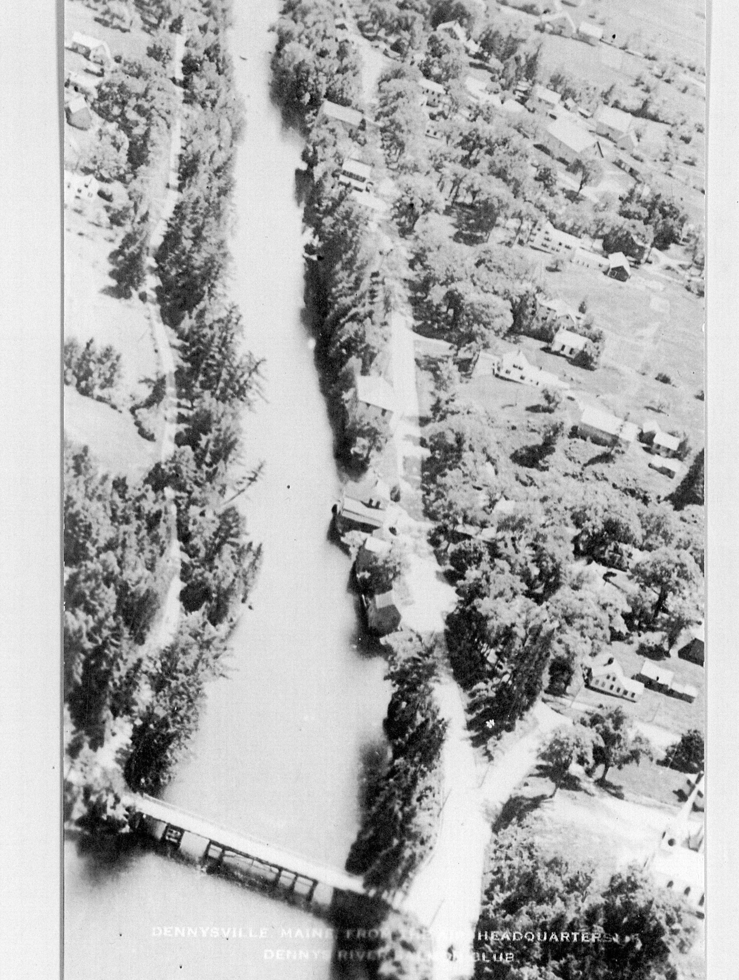
Aerial View of the Dennys River in the 1940'sDescription
An aerial view looking down the Dennys River taken in the 1940's, and marked "Dennysville, Maine Headquarters of the Dennys River Salmon Club." Edmunds is on the left-hand side of the picture, and Dennysville on the right. Many early buildings are visible in the picture, with the Lower (or downstream) Bridge at the bottom of the photograph.Context
Rebecca Weston Hobart, in her Epilogue to "Dennysville 1786-1986 . . . and Edmunds, too!", entitled 'Looking Ahead', writes (p. 107): "The river wending its way between the two towns, still flows between the two hills which rise on either side of it. The majority of the fine old homes remain, interspersed with attractive modern ones which have made their appearance in more recent years. Nevertheless, a thoughtful, observant pedestrian, or a moderate, sight-seeing rider, passing through the community views many situations where improvement could well be made. The clearing of roadside debris and underbrush would enhance the views of the river and the natural beauty of the once-picturesque town. Projects, which seem difficult and almost impossible to individuals, may easily be accomplished with gratifying results by groups of civic-minded, community proud workers" She continues, "It is evident that Dennysville and Edmunds cannot be restored to the busy, industrious state of activity of a hundred years ago. The mills, the shipyards, the blacksmith shops and general stores of by-gone days cannot be brought back. The need for their services and many of their products no longer exists. However, a conservation of that which remains, and a restoration of that which is appropriate to the life of this modern age would preserve for coming generations the legacy of the past which is rightfully theirs."Collection
Dennys River Postcard Collection, Photos for Map