Name/Title
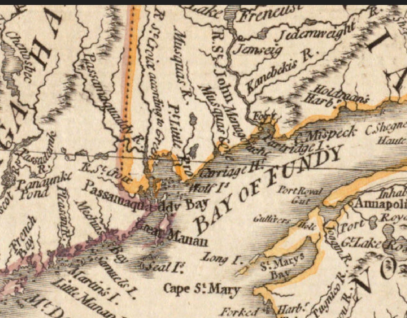
Map Detail of Passamaquoddy Bay, London, 1776Description
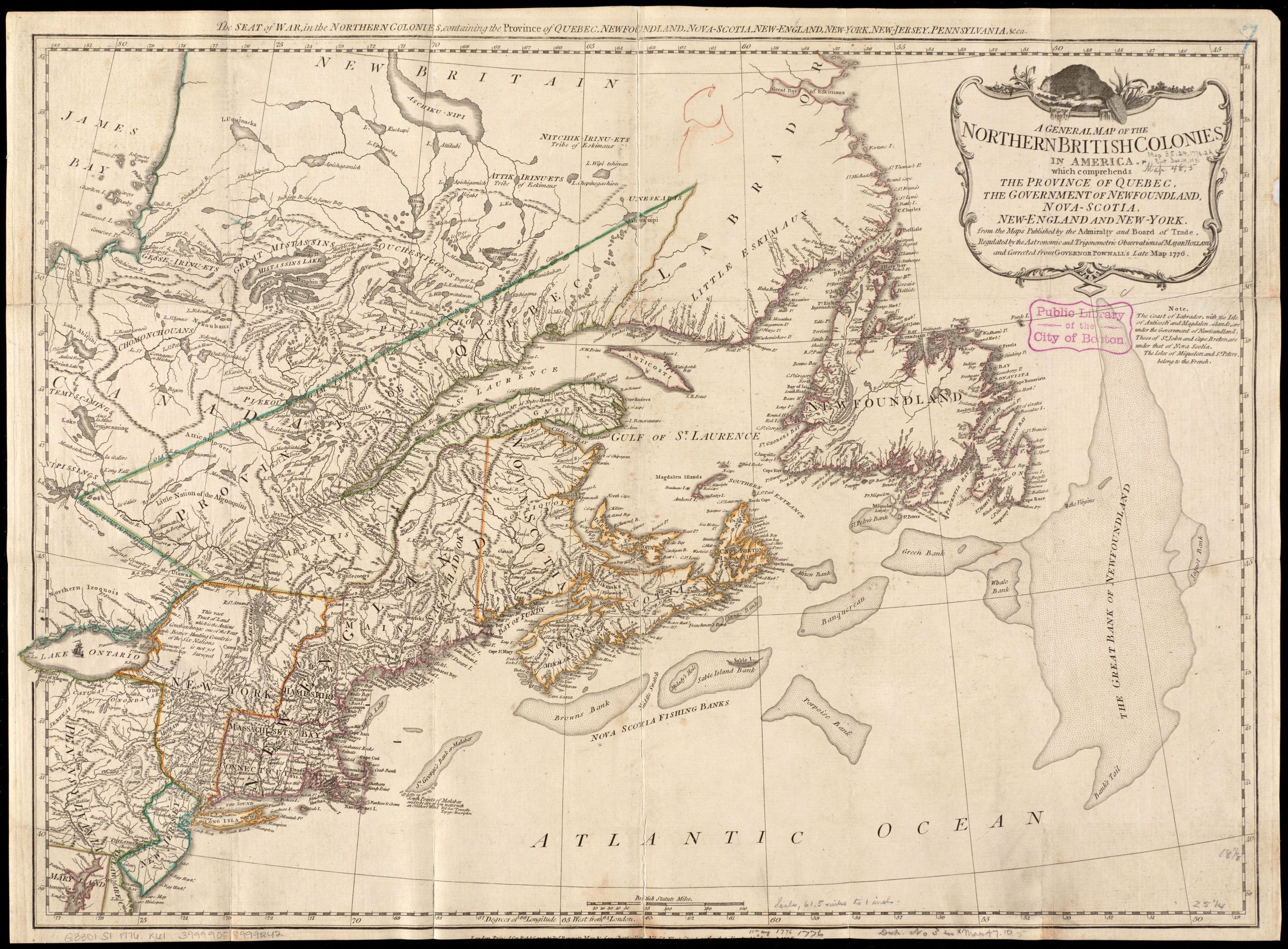
Published by a prominent London firm, this map illustrates the extent of the British colonies in northern North America at the beginning of the American Revolutionary War. Britain was keenly interested in maintaining control of this region because the exportation of furs and cod fish generated sizable income for merchants back in England. Profitable natural resources were abundant in Canada, as suggested by the placement of a North American beaver atop the cartouche, and the detailed depiction of the fishing banks off the coast of Newfoundland and Nova Scotia. A detail of Passamaquoddy Bay shows the river flowing from the north branch of Cobscook Bay labeled as the River St. Croix, rather than the Dennys River.Collection
Photos for Map