Name/Title
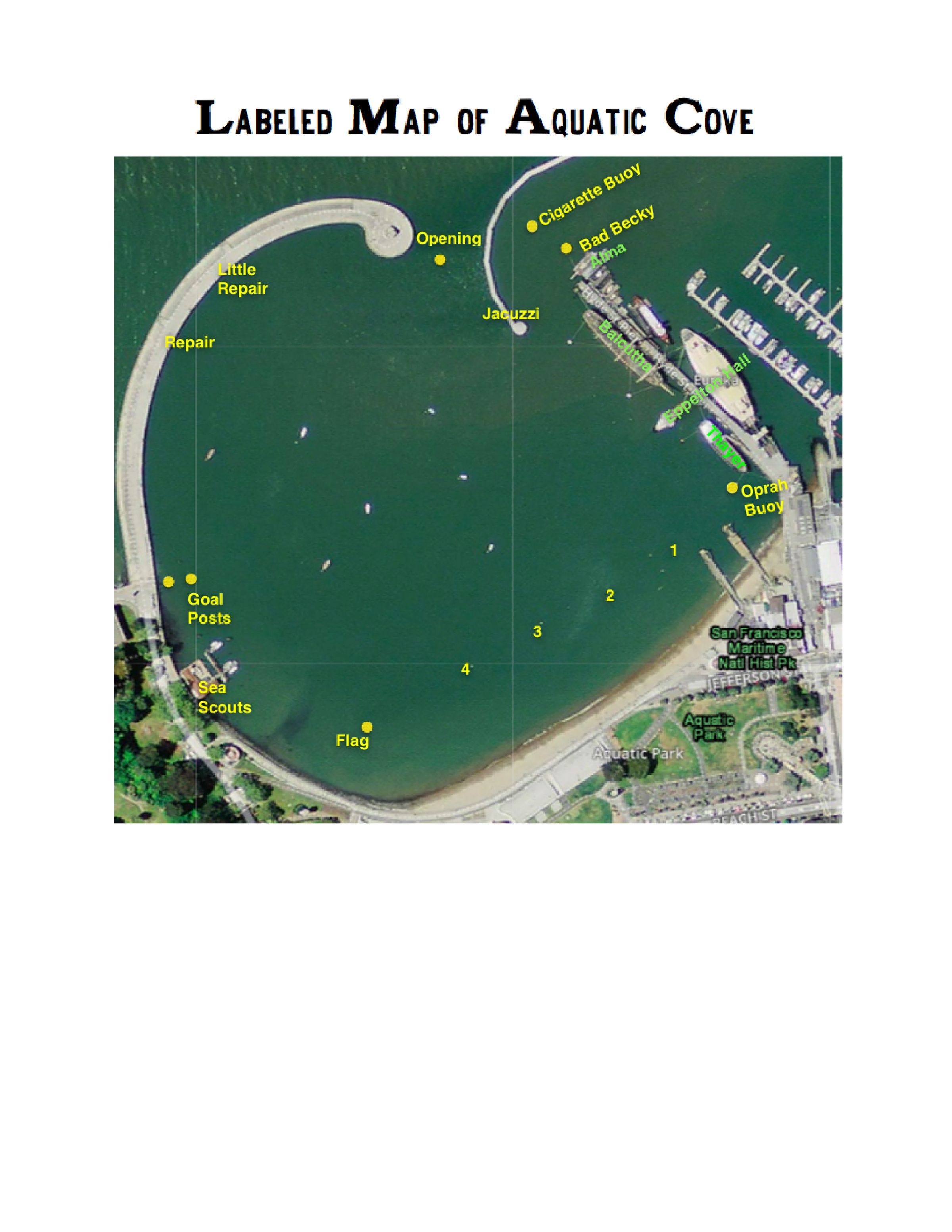
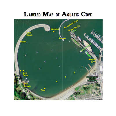
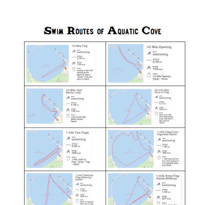
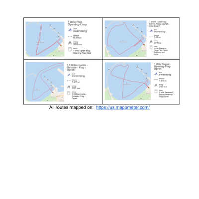
Map of Cove with Swim Routes/Distances and Named Buoys & LocationsEntry/Object ID
Archives 2020Tags
SwimmingScope and Content
Map of locations and buoys in Aquatic Park Cove with names , Created by member Marie Sayles in January 2020. Three page pdf with different routes and distances.
Map has has been posted on members groups.io site several times.
See other other cove maps from 1999 and 2012 in Ephemera folder.Archive Details
Date(s) of Creation
January 16, 2020Research Notes
Notes
From map creator Marie Sayles:
I started by using an online mapping tool called Mapometer. https://us.mapometer.com/
I was using this tool to plot our group hiking routes regularly, so thought it would be helpful for swimming. In the winter of 2020, I started asking club members about alternative routes for different distances, based on what the water is doing - flooding or ebbing. When I created the first of this series of maps on January 16, 2020, it was to help me track my miles for polar bear. I shared with other club members a number of times on the list serve, and finally printed a few versions in October 2020 to pot on the bulletin boards.