Notes
From event organizers:
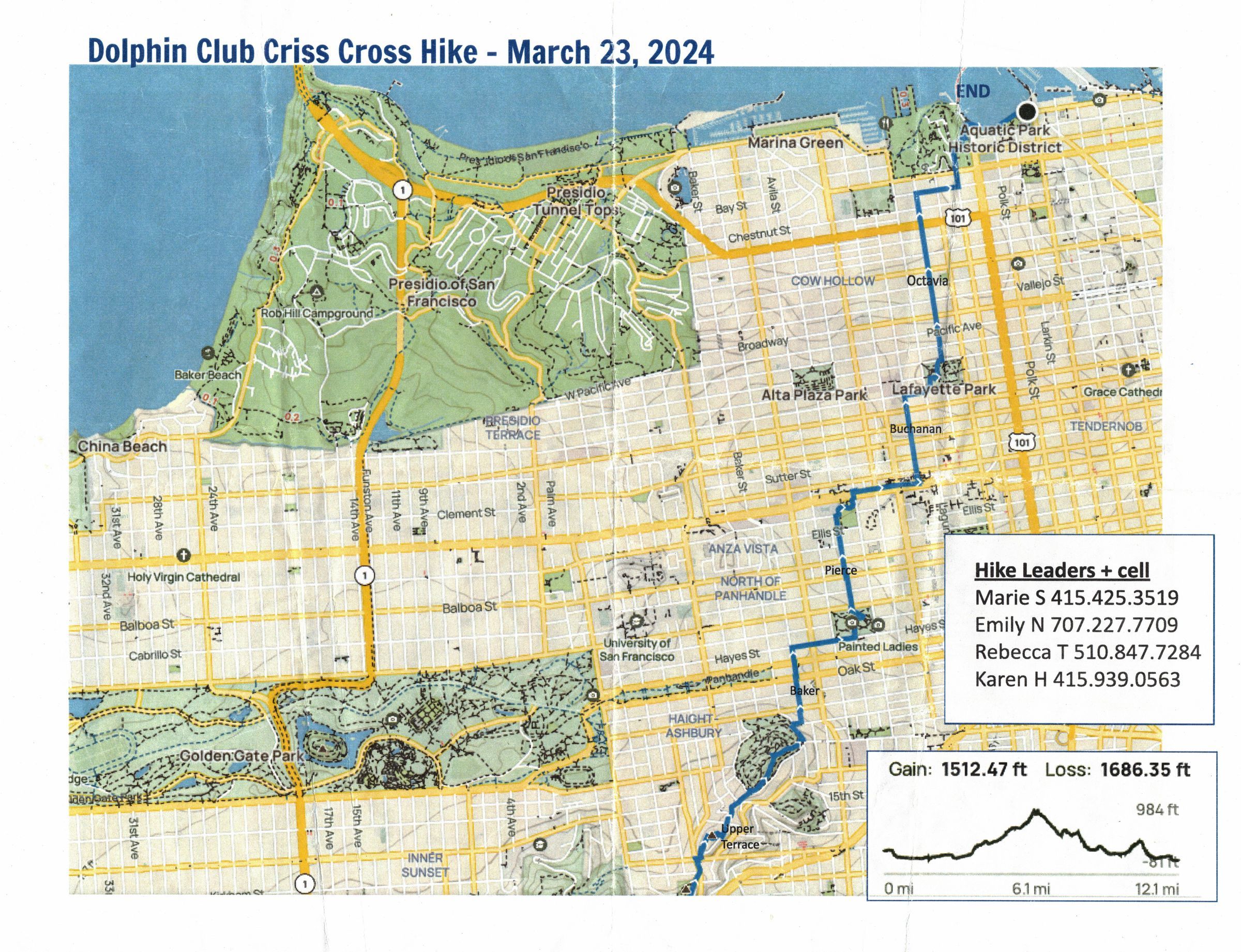
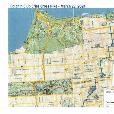
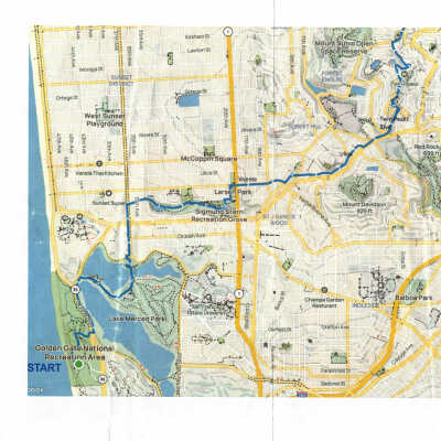
1st Annual CrissCross Town Hike: Fort Funston to Aquatic Park. Saturday, March 23, 2024
The “CrissCross” was a 12-mile hike that started at Fort Funston and ended at Aquatic Park. Starting in the SW corner of the city, the hike followed the Bay Area Ridge Trail’s San Francisco route to the top of Twin Peaks, then wove its way NE to Alamo Square, through Lafayette Park, and eventually to Fort Mason and Aquatic Park, ending in front of the Dolphin Club. There were fabulous views and a mix of natural trail and paved surfaces. Hikers gathered for a post-hike swim (optional) then shared a big pot of soup.
Route Map: https://www.alltrails.com/explore/map/map-february-19-2024-a821a16?u=i&sh=0uxfcz
Participants: 49 signed up; 35 participated (a few joined mid-way); 30 completed the hike.
Purpose: 1) A fun group activity; 2) Connect club members to broader landscape/community via cross-town hike on Bay Area Ridge Trail; 3) Help kick-off the annual Walt Stack Run/Walk Challenge.
This was an example of an individual members' proposed event (Marie Sayles and Emily Nogue). It was supported by People & Culture Committee, because it is a great idea and is also reminiscent of the many the Dolphin members’ “Hike and Run” (walk from the Club to Ocean Beach for a dip) from the 1900s into the 1950s. The organizers plan an annual cross-town walk, this route or another route.