Name/Title
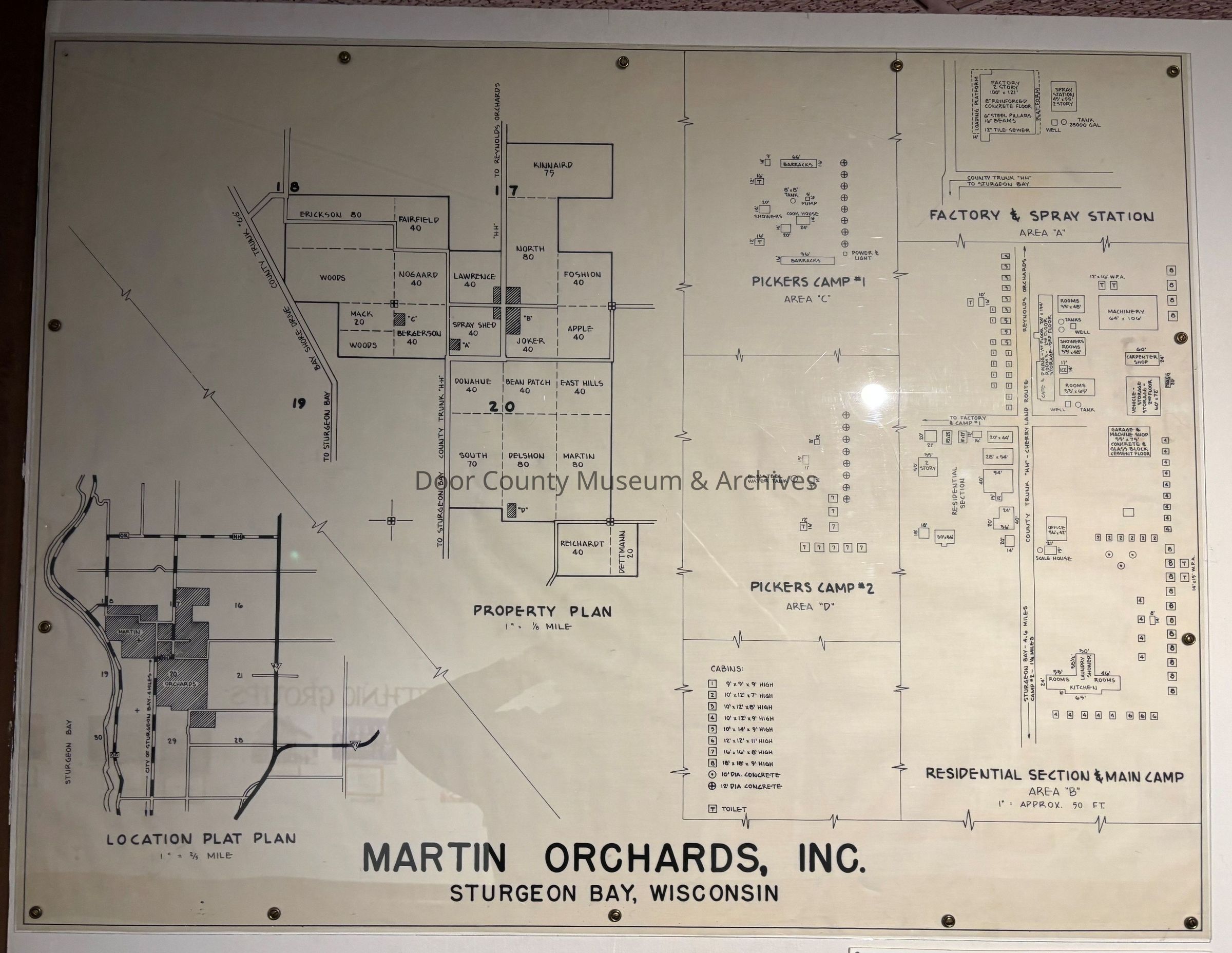
Martin Orchards, Inc. - 1952 - Plat PlanEntry/Object ID
2003.02.0033Description
Martin Orchards, Inc. - 1952. Plat Plan of the Martin Orchards Inc. holdings in 1952 and shows their locations on a map of the area. Also shown is the property plan which identifies various acreage by name, use, or area. There are also insets of area plats with keys that show the locations and identities of buildings within the plat. Insets include: Factory & Spray Station - Area "A"; Residential Section & Main Camp - Area "B"; Pickers Camp #1 - Area "C"; and Pickers Camp #2 - Area "D".
Physical Characteristics: 1 large, rolled sheet, 31 1/2" x 41 1/2" and 1 sheet, 8 1/2" x 11" in a folderCollection
Door County Archives Map CollectionCataloged By
Sally TreichelAcquisition
Accession
2003.02Source or Donor
Door County Historical Society - New, Purchases, etc.Acquisition Method
GiftLexicon
Search Terms
Maps, Plat Map, Business, Martin OrchardsLocation
Category
PermanentDate
September 26, 2025Provenance
Notes
Custodial History: This map was originally located in the offices of Martin Orchards, Inc.. With the disposal of the final properties of the owner, Jules Parmentier, Sr., the map was given to Dean and Judy Krueger, who had the large map scanned to a smaller size at Green Bay Blueprint. They then donated the original large map and a copy (8 1/2" x 11") to the archives. (The archives has scanned the small copy and has it saved on Arc Photos 2003 - Disc 2 - #03.0158.)Create Date
October 7, 2003Update Date
July 7, 2026